Leicestershire Walks

Use the filter to show walks of a certain type such as woods, reservoirs, hills, long distance, country parks, canals and rivers.
In the spring walkers flock to the beautiful bluebell woods in the Leicestershire area. Click the 'Woodland' button below to see these.
Use the links to view full route information including elevation profiles, interactive maps and GPS downloads.
You can also view an overview map of all the routes in the using the Leicestershire Walk Map>>
*New* - Walks and Cycle Routes Near Me Map - Waymarked Routes and Mountain Bike Trails>>
| Filter: |
| Route Name | Photo | Distance | Description |
| Around Corby | 31.1 miles (50 km) | This is a delightful 31 mile circular walk which visits a number of pretty villages and parks around the town of Corby in Northamptonshire. You start off at East Carlton Park on the edge of the Welland Valley and follow the path through a series of pretty villages including Wilbarston, Geddington, Great Oakley, Gretton, Rockingham, Stanion and Brigstock. View Full Details>> | |
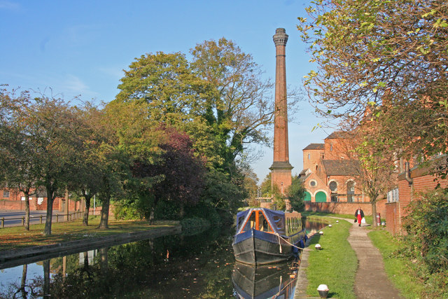
| Ashby Canal | 21.7 miles (35 km) | Follow the Ashby-de-la-Zouch Canal from Bedworth in Warwickshire, to the little village of Snareston in Leicestershire. The towpath runs for just over 20 miles with pretty hedgerows, reeds, countryside views and lots of wildlife to look out for on the way. The route starts just to the north east of Bedworth town centre at Marston Junction. If you are coming from the town centre or train station just follow the Coventry Canal north and then head east at Marston Junction. The canal is located very close to Nuneaton as well. You could follow the Centenary Way from the southern edge of the town to the start of the route. The towpath first heads east towards Burton Hastings before skirting the western edge of the market town of Hinckley. You continue north towards Stoke Golding and Ambion Hill. The hill was long considered to be the site of the Battle of Bosworth Field and is where the Bosworth Battlefield Heritage Centre is situated. It is now accepted that the core of the battlefield lies either side of Fenn Lanes, about two miles south-west of the visitor centre and that Ambion Hill was Richard III's camp on the night before the battle. You continue north past Shenton, the terminus of the Battlefield Line Heritage Railway which runs steam and diesel-hauled trains every weekend and Bank Holiday from March to December. The canal then skirts the western edge of Market Bosworth, passing Bosworth Water Park before coming to Shackerstone at the other end of the Battlefield Line Railway. The final section runs north west from Shakerstone to Snarestone, passing some attractive woodland on the way. Around Market Bosworth you can pick up the Ivanhoe Way and Leicestershire Round long distance trails in order to further explore the area. You can pick up the Ivanhoe Way at Snarestone and follow it north to Measham where the Ashby Woulds Heritage Trail starts. You could also take a small detour at Market Bosworth and visit the splendid Bosworth Battlefield Country Park. View Full Details>> | |
| Ashby Woulds Heritage Trail | 3.7 miles (6 km) | This lovely short cycle and walking trail runs from Measham near Ashby-de-la-Zouch to Moira along a disused railway path. The path passes old Donisthorpe Colliery site, which is now a Woodland Park and Conkers - a forest-based attraction with a number of activities to enjoy. The trail includes a pleasant waterside section along the Ashby Canal. View Full Details>> | |
| Aylestone Meadows | 1.2 miles (2 km) | This easy walk visits Leicester's largest local nature reserve. View Full Details>> | |
| Bagworth Heath Woods | 1.4 miles (2.2 km) | This walk explores Bagworth Heath Woods in the National Forest area of Leicestershire, near the town of Coalville. View Full Details>> | |
| Bardon Hill | 2.5 miles (4 km) | Climb to the highest point in Leicestershire on this walk near Coalville. The hill is located just a couple of miles east of Coalville town centre. A good start point for the walk is the village of Whitwick just to the north of the hill. From here you can follow the Ivanhoe Way long distance trail to the hill. It's about a 2.5 mile walk from the village to the 912 feet (278 m) high hill summit where you will find a radio mast and wonderful views over the Charnwood Forest and the extensive Bardon Hill quarry below. On a clear day you can see as far as the Malvern Hills, the Shropshire Hills and the Peak District. To extend your walking in the area you could pick up the Charnwood Forest circular walk which runs past the hill. Following it south will take you to the village of Markfield which is an alternative start point for visiting the hill. View Full Details>> | |
| Beacon Hill Country Park | 2.2 miles (3.5 km) | Explore 335 acres of mixed woodland, grassland, wildflower meadows and farmland on this country park walk or cycle near Loughborough. At 248m (814 feet), Beacon Hill is the second highest point in Leicestershire and the site of a Bronze Age hill fort. As such there are fabulous views of the Leicestershire countryside. There's a handy toposcope at the hill summit where you can see all the landmarks visible from the viewpoint. The park also has a wooden boardwalk sculpture trail, a maze and a 4.8km cycle track circling the park so you can bring your bike too. Beacon Hill is located a few miles south of Loughborough town centre and very close to the Leicestershire Round walking route. You could pick up the trail and head to Bradgate Country Park if you wished to extend your walk. View Full Details>> | |
| Blackbrook Reservoir | 3.1 miles (5 km) | This short walk visits Blackbrook Reservoir near Coalville in Leicestershire. There are walking trails on the southern and northern ends of the water with pockets of woodland and nice views of the surrounding countryside. You can look out for wildlife such as Mandrin ducks on the way. The Ivanhoe Way long distance footpath runs through Whitwick and Thringstone so you can pick up this path to extend your walk. You could follow the trail through Cademan Wood and the historic Grace Dieu Priory just to the west of the reservoir. If you follow the trail south you can visit Thornton Reservoir which has nice footpaths along the water. View Full Details>> | |
| Bosworth Battlefield Country Park | 3.7 miles (6 km) | Walk the Battlefield Trail with panoramic views over the Leicestershire countryside in this country park in Market Bosworth. You can also visit the Bosworth Battlefield Heritage Centre which tells the dramatic story of the Battle of Bosworth on 22nd August 1485, which marked a major turning point in English history. It was the last significant battle of the Wars of the Roses, fought between the rival Houses of Lancaster and York in the latter half of the 15th century. The Lancastrian leader Henry Tudor, secured the throne to become the first English monarch of the Tudor dynasty. His opponent, Richard III, the last king of the House of York, was killed in the battle. The walk starts at the car park at the visitor centre on Ambion Hill. The Hill was long considered to be the site of the Battle of Bosworth Field and is where the Bosworth Battlefield Heritage Centre is situated. It is now accepted that the core of the battlefield lies either side of Fenn Lanes, about two miles south-west of the visitor centre and that Ambion Hill was Richard III's camp on the night before the battle. The battlefield heritage centre now has a viewing point with the Fenn Lane Farm site and other notable points marked. Near here you will also find King Richard's Well which dates to 1813. It is reputed to be the place where Richard III drank before the Battle of Bosworth. The route heads through the attractive woodland of Ambion Wood before picking up a nice section of the Ashby Canal, following it towards the nearby village of Dadlington. You'll pass the lovely Sutton Wharf where you can enjoy a boat trip along the canal. The route then follows more pleasant woodland trails through Ambion Wood before returning to the start point at the car park. View Full Details>> | |
| Bradgate Country Park | 5.2 miles (8.3 km) | Bradgate is a very large, 830 acre park located just outside the city of Leicester. It is hugely popular, with almost a million visitors each year. At Bradgate you will find a deer park with herds of red and fallow deer, a waterside path along the pretty Cropston Reservoir and a multitude of peaceful woodland walking trails. Also of interest is the climb to Old John Tower, the highest hill in Bradgate Park. The hill stands at 212 metres (696 ft) high, and is a prominent landmark across Leicester and Leicestershire. The route below is designed for walkers but cycling is allowed along the tarmac Carriageway within Bradgate Park and along bridleways in the nearby Swithland Woods. Bradgate is also historically significant as the birthplace and early home of Lady Jane Grey - Queen of England for 9 days in the 16th century. In the park you can visit the ruins of Bradgate House, built some time around 1520. View Full Details>> | |
| Brampton Valley Way | 14.3 miles (23 km) | This walk and cycle trail runs from the outskirts of Northampton to Market Harborough along the trackbed of a disused railway line and National Cycle Route 6. The route passes Brixworth, Maidwell and Great Oxendon with the popular Brixworth Country Park just off the route. This is well worth a small detour as you will find the lovely Pitsford Reservoir which has a fine waterside cycling and walking trail to try. Cycles can also be hired here at the Brixworth visitor centre. As well as the beautiful rural scenery you will also pass Northampton & Lamport Railway with its old steam railway on this pleasant trail. View Full Details>> | |
| Breedon Hill | 0.9 miles (1.5 km) | This walk explores the attractive Leicestershire village of Breedon on the Hill. View Full Details>> | |
| Brocks Hill Country Park | 1.2 miles (2 km) | Enjoy woodland, meadows, ponds and a community orchard in this 67 acre country park in Leicester. There are a number of well laid out footpaths to follow and a visitor centre with a cafe. The park is located between Oadby and Wigston. View Full Details>> | |
| Burbage Common | 4 miles (6.5 km) | Explore 200 acres of semi-natural woodland, wildflower meadows and unspoilt grassland in this country park in Hinckley. There are a number of well maintained walking paths and a bridleway suitable for cyclists. There is also a visitor centre with displays explaining the management of the common and woods. The park is located about a mile east of Hinckley town centre. The Leicestershire Round walking route runs through the park so you could extend your walk if you wish. View Full Details>> | |
| Burrough Hill Country Park | 2.8 miles (4.5 km) | This circular walk climbs to the 210m (690 ft) high Burrough Hill. Here you'll find a well-preserved Iron Age hill fort and fabulous views of the Leicestershire countryside. Plantlife in the park includes wild thyme, harebell, lady's bedstraw, salad burnet and musk thistle. Also look out for skylarks, linnets, yellowhammers, willow warblers, woodpeckers, and kestrels. Burrough Hill is located a few miles south of Melton Mowbray near the villages of Burrough on the Hill and Somerby. View Full Details>> | |
| Charnwood Forest | 15.5 miles (25 km) | This long circular walk explores the parks, woodland, hills, nature reserves and countryside in the attractive Charnwood Forest area of Leicestershire. There's much to enjoy with some challenging climbs, great views and a series of pretty towns and villages. There's also popular areas of woodland with pretty bluebells in the spring. The walk starts in the village of Newtown Linford and heads through Bradgate Country Park where you will find 830 acres of parkland and woodland. There's also a deer park with herds of red and fallow deer, a waterside path along Cropston Reservoir and the ruins of the 16th century Bradgate House. After leaving the park you head north towards Woodhouse Eaves where you will pass through Broombriggs Country Park and the splendid Beacon Hill Country Park. In the park you can climb to the 248m (814 feet) high Beacon Hill which is the second highest point in Leicestershire and the site of a Bronze Age hill fort. The route then heads west towards Charley Hall where you turn south to Bardon Hill. At 912 feet (278 m) Bardon Hill is the highest point in the county and commands wonderful views towards the Malverns, Shropshire Hills and the Peak District in Derbyshire. The route then passes a series of quarries before coming to the village of Markfield. The final section takes you through woodland to the finish point back at Newtown Linford. Part of the walk makes use of the Leicestershire Round. You can extend your walking in the area by picking up this long distance trail. Other highlights of the forest include Thornton Reservoir, Blackbrook Reservoir, Grace Dieu Priory and the fascinating Cistercian monastery of Mount St Bernard Abbey near Whitwick. Around Woodhouse Eaves you will pass the lovely Swithlands Wood and Swithland Reservoir where you can look out for a variety of water loving birdlife on the water. View Full Details>> | |
| Croft Hill and Quarry Walk | 3.2 miles (5.2 km) | This walk visits the Croft Hill viewpoint and the old Croft Quarry near Leicester. It's a photogoenic spot with fascinating geology and fine views over the area from the hill top. There's no public access to the quarry itself but there are public footpaths heading around the site with fine views down to the quarry workings. View Full Details>> | |
| Cropston Reservoir | 3.4 miles (5.5 km) | Enjoy a waterside walk along this pretty reservoir in the Charnwood Forest area of Leicestershire. It's about a 3.5 mile walk around the water with nice views of the surrounding countryside and woodland. You can also look out for a variety of water loving wildlife on the lake. Keep your eyes peeled for tufted duck, cormorant, great crested grebe and canada goose. There's a car park at the north western end of the water on Roecliffe Road. From here you can pick up the nice surfaced footpath which will take you along the western side of the reservoir to the boat house. You can follow footpaths all the way around the reservoir with a visit to the little village of Cropston on the eastern side. The last half mile from Cropston back to the car park follows pavements along Reservoir Road and Roecliffe Road. The route includes a section through the adjacent Bradgate Country Park where you can look out for the resident deer. There's lots of good options if you would like to extend your walk. You could further explore the parkland and woodland of the 830 acre Bradgate Park or head north and visit Swithland Woods and Swithland Reservoir. The Charnwood Forest circular walk also passes the reservoir so you could pick this up and head to the second highest point in the county at Beacon Hill. View Full Details>> | |
| East Carlton Park | 1.2 miles (2 km) | This popular country park near Corby has a number of nature trails taking you through the mature woodland and grasslands surrounding the 19th century East Carlton Hall. The park is surrounded by the beautiful countryside of the Welland Valley and is also a great place for bird watching. There are also good facilties with extensive parking, a play park and a delightful tea shop with a wide range of refreshments. Cyclists can reach the park on a regional cycle route running from the centre of Corby. If you'd like to extend your walk then you could pick up the Jurassic Way which runs past the northern end of the park. You could follow it through the countryside to the nearby Rockingham Castle where you will find beautiful gardens and woodland to walk through. View Full Details>> | |
| Erewash Canal | 11.8 miles (19 km) | Follow the Erewash canal through south Derbyshire on this waterside cycling and walking route. The canal runs from Trent Lock near Long Eaton to the Langley Mill (Great Northern) basin. You can follow the towpath all the way on your bike or on foot. It's a nice easy route that runs for about 12 miles so it's a good family cycle ride or long walk. On the way you'll pass old mills, pretty locks and a number of stone bridges. The areas around Nutbrook Junction and Trowell Marsh are nature reserves where you can look out for a wide variety of wildlife. There's also nice views of the River Erewash and the surrounding countryside. The canal forms part of the larger Erewash Valley Trail so it's easy to extend your exercise on this circular route. You start off at Trent Lock on the border of Derbyshire, Leicestershire and Nottinghamshire. It's a major canal junction where several significant waterways meet including the River Soar, the Trent and Mersey Canal, the River Trent and the Erewash Canal. The canal then weaves its way through the town of Long Eaton to Sandiacre. You continue north to Ilkeston, passing Gallows Inn and the impressive Bennerley Viaduct, before finishing at Langley Mill at the basin of the Erewash Canal. You can virtually follow part of the route along the canal from Trent Lock by clicking on the google street view link below. To continue your walking in the area you can visit the lovely Attenborough Nature Reserve which is located near the start of the canal at Long Eaton. You can follow the Trent Valley Way along the River Trent to reach the reserve. The Beeston Canal can also be picked up at the eastern end of the reserve, next to the pretty Beeston Lock. The canal also forms part of the Nutbrook Trail Cycle Route which runs up to Shipley Country Park on a dismantled railway line. View Full Details>> | |
| Erewash Valley Trail | 28 miles (45 km) | This splendid cycling and walking trail explores the canals, countryside, towns and villages of south Derbyshire and Nottinghamshire. It's a circular route with miles of great traffic free sections so it's ideal for families or anyone looking for a safe cycle ride. Walkers can also enjoy the nice surfaced trails along the canals and through the nature reserves on this varied route. As a circular route there are several options for a start point. This route starts at Trent Lock on the Erewash Canal just south of the town of Long Eaton. Trent Lock is a significant canal junction where the River Soar, the Trent and Mersey Canal, the River Trent and the Erewash Canal meet (you can virtually explore this section on the street view link below). You then follow the canal towpath north through the town of Long Eaton to Sandiacre. You continue to Ilkeston, passing Gallows Inn and the impressive Bennerley Viaduct, before coming to Langley Mill at the basin of the Erewash Canal. It's a nice section with lots of pretty locks, stone bridges and views of the River Erewash. At Langley Mill you turn south and pick up the Nottingham Canal heading to Cossal and Trowell. The disused canal has now been declared as a nature reserve which attracts lots of dragonflies, damselflies and birdlife. The canal leads you towards Stapleford Hills and Bramcote Hills Park. The park includes a mix of woodland and parkland with a nice walled garden. You'll also pass the geologically fascinating Hemlock Stone. The stone is an outcrop of New Red Sandstone, deposited more than 200 million years ago in the Triassic Period. It's worth stopping to have a look at the plaque and stone on Stapleford Hill before continuing. From the park you continue through Stapleford and Chilwell to the lovely Attenborough Nature Reserve. Here you'll find 350 acres of lakes, wetland, woodland, grassland and scrub with a huge variety of wildlife to look out for. The Beeston Canal can also be picked up at the eastern end of the reserve, next to the pretty Beeston Lock. The final waterside section takes you along the River Trent to Trent Lock and the finish point. Towards the end of the route you pass along the Trent Valley Way so this is a good option if you would like to continue your walking in the area. The trail also forms part of the Nutbrook Trail Cycle Route which runs along the Erewash Canal before bearing right near Stapleford and heading up to Shipley Country Park on a dismantled railway line. View Full Details>> | |
| Everards Meadows | 0.8 miles (1.3 km) | This 70 acre park in Leicestershire has some great cycling and walking trails to try. On the eastern side of the park there's waterside trails to pick up along the River Soar and the Grand Union Canal Walk. The meadows are a great spot for wildlife watching with a variety of bird species to see at the site. View Full Details>> | |
| Eye Kettleby Lakes | 3.4 miles (5.5 km) | This holiday park is located just south west of Melton Mowbray in rural Leicestershire. View Full Details>> | |
| Eyebrook Reservoir | 3.7 miles (6 km) | Enjoy a stroll alongside this lovely reservoir near Corby. You can park at the car park at the north eastern end of the water off Main Street in Stoke Dry. The village of Stoke Dry is reputed to be the place where the Gunpowder Plot was hatched. It has an interesting medieval church dedicated to Saint Andrew. You can pick up country lanes heading north along the reservoir from the car park. The area to the south is private land so please do not enter this section. The area includes nice views of woodland and lots of wildlife. Look out for badger, fox, otter, muntjac deer, osprey, red kite, buzzards and various wildfowl on the water. Sightings include widgeon, pochard, teal and smew. It's a beautiful area with the reservoir surrounded by rolling countryside of Leicestershire, Rutland and Northamptonshire. If you'd like to extend your walk you could pick up the Rutland Round which passes the reservoir. View Full Details>> | |
| Foxton Locks | 4.7 miles (7.5 km) | This impressive staircase of locks in Foxton are a popular tourist attraction. The flight of ten locks are located on the Leicester line of the Grand Union Canal. The locks are also designated as a country park with lovely walks along the canal and into the surrounding countrsyide. This 4.5 mile circular walk includes long canalside stretches, a woodland trail, lovely rural views and a visit to the village of Foxton. The walk starts right next to the locks at the Foxton Locks car park and heads west along the canal to Gumley Wood. A public footpath skirts the eastern edge of the peaceful wood. You follow it north past Debdale Grange before returning to the canal. Follow the towpath east to Debdale Wharf before turning south to return to the locks. You can then turn east and enjoy a short stroll into Foxton village. Here you can seek out the 13th century St Andrew's Church which sits at the highest and southernmost point of the parish. Also of interest is Manor House, situated south of the Grand Union Canal and north of Swingbridge Street. The 18th-century farmhouse sits on the site of an old Norman Manor. At the end of your walk you can enjoy refreshments at the waterside Foxton Locks Inn. View Full Details>> | |
| Grace Dieu Priory | 1.9 miles (3 km) | This historic 13th century priory is located close to Coalville in North West Leicestershire. View Full Details>> | |
| Grantham Canal | 32.3 miles (52 km) | A lovely peaceful walk alongside the Grantham Canal from Grantham to Nottingham. The walk takes you through through the glorious Vale of Belvoir and passes Woolsthorpe, Redmile, Harby, Hickling, Gamston and the delightful Cotgrave Country Park. View Full Details>> | |
| Hicks Lodge | 1.2 miles (2 km) | Enjoy cycling and walking trails in this converted coal mining site in Ashby-de-la-Zouch. View Full Details>> | |
| Hinckley | 7.8 miles (12.5 km) | This historic market town is located in southwest Leicestershire close to Nuneaton. There's nice walks in the town in Hollycroft Park and along the Ashby Canal which runs just to the west. View Full Details>> | |
| Ivanhoe Way | 34.8 miles (56 km) | Travel through the setting of Sir Walter Scott's 19th century novel on this circular walk around Ashby-de-la-Zouch in Leicestershire. The path starts Ashby-de-la-Zouch and first heads to Moira where you will follow the Ashby Canal for a short stretch. The route continues passing Shackerstone, Coalville and Staunton Harold. Highlights on the path include the Ashby Canal, Cliff Hill Quarry and Staunton Harold Reservoir. Also look out for the National Trust owned Calke Abbey Park near the Staunton Harold Reservoir. This Grade I listed country house is slightly off the route but well worth a visit. View Full Details>> | |
| Jubilee Way (Leics) | 21.1 miles (34 km) | Follow the Jubilee Way through Leicestershire and into Lincolnshire on this delightful walk. The walk starts off at the beautifulBurrough Hill Country Park and heads to Melton Mowbray passing Little Dalby on the way. You continue north through Melton Country Park, with its pretty lakes, before joining the Scalford Brook which takes you to Scalford. The path continues through Eaton and then to a pleasant wooded section through Barkestone Wood that leads to the impressive Belvoir Castle. This 19th century castle has a splendid interior with grand State Rooms and several notable paintings by Gainsborough. The gardens are also beautifully laid out making the castle a real highlight on the trail. The walk finishes soon after at the pretty village of Woolsthorpe by Belvoir. View Full Details>> | |
| Knipton Reservoir | 1.6 miles (2.5 km) | An easy walk from the village of Knipton to Branston, passing Knipton Reservoir on the way. The route follows a lovely country lane with views of the beautiful Vale of Belvoir countryside. The walk starts in the pretty Leicestershire village of Knipton, on the border of the Belvoir Castle Estate. In the village there's some pretty 19th century cottages built for the estate and a Grade II listed church with a 13th-century tower. You can follow Branston Lane south towards Branston. At Croxton Lodge you turn right to follow a footpath past the southern end of the reservoir into Branston. There's some nice views of the River Devon and the reservoir before coming into the village. Here you will find several interesting Grade II listed buildings including 18th-century farmhouses, the early 19th-century Old Rectory, a Village Hall dating from 1843 and the parish church which originates from the 13th century with alterations up the 15th. View Full Details>> | |
| Launde Abbey | 3.7 miles (6 km) | This walk visits an Elizabethan manor house near Oakham. View Full Details>> | |
| Leicestershire Round | 101.9 miles (164 km) | Explore the countryside, villages, canals, rivers and reservoirs of Leicestershire on this interesting and varied circular walk. The walk beings at the lovely Bradgate Country Park near Newtown Linford and heads to Swithland Reservoir, Burrough Hill Country Park, the Grand Union Canal at Market Harborough, the wonderful Foxton Locks, Saddington Reservoir, Bosworth Battlefield Country Park, the Ashby Canal at Shackerstone and Thornton Reservoir. View Full Details>> | |
| Loughborough Canal Walk | 13.7 miles (22 km) | A waterside walk from Loughborough to Leicester along a section of the Grand Union Canal and the River Soar. It's about a 13 mile route, so it's possible to do in a day. At the end of the walk you can get the train directly back to Loughborough from Leicester. The walk starts on the canal just to the east of the train station. You can access the towpath from Moor Lane Bridge and then follow it south east towards the village of Barrow upon Soar. The route continues through the lovely Soar Valley to Mountsorrel and Syston, where you pass through Watermead Country Park. View Full Details>> | |
| Macmillan Way | 290.2 miles (467 km) | This epic long distance path links Boston in Lincolnshire to Abbotsbury in Dorset. It is promoted to raise money for the charity Macmillan Cancer Relief.
The route starts from Boston and then runs across the Fens to Bourne before joining the limestone belt. You then head to Stamford and then along the shoreline of Rutland Water. You'll also pass through the medieval market town of Oakham where there's some wonderful old architecture at the Norman castle and the 16th century Oakham School. The trail then heads south and west via Warmington to Stow-on-the-Wold, then into the Cotswolds via Cirencester and Tetbury to Bradford-on-Avon. After leaving the Cotswolds you follow the path through Somerset passing Castle Cary before entering Dorset and the final section to Abbotsbury via Sherborne. The route joins with other popular trails including the Viking Way at Oakham, the Thames Path National Trail near Thames Head and with the South West Coast Path towards the end of the route. View Full Details>> | |
| Market Bosworth Country Park | 6.5 miles (10.4 km) | This 85 acre country park in Leicestershire contains a lake, a planted arboretum with exotic species, a wildflower meadow and a community woodland. The route takes you through the park to Sutton Cheney and then on to Bosworth Battlefield. This field is the site of the last significant battle of the Wars of the Roses, the civil war that took place in the 15th century. The Leicestershire Round walking route runs through the park so you can use this path to visit the nearby Bosworth Battlefield Country Park. View Full Details>> | |
| Market Harborough Canal | 5.6 miles (9 km) | Follow the Market Harborough Arm of the Grand Union Canal from Market Harborough to Foxton Locks on this waterside walk in Leicestershire. It runs for about 6 miles along a nice flat towpath, passing a series of pretty bridges. The walk starts at the canal basin in Market Harborough. It's a very pretty area with restored red-brick warehouses, waterfowl and lots of barges providing boat trips along the canal. From here you can pick up the towpath and follow it past Great Bowden and Gallow Hill to Foxton Locks. Here you'll find an impressive staircase of ten locks located on the Leicester line of the Grand Union Canal. It's a lovely area which is also designated as a country park. The area includes a woodland trail, lovely rural views and the pretty village of Foxton. You can enjoy post walk refreshments at the canalside inn at the end of the walk. View Full Details>> | |
| Martinshaw Wood | 1.9 miles (3 km) | This walk visits Martinshaw Wood in the National Forest near Groby and the city of Leicester. View Full Details>> | |
| Melton Country Park | 1.2 miles (2 km) | Explore 137 acres of open space in Melton Mowbray. The park has nice footpaths and lots of water features with ponds, lakes and weirs to enjoy. There's also a peaceful woodland walk and some stepping stones between the small top lake and the large middle lake. Dotted around the park are plenty of picnic tables where you can relax next to the water. There's other good facilites with a visitor centre, play areas and a cafe for refreshments after your exercise. View Full Details>> | |
| Midshires Way | 224.9 miles (362 km) | This route follows public bridleways and quiet country lanes through Middle England, from Bledlow, near Aylesbury in Buckinghamshire, to Stockport in Greater Manchester. The path links The Ridgeway National Trail with the Trans Pennine Trail passing through the countryside of Buckinghamshire, Northamptonshire, Leicesteshire, Nottinghamshire and the Derbyshire Peak District National Park. Highlights include waterside sections along the Grand Union Canal, the Peak Forest Canal and the River Ouse. There is a splendid wooded section through Salcey Forest near Northampton where you could try the Tree Top Trail. View Full Details>> | |
| Mount St Bernard Abbey | 1.9 miles (3 km) | Visit this Cistercian monastery near Coalville on this short walk. It's a delightfully peaceful place and one of the highlights of the Charnwood Forest. The Abbey grounds are just a short stroll from the village of Whitwick. You can follow footpaths past Whitwick Quarry through woodland and countryside to the abbey. Here you can explore the grounds with its beautiful gardens, visit the church and walk up to the cross at 'Calvary'. From the elevated position of the cross there's lovely views over the area. There's also a well stocked shop with pottery made by the monks in the Abbey Pottery. You can continue your walk to the nearby Blackbrook Reservoir, located just to the north of the site. The Ivanhoe Way long distance trail also passes nearby. You can pick this up and head south to the highest point in the county at Bardon Hill. You can further explore the area by picking up the Charnwood Forest circular walk which will take you on a tour of the countryside, reservoirs, woodland and hills of this lovely area. View Full Details>> | |
| Mowbray Way | 8.7 miles (14 km) | A short walk through the Leicestershire countryside from Scalford, passing Waltham on the Wolds and Buckminster park before finishing at Buckminster. Highlights on the route include several small villages and Buckminster Park and Hall at the end of the route. View Full Details>> | |
| Nuneaton Rotary Walk | 24.2 miles (39 km) | This super circular walk was devised by the Nuneaton Rotary Club and takes you on a tour of the countryside, parks and canals around Nuneaton. The walk begins at Weddington, by the River Anker and passes Hartshill, Higham on the Hill and Hinckley. It runs for about 24 miles on a series of fairly flat easy footpaths. The main attractions on the walk are the delightful waterside stretches along the Coventry Canal and Ashby Canal. You will also visit the beautiful Hartshill Country Park where you will find 137 acres of woodland and open hilltop with magnificent views across the Anker Valley. The next attraction near route is the splendid Arbury Estate just outside Nuneaton. Here you will find a beautiful Elizabethan mansion house surrounded by beautiful 18th century landscaped gardens and over 100 acres of lakes and parkland. This is a fairly easy walk with good access points just to the south of the route start at Nuneaton rail and bus stations. View Full Details>> | |
| Queen Elizabeth Diamond Jubilee Wood | 3.4 miles (5.4 km) | This walk explores the Queen Elizabeth Diamond Jubilee Wood near Normanton Le Heath in the National Forest. View Full Details>> | |
| River Soar | 6.8 miles (11 km) | This lovely circular waterside walk takes you along both sides of the River Soar in the city centre of Leicester. It's a lovely area for a stroll with 2 beautiful parks and the Grand Union Canal to visit as well. The walk starts on the pretty bridge in Abbey Park which spans the river. Here you will find formal gardens, a sensory garden, a boating lake, a model boat lake and a miniature railway. Follow the riverside paths north to Ellis Meadows and then on to Watermead Country Park. It's a real highlight of the area with over 12 lakes and ponds, wildflower meadows, woodland, grassland and reedbeds set in 350 acres of parkland. After exploring the park the route heads south along the other side of the Soar, passing the canal in Belgrave before returning to Abbey Park. Here you can visit the historic Abbey Grounds with the remains of the twelfth century Leicester Abbey, and the ruins of Cavendish House, a seventeenth century mansion. There's also a fine cafe where you can enjoy refreshments after your walk. View Full Details>> | |
| Rockingham Castle | 0.6 miles (1 km) | The grounds and pretty gardens surrounding this castle near Corby are ideal for an easy afternoon stroll. The castle is in an elevated position giving wonderful views over the Welland Valley and five surrounding counties of England. There are 18 acres of beautiful gardens to explore with herbaceous borders, a rose garden, ornamental statues, yew hedges and yew pillars. There are also woodland trails, a pond and a tea room for refreshments. You can purchase a ticket for the grounds and gardens only to enjoy the walk. See website below for details. If you would like to continue your walk then you could pick up the long distance Jurassic Way trail and follow it to the nearby East Carlton Park. View Full Details>> | |
| Saddington Reservoir | 1.2 miles (2 km) | Enjoy a circular walk to this pretty reservoir from the Leicestershire village of Saddington. The area is very attractive with lots of wildlife to look out for on the water. Keep your eyes peeled for Egret and Goosander as you make your way around the site. You may also see little sailboats as the reservoir is home to a sailing club which runs taster sessions for novices. Starting from the village you can follow the Leicestershire Round long distance trail to the reservoir. There's a nice country lane running along the water which you can follow back to Weir Road. This road has some lovely views across the countryside and will lead you back to the village. Here you can pay a visit to St Helen's Church which has sections dating from the 13th century. The Grand Union Canal runs past the village. You can pick this up to continue your walk. Follow it east and it will take you to the splendid Foxton Locks and country park. You can also use the Leicestershire Round to further explore the area. View Full Details>> | |
| Sence Valley Forest Park | 1.9 miles (3 km) | Enjoy a series of lovely cycling and walking trails in this good sized country park near Ibstock. There are a number of well surfaced paths taking you past meadows, woodland and three lakes. It's great for families looking for a safe, easy cycle ride or walkers looking for a pleasant afternoon stroll. It's also good for birdwatching with various wildfowl around the lakes. Look out for Heron, swans, coots and mallard. The attractive woodland consists of Corsican pine, larch and poplar and also attracts many different species of bird. The park has good facilities with car parking, toilets and picnic areas. Sence Valley Forest Park is located near Coalville. If you are coming by bike you could follow National Route 52 from the town to the park. If you would like to continue your exercise then you could head to the nearby Thornton Reservoir where there are more waterside walking and cycling paths. View Full Details>> | |
| Shackerstone | 5 miles (8 km) | This Leicestershire based village is located in a pleasant rural spot on the Ashby-de-la-Zouch Canal and the River Sence. View Full Details>> | |
| Swithland Reservoir | 1.2 miles (2 km) | This pretty reservoir is located just to the south east of Loughborough. The Leicestershire Round long distance trail runs along the north eastern side of the water. You can follow the trail from the nearby village of Woodhouse Eaves to the water. It's about a one mile walk through farmland to the Aqueduct and Boat House at the reservoir's northern tip. It's a very pretty spot with nice views across the water to the surrounding woodland and countryside. Also look out for the steam trains of the Great Central Railway passing over Swithland Viaduct. The reservoir is popular with bird watchers with lots of water loving visitors to look out for. Keep your eyes peeled for Great Crested Grebe and Mandarin Ducks on the water. Above the lake you can look out for Peregrines in the winter months. To extend your walk you can explore Charnwood Forest on our circular walk and visit the nearby Bradgate Country Park and Beacon Hill Country Park. View Full Details>> | |
| Swithland Woods | 1.9 miles (3 km) | These woods in the Charnwood Forest have a series of good footpaths to try. There's also bridleways suitable for mountain bikers. The woods are located just to the south of Loughborough with car parks at the northern end of the woods off Swithland Road and at the southern end off Roecliffe Road. From here you can pick up the trails taking you through mature oak, birch, alder and lime woodland. There's also a series of pretty streams and lots of woodland wildlife to look out for. In the spring months the forest floor is covered in carpets of lovely bluebells. The woods link with the adjacent Bradgate Country Park where you will find a deer park and a great viewpoint. Just to the north east you will find the pretty Swithland Reservoir. The reservoir has a nice waterside walking trail with lots of birdlife to look out for on the water. You could also pick up our Charnwood Forest circular walk and visit Beacon Hill Country Park. It's about a two mile walk from the woods to the park where you can climb Beacon Hill for fabulous views over the area. View Full Details>> | |
| Thornton Reservoir | 2.2 miles (3.5 km) | Enjoy cycling and walking around this pretty reservoir in Thornton, Leicestershire. There is a well surfaced track running along the waterside for just over 2 miles. The water is surrounded by some lovely countryside and woodland. There are good facilites with a parking area, visitor centre and picnic areas. There is also a sculpture trail to follow and a variety of wildfowl to look out for on the water. On the northern side of the reservoir there is the option of extending your walk into the adjacent Browns Wood. The Leicestershire Round also runs past the reservoir so you could pick this up and extend your walk to the nearby Bagworth Heath Woods. The Ivanhoe Way also runs past the reservoir so you could follow this north through the Charnwood Forest to Blackbrook Reservoir. The Sence Valley Forest Park is also nearby and has miles of good woodland cycling and walking trails to try. View Full Details>> | |
| Vale of Belvoir | 15.1 miles (24.3 km) | A long circular walk through the lovely Vale of Belvoir on the borders of Leicestershire, Nottinghamshire and Lincolnshire. It's a varied walk with woodland trails, waterside paths along the Grantham Canal and a visit to the splendid Belvoir Castle. The walk runs for about 15 miles with some moderate climbing at the start through the Belvoir Estate. The remainder of the route is fairly easy going with nice flat paths from Stathern onwards. The walk starts in the Lincolnshire village of Woolsthorpe by Belvoir and heads west along the Jubilee Way to Belvoir Castle in Leicestershire. View Full Details>> | |
| Viking Way | 147.3 miles (237 km) | Follow in the footsteps of the Norse invaders on this long distance walk from the Humber Bridge to Oakham in Rutland. The walk passes through the Lincolnshire Wolds AONB and some delightful Leicestershire countryside before rounding Rutland water to the finish point at Oakham.
Walk highlights include
| |
| Watermead Country Park | 5 miles (8 km) | This beautiful country park contains over 12 lakes and ponds, wildflower meadows, woodland, grassland and reedbeds set in 350 acres of parkland. Also running through the park are the River Soar and Grand Union Canal. It's a great place for a peaceful waterside cycle ride or walk, located just north of Leicester city centre with National Cycle Network Routes 6 and 48 running through the park. The park also contains the lovely Reedbed Nature Reserve which is a perfect place for bird watching. To continue your exercise you could follow the Grand Union Canal towards Leicester or Loughborough. Our River Soar Walk visits the park by following the river from the lovely Abbey Park, located just to the south of Watermead. View Full Details>> | |
| Wistow | 5 miles (8 km) | This Leicestershire based hamlet is a fine place to visit with a variety of attractions and an interesting history. View Full Details>> |