Kelso Walks - Kelso to Roxburgh Circular Riverside Walk
![]()
![]() This town in the Scottish Borders is a fine place for riverside walking.
This town in the Scottish Borders is a fine place for riverside walking.
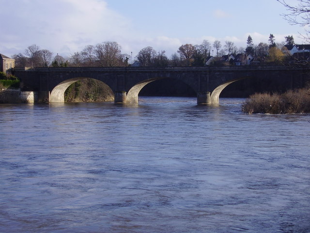
This circular walk takes you to the historic Roxburgh Castle and the Roxburgh Viaduct. The walk starts on Kelso Bridge where you can pick up the Borders Abbeys Way and follow it west to Roxburgh Castle. The ruined castle sits in a scenic location next to the River Teviot.
The route continues south along the river to Roxburgh where you can cross the river on the impressive viaduct. The route then follows the line of the old railway north back to Kelso.
To continue your walking around Kelso head just over a mile north to visit Stichill Linn. It's something of a hidden gem with peaceful woodland trails and a picturesque waterfall to see.
Kelso Ordnance Survey Map  - view and print off detailed OS map
Kelso Open Street Map  - view and print off detailed map
Kelso OS Map  - Mobile GPS OS Map with Location tracking
Kelso Open Street Map  - Mobile GPS Map with Location tracking
Walks near Kelso
- Stichill Linn - This walk visits the pretty Stichill Linn Waterfall in the Scottish Borders near Kelso.
- Borders Abbeys Way - Explore the Scottish Borders and visit several historical ruined abbeys on this interesting and beautiful circular walk
- Eildon Hills - This circular walk climbs to a series of wonderful viewpoints above the town of Melrose on the Scottish Borders
- Leaderfoot Viaduct - This walk takes you to the impressive Leaderfoot Viaduct in Melrose on the Scottish Borders
- Roughting Linn - Enjoy a walk from the village of Ford to this beautiful hidden gem in Northumberland.
The walk starts at the remains of Ford castle and heads east into some beautiful countryside - Hirsel Estate - Enjoy an easy walk around the Hirsel Estate and country park in Coldstream
- Melrose - This town in the Scottish Borders is a fine place for walkers with an historic abbey, riverside trails and nearby hill climbs to enjoy
- Southern Upland Way - This splendid route is one of the four official Long Distance Routes in Scotland and is Britain's first official coast to coast long distance foot-path
- St Cuthbert's Way - This walk runs from Melrose in the Scottish Borders to Lindisfarne Castle and Holy Island
- Jedburgh - This lovely town in the Scottish Borders has some interesting historic sites and some fine riverside footpaths.
- 4 Abbeys Cycle Route - This historic circular cycle route explores the countryside of the Scottish Borders
- Scotts View - This walk visits a splendid viewpoint in the Scottish Borders, near Melrose.
- Norham - This Northumberland village is located on the River Tweed next to the Scottish border.
- Harestanes - This circular walk visits the Harestanes countryside centre near Jedburgh in the Scottish Borders.
Further Information and Other Local Ideas
Head south from the town and you could visit nearby Jedburgh and explore the 12th century abbey ruins and enjoy a stroll alond the Jed Water river. On the way you will pass Harestanes where you can climb to the Waterloo Monument on Peniel Heugh hill and enjoy some fine views of the area. The Georgian Monteviot House and Gardens is also located in this area.
Just to the south west of Harestanes there's Fatlips Castle where you can enjoy a climb to a splendid 16th century peel tower and enjoy wonderful views over Teviotdale.
For cyclists the 4 Abbeys Cycle Route passes through the area. The circular trail uses a series of quiet country lanes to visit the same 4 abbeys as the Borders Abbey Way. Most of the route is also suitable for walkers.
Photos
A head for heights? Roxburgh Viaduct. The railway between St Boswells and Kelso across Roxburgh Viaduct, about 70 feet above the River Teviot, was opened in 1850, although one pier of the viaduct had collapsed during its building in 1849. The viaduct has 14 arches and is built on a curve. At the foot of the piers, the cutwaters on the north side are extended to carry a footbridge across the river.


