Labrador Bay Walk
![]()
![]() This walk visits the lovely Labrador Bay nature reserve and coastal viewpoint near Shaldon in Devon.
This walk visits the lovely Labrador Bay nature reserve and coastal viewpoint near Shaldon in Devon.
You can start the walk from the Labrador Bay car park on Teignmouth Road, just south of Shaldon. There's some great views over the bay from here and a RSPB nature reserve where you can look out for wildlife including cirl buntings. Dolphins can also sometimes be spotted in the waters below. During the warmer months there's a van selling delicious ice cream and other refreshments.
Near here you can pick up the South West Coast Path and follow it north to Bundle Bay and Ness Beach. There's nice views here over the Teign River to Teignmouth.
Postcode
TQ1 4TP - Please note: Postcode may be approximate for some rural locationsLabrador Bay Ordnance Survey Map  - view and print off detailed OS map
Labrador Bay Open Street Map  - view and print off detailed map
Labrador Bay OS Map  - Mobile GPS OS Map with Location tracking
Labrador Bay Open Street Map  - Mobile GPS Map with Location tracking
Further Information and Other Local Ideas
In Shaldon you can pick up the River Teign Walk and follow the trail west along the river to Newton Abbot. Here you could pay a visit to Decoy Country Park. There's a Wildlife Discovery Centre, Nature Reserve and a watersports centre next to a pretty lake to enjoy here.
The circular Shaldon Walk starts from the nearby village and visits the bay. It also passes the splendid Shaldon Botanical Gardens which are well worth a visit.
Head south towards Torquay and you'll find the peaceful Brunel Woods on the northern outskirts of the town. The site is named after Isambard Kingdom Brunel who loved the area and intended to set up home at Watcombe Park before he died. The John Musgrave Heritage Trail can be picked up in this area too. The waymarked trail runs from Maidencombe to Brixham, visiting several of South Devon's interesting historical sites on the way.
For more walking ideas in the area see the Devon Walks page.
Cycle Routes and Walking Routes Nearby
Photos
Labrador Bay Car Park. The seat is handily placed by a long-established walking route that links the car park to the coast path. However, this is becoming very overgrown as a much more prominent stile gives access to a field with magnificent sea views. The car park became pay and display this spring, but the ice cream trade seems brisk.
Cattle above Smugglers Cove. Cattle occupying the line of Shaldon Footpath 15 as it reaches a hilltop near Teignmouth Road to gain one of South Devon's best coastal views. The wooded hill is The Ness; beyond is Teignmouth and the coast to Hole Head. In the distance is Exmouth.
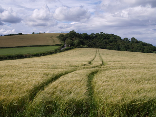
Tramlines across a field of barley beside the A379 (running along to the left). The hill is The Beacon and the road going up it (to the left of the bend warning sign on the main road) is Commons Lane, which must have been the early route to Shaldon before the corniche around the headland was constructed. Taken from a hedged track that leads from the car park to the coast path.
Coastal fields near Labrador Bay. Morning sunshine on fields and on the abrupt wooded slope down towards the sea above Plantation Cove.
Labrador Bay Beach. The view shows the remains of a concrete boat abandoned on the beach after World War II. It is surprising to see just how the view of this changes as the level of the sand rises and fall with the effect of storms. The large change which has occurred in a few months can be seen by viewing the linked photograph. The sea has the enormous power to shift tons of sand.


