Lampeter Walks
![]()
![]() This Ceredigion based town sits at the confluence of the Rivers Dulas Teifi. It's surrounded by plenty of footpaths on which to explore the beautiful Teifi Valley. It also includes a campus of the University of Wales making it the smallest university town in the UK.
This Ceredigion based town sits at the confluence of the Rivers Dulas Teifi. It's surrounded by plenty of footpaths on which to explore the beautiful Teifi Valley. It also includes a campus of the University of Wales making it the smallest university town in the UK.
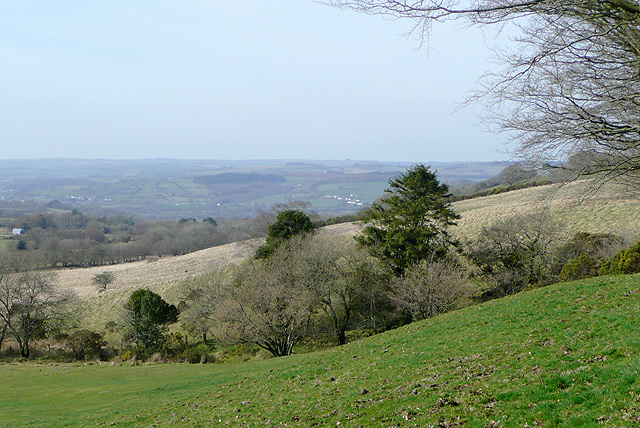
This walk from the town takes you up to the viewpoint at Bryn Mawr to the south of Lampeter. From here you can enjoy splendid views over the countryside of the Teifi Valley.
The walk starts in the town next to the River Dulas and follows a footpath south along the water. You then cross the Teifi on Pont Stephen before following country lanes east and then south east up to Bry Mawr. Here you reach a height of over 300 metres with excellent views over the fields to the town below. After taking in the views the route returns to the town on the same footpaths.
Lampeter Ordnance Survey Map  - view and print off detailed OS map
Lampeter Open Street Map  - view and print off detailed map
*New* - Walks and Cycle Routes Near Me Map - Waymarked Routes and Mountain Bike Trails>>
Lampeter OS Map  - Mobile GPS OS Map with Location tracking
Lampeter Open Street Map  - Mobile GPS Map with Location tracking
Walks near Lampeter
- Llyn Brianne - Enjoy a walk or cycle along this beautiful reservoir in central Wales
- Cors Caron - This short walk explores the delightful Cors Caron National Nature Reserve in Ceredigion
- Teifi Pools - This splendid circular walk in the Cambrian Mountains takes you around a series of beautiful lakes
- Cenarth Falls - Visit these beautiful falls and enjoy a woodland stroll along the Afon Teifi on this walk in Carmarthenshire
- Claerwen Reservoir - Enjoy a cycle or walk along this large reservoir in the Cambrian Mountains
- Llandeilo - This circular walk takes you through the countryside surrounding the Carmarthenshire town of Llandeilo
- Brechfa Forest - Enjoy miles of footpaths and mountain bike trails in this super forest in Carmarthenshire
- Llandovery - This market town in the Cambrian Mountains has some nice riverside walks along the River Towy and River Bran to try
- LLanwrtyd Wells - This settlement in Powys is notable as the smallest town in Britain
- Gelli Aur Country Park - This lovely country park surrounds the Golden Grove mansion in Carmarthenshire.
- Newcastle Emlyn - This lovely Welsh town is located in the heart of the Teifi Valley near Carmarthen.
- Abergorlech - This village in Carmarthenshire is the gateway to the expansive Brechfa Forest where you can enjoy miles of waymarked walking and mountain bike trails
- Talley Abbey - This walk explores the atmospheric ruins of the 12th century Talley Abbey in Carmarthenshire.
- Llandysul - This small market town in Ceredigion is located in the valley of the River Teifi
Pubs/Cafes
The Royal Oak Hotel on the High Street is a good choice for some post walk refreshments. They do very good food and also have a garden area for warmer days. You can find them at 38 High Street with a postcode of SA48 7BB for your sat navs.
Dog Walking
The country and river trails make for a nice walk with your dog. The Royal Oak mentioned above is also dog friendly.
Further Information and Other Local Ideas
To the south of the town you can continue your walking in the expansive Brechfa Forest. There's miles of waymarked cycling and walking trails to be found here. The forest is located close to Dinefwr Park which sits on the edge of the Brecon Beacons. Here you'll find a 12th-century Welsh castle, the historic house, the 18th-century landscaped park and the medieval deer park. Near here there's also Gelli Aur Country Park. The park surrounds the Golden Grove mansion and includes a deer park, peacocks, views of the Tywi Valley and an aboretum with some fine specimen trees.
The forest is also not far from Llandeilo and Carmarthen where you can pick up the Welsh Coast Path and enjoy some wonderful sea views.
To the south east is the interesting town of Llandovery in the Cambrian Mountains.
To the east there's the peaceful little village of Rhandirmwyn where you can explore the interesting old lead mines, the River Towy Valley and the local woods.
Photos
Lampeter University. Started out in 1822 as St David's College, founded by Bishop Thomas Burgess. After the ancient universities of Oxford and Cambridge and Scotland, it is the oldest university institution in Britain, receiving its first charter in 1828. In 1995 became University of Wales, Lampeter.


