Little Missenden Walks
![]()
![]() This delightul Buckinghamshire village has some nice country and river walking trails to try. There's also a picturesque village green and a couple of fine old pubs for refreshments afterwards. The church is also noteworthy, dating back to the 13th century it includes some amazing wall paintings.
This delightul Buckinghamshire village has some nice country and river walking trails to try. There's also a picturesque village green and a couple of fine old pubs for refreshments afterwards. The church is also noteworthy, dating back to the 13th century it includes some amazing wall paintings.
This circular walk from the village takes you to the nearby Shardeloes Lake before visiting the neighbouring village of Holmer Green.
The walk starts in the village where you can pick up the South Bucks Way and follow the waymarked footpath east to Shardeloes where there's pretty lakes and views of the River Misbourne.
The route then follows a public footpath south west toward Mop End where there are some nice trails through the bluebell woods. From here you head west past Beamond End to the village of Holmer Green. From here you follow Kingstreet Lane north to meet up with the South Bucks Way at Suffolk Bridge. Head east from here and you will soon come back to Little Missenden.
Postcode
HP7 0RF - Please note: Postcode may be approximate for some rural locationsLittle Missenden Ordnance Survey Map  - view and print off detailed OS map
Little Missenden Open Street Map  - view and print off detailed map
*New* - Walks and Cycle Routes Near Me Map - Waymarked Routes and Mountain Bike Trails>>
Little Missenden OS Map  - Mobile GPS OS Map with Location tracking
Little Missenden Open Street Map  - Mobile GPS Map with Location tracking
Pubs/Cafes
Back in the village The Crown is a good choice for some post walk refreshment. It's a pub of some note having been named ‘Best Country Pub’ in the Good Pub Guide 2019 edition. It has some history too, having been turned into a pub in 1800. They serve high quality food which you can enjoy in the lovely garden area during the warmer months. You can find them at Highmore Cottages, HP7 0RF.
Dog Walking
The country and Mop End woodland trails make for a fine dog walk and the Crown mentioned above is also dog friendly.
Further Information and Other Local Ideas
Head west along the South Bucks Way and you could visit the sister village of Great Missenden.
The long distance Chiltern Heritage Trail passes through the village, providing the opportunity of visiting several of the highlights of the Chilterns AONB.
For more walking ideas in the area see the Chilterns Walks and the Buckinghamshire Walks pages.
Cycle Routes and Walking Routes Nearby
Photos
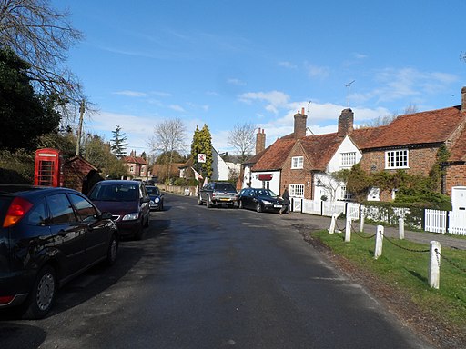
Little Missenden. Showing the Red Lion Pub and further up the road the Manor House. The name Missenden is derived from the Old English for "where the marsh plants grow". The place is named "Missendene" in the Domesday Book. The London Aylesbury road passed through the village until the C19 when it was bypassed.
Mill House, Little Missenden. It seems hard to believe that the little River Misbourne had enough water to reliably run a mill this size. I'm guessing the chimney on the left was for a boiler added later for auxiliary power.


