Llannefydd Walks

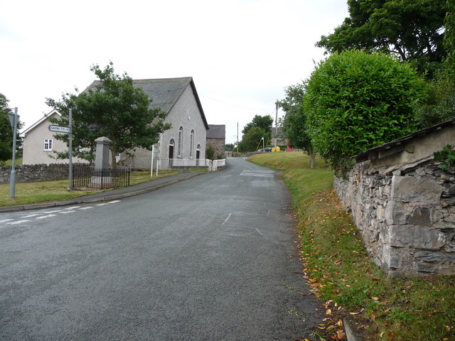
 This small Welsh village is located in Conwy County near Denbigh and St Asaph.
The village is notable for several historic buildings including a Grade I listed church and a 17th century public house.
This walk from the village takes you up to the Mynydd y Gaer hill fort and the Plas Uchaf Reservoir.
The hill fort can be reached by following footpaths north from the village. From the 295-metre-high summit there are excellent views over the surrounding countryside and back down to Llannefydd village. Ona clear day you can also see the mountains of Snowdonia, the Clwydian Range, Mynydd Hiraethog, Blackpool Tower and the Cumbrian hills.
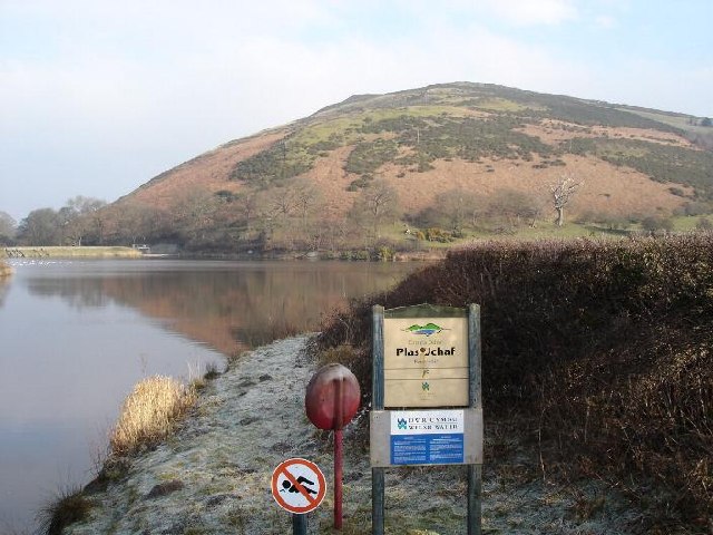
Just south west of the hill you'll also find the picturesque Plas Uchaf Reservoir where there are some nice waterside trails with views over the water to the hills.
Postcode
LL1 65ED - Please note: Postcode may be approximate for some rural locationsLlannefydd Ordnance Survey Map  - view and print off detailed OS map
Llannefydd Open Street Map  - view and print off detailed map
Llannefydd OS Map  - Mobile GPS OS Map with Location tracking
Llannefydd Open Street Map  - Mobile GPS Map with Location tracking
Walks near Llannefydd
- Llanfair Talhaiarn - This pretty village sit in a fine location, surrounded by the countryside of the lovely River Elwy Valley.
- Denbigh - This market town is located in the north east of Wales in the county of Denbighshire
- St Asaph - Enjoy a nice waterside walk along the River Elwy on this walk in the historic North Wales city of St Asaph
- Abergele - This town in North Wales has some nice walks along the coast and local woodland to try
- Bodelwyddan Castle - Explore the 260 acres of parkland and gardens surrounding this 19th century castle in Denbighshire, North Wales
- Rhuddlan To Rhyl - River and Coast Walk - This nice walk from runs from Rhuddlan To Rhyl along the River Clwyd and the North Wales Coast
- Dolgarrog Pipeline Walk - This walk explores the area around the village of Dolgarrog in Conwy County Borough on the edge of the Snowdonia National Park
- Prestatyn - This seaside resort is located in a great spot on the North Wales coast in Denbighshire
- Colwyn Bay - This lovely coastal walk in Colwyn Bay takes you to some of the highlights of this lovely area
- Gwrych Castle - This Grade I listed castle is located near Abergele in Conwy, Wales.
- Rhyd y Foel - This small rural village lies in a lovely spot in the River Dulas Valley, near to the Conwy coast.
- Llyn Eigiau - This walk visits the beautiful Llyn Eigiau in the Carneddau Mountains of the Snowdonia National Park.
- Rhyl - This seaside town is located between Prestatyn and Abergele on the North Wales coast.
- Cadair Ifan Goch - This walk climbs to the excellent viewpoint on Cadair Ifan Goch in the Conwy Valley just north of Llanrwst, North Wales.
- Henllan - The village of Henllan is located near the town of Denbigh in the Welsh county of Denbighshire
Pubs/Cafes
The Hawk and Buckle is a former coaching inn dating all the way back to the 17th century. The pub has a cosy interior with two log fires. Outside there's a sunny garden for warmer days.
You can find them on Henllan Street at postcode LL1 65ED for your sat navs. They are also dog friendly.
The church is also open daily from 10am to 4pm with DIY tea & coffee & biscuits available inside - all welcome. It is well worth a visit with Medieval stone carvings, fine architecture and splendid stained glass windows to see. You can find them at postcode LL16 5EQ.


