Longshaw Estate Walks
![]()
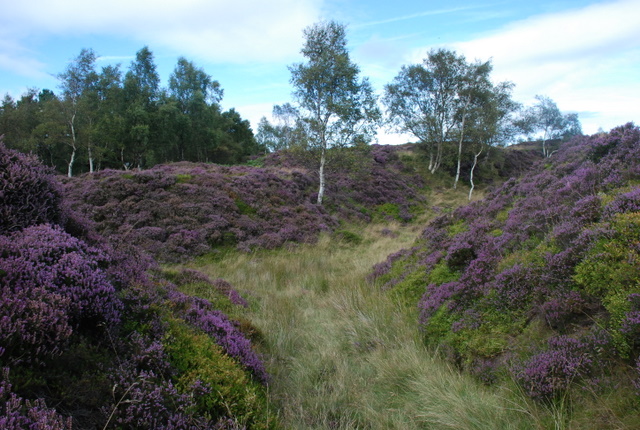
![]() The Longshaw Estate is a National Trust owned country park in Upper Padley in the Peak District. The estate is perfect for walking with fabulous views of the Peak District, ancient woods, parkland and heather moorland. In the park there are pretty ponds, a waterside path along Barbrage Brook and the lovely Big Moor where you should look out for red deer. There are also excellent facilities with a tea room, shop and the Moorland Discovery Centre.
The Longshaw Estate is a National Trust owned country park in Upper Padley in the Peak District. The estate is perfect for walking with fabulous views of the Peak District, ancient woods, parkland and heather moorland. In the park there are pretty ponds, a waterside path along Barbrage Brook and the lovely Big Moor where you should look out for red deer. There are also excellent facilities with a tea room, shop and the Moorland Discovery Centre.
From easter 2014 there will be two new bridleways suitable for cyclists. The routes will be waymarked so you can explore the estate on two wheels or on foot.
The Derwent Valley Heritage Way runs near the estate so you could continue your walk along the River Derwent. You could also continue south and climb up to Froggatt Edge and Curbar Edge where there are spectacular views of the Peak District. The wonderful Padley Gorge Trail with its babbling brook and pretty waterfalls is another good option.
You're also close to Stanage Edge where you can enjoy fabulous views and interesting rock formations.
The park is located just a few miles from Sheffield.
Please click here for more information
Longshaw Estate Ordnance Survey Map  - view and print off detailed OS map
Longshaw Estate Open Street Map  - view and print off detailed map
Longshaw Estate OS Map  - Mobile GPS OS Map with Location tracking
Longshaw Estate Open Street Map  - Mobile GPS Map with Location tracking
Longshaw Estate Walks
- Padley Gorge Trail - Follow the Padley Gorge Trail through the stunning Hope Valley in the Peak District
- Curbar Edge - This circular walk takes you along the spectacular Curbar Edge in the Peak District
- Derwent Valley Heritage Way - Follow the River Derwent through the Derbyshire Peak District on this stunning walk
- Higger Tor - This circular Peak District walk visits the prehistoric Carl Wark and Higger Tor on the eastern moor of the Dark Peak
- Burbage Edge and Burbage Brook Walk - This circular walk takes you to Burbage Rocks and the Burbage Brook in the Peak District
- Great Longstone - This Derbyshire Dales based village is a great base for exploring some of the Peak District's highlights
- Barbrook Reservoir and Stone Circle - This walk visits Barbrook Reservoir and Stone Circle on Big Moor and Ramsley Moor in the Peak District National Park
- Millstone Edge - This circular walk climbs to Millstone Edge near Hathersage in the Peak District
- Owler Tor - This circular walk visits Owler Tor on the Longshaw Estate in the Peak District
- White Edge - This circular walk climbs to White Edge on the Longshaw Estate in the Peak District National Park.
Pubs/Cafes
After your walk head to the Fox House Inn located just to the south east of Burbage Bridge (Postcode:S11 7TY). The rustic country pub/restaurant includes a comfort food menu and exposed beams. There's also lovely gardens outside where you can enjoy your meal with lovely views. It also has an intersting history dating all the way back to 1773.
Dog Walking
The National Trust welcomes dogs throughout the Longshaw Estate. Please keep your dog on a lead though as there are ground-nesting birds and livestock on the estate.
Further Information and Other Local Ideas
Just to the north of the estate there are a couple of popular circular walks to try. You can enjoy a climb to Higger Tor and the prehistoric Carl Wark, where there are a number of photogenic gritstone rocks to see. There's also the Burbage Edge and Burbage Brook Walk which takes you along a picturesque section of the pretty brook which runs through the estate to Padley Gorge.
To the south you can pick up the circular Barbrook Reservoir And Stone Circle Walk. The route visits a scenic 19th century reservoir and an ancient stone circle on Big Moor and Ramsley Moor.
For more walking ideas in the area see the Peak District Walks page.
Photos
Longshaw Lake. Carl Wark the ironage hillfort can be seen in the distance at the centre of the photo below the lovely autumn leaves. Taken in November 2006.
Private chapel to Longshaw Lodge. This building stands to the south of the main Lodge within the private area of the estate.
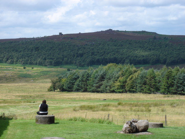
This is a view from the National Trust visitor centre over part of the estate, with Mother Cap visible on the horizon in the distance. Although it's not obvious from this photo, there are two roads between this point and the heights at Mother Cap, and vehicles travelling along those roads often spoil the purity of the view.
Stone seat on Longshaw Edge. This seat gives panoramic views across Longshaw and the Peak District as far as the Kinder Plateau. behind the seat is a professional carving - 'DEC 1830'. I think this is more likely to be the initials of someone from Longshaw Lodge rather than just a month and the year.


