Great Longstone and Longstone Edge Walk
![]()
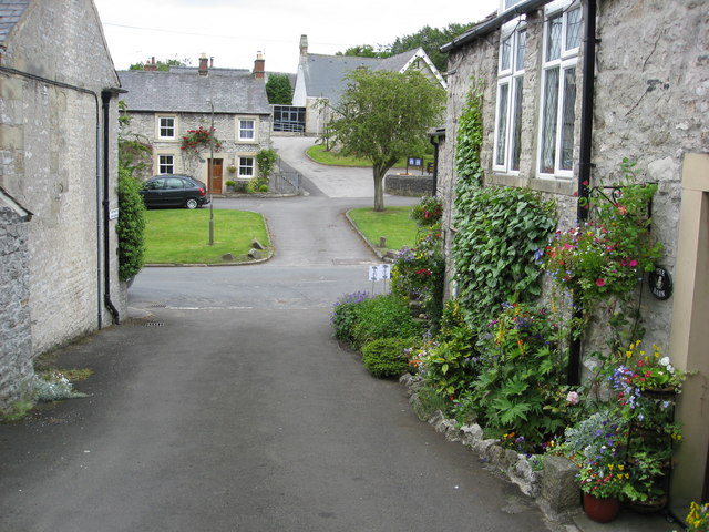
![]() This Derbyshire Dales based village is a great base for exploring some of the Peak District's highlights. It's an historic area with a 13th century church and 18th century hall. Neighbouring Little Longstone, further west, has a 17th-century manor house and still has its village stocks.
This Derbyshire Dales based village is a great base for exploring some of the Peak District's highlights. It's an historic area with a 13th century church and 18th century hall. Neighbouring Little Longstone, further west, has a 17th-century manor house and still has its village stocks.
This circular walk from the village takes you up to the viewpoint at Longstone Edge. The limestone ridge stands at 1,300 feet (400 m) in height to the north of the settlement.
The walk starts in the village and follows Handrake Lane north east up to the Edge. There's fine views back down to the village and to the surrounding Peak District Hills from this elevated spot. You could extend the walk by continuing north west onto Longstone Moor. This area is described as "the largest example of limestone heathland in the Peak District National Park".
After exploring the Edge you can then descend back to Great Longstone on alternative footpaths to the west.
Postcode
DE45 1TZ - Please note: Postcode may be approximate for some rural locationsGreat Longstone Ordnance Survey Map  - view and print off detailed OS map
Great Longstone Open Street Map  - view and print off detailed map
Great Longstone OS Map  - Mobile GPS OS Map with Location tracking
Great Longstone Open Street Map  - Mobile GPS Map with Location tracking
Walks near Great Longstone
- Stoney Middleton - Enjoy a short walk through the pretty Coombs Dale on this route from the village of Stoney Middleton
- Derwent Valley Heritage Way - Follow the River Derwent through the Derbyshire Peak District on this stunning walk
- Eyam - This popular village in the Derbyshire Dales has a fascinating history and some lovely walks to try
- Curbar Edge - This circular walk takes you along the spectacular Curbar Edge in the Peak District
- Froggatt Edge Circular Walk - Enjoy splendid views over the Dark Peak on this climb to the gritstone escarpment of Froggatt Edge
- Monsal Dale - This circular walk explores the beautiful Monsal Dale in the Derbyshire Dales
- Monsal Head - This circular walk from Monsal Head crosses the Headstone Viaduct for fine views across the Derbyshire Dales.
- Monsal Trail Circular Walk - A circular walk along the Monsal Trail visiting Miller's Dale, Monsal Dale and Monsal Head before returning via Taddington.
The route starts from the car park at the Miller's Dale Viaduct - Monsal Trail - Follow the Monsal Trail through the Peak District National Park on this cycling and walking path.
The trail follows a disused railway line from Chee Dale near Buxton to Bakewell with the first section following the River Wye to Monsal Head via Cressbrook Dale and Miller's Dale - Padley Gorge Trail - Follow the Padley Gorge Trail through this stunning wooded valley in the Peak District
- Longshaw Estate - The Longshaw Estate is a National Trust owned country park in Upper Padley in the Peak District
- Bakewell - The market town of Bakewell makes and excellent base for exploring the Derbyshire Dales area of the Peak District National Park.
This long circular walk visits some of the villages, parks, woods and hills surrounding the town - Bakewell Railway Walk - This circular railway walk from Bakewell uses part of the Monsal Trail to take you to the nearby Monsal Head
- Cressbrook Dale - This walk follows pubic footpaths through Cressbrook Dale Nature Reserve in the Derbyshire Dales.
The walk starts in the village of Cressbrook which sits at the southern end of the Dale - Ashford in the Water - The pretty Peak District village of Ashford in the Water has some nice walking trails to try along the River Wye
- Magpie Mine - This walk visits the Magpie Mine from the Derbyshire village of Sheldon
Pubs/Cafes
Head to The Crispin for some post walk refreshments. The historic inn dates back to the 1600s and includes a charming interior with ceiling beams studded with a wonderful array of beer mugs and old horse buckles. They do a fine Sunday lunch which you can enjoy in the sunny garden area. You can find them on Main Street at postcode DE45 1TZ for your sat navs.
Dog Walking
The moorland and hill climbs make for a fine dog walk. The Crispin mentioned above is also dog friendly.
Further Information and Other Local Ideas
Just to the south at the old station you can pick up the Monsal Trail, an excellent shared cycling and walking path. This will take you to some major local highlights at Monsal Dale and Monsal Head.
For more walking ideas in the area see the White Peak Walks page.
Photos
Great Longstone railway station (site).
Opened in 1863 as 'Longstone' by the Midland Railway on the line from Matlock to Buxton and Manchester, this station was renamed 'Great Longstone for Ashford' in 1913. It closed to passengers in 1962 and completely in 1967. View west towards Monsal Dale and Manchester / Buxton. The Monsal Trail runs through the site but the former station house is now a private dwelling.
The Great Longstone church of St Giles dates from the 13th century. A medieval cross stands in the churchyard, and the head of a cross is built into the wall of the vestry.


