Mallerstang Walks
![]()
![]() This circular walk explores the Mallerstang area of Cumbria. The narrow river valley is an interesting place for a hike with some dramatic scenery including old lime kilns, becks, waterfalls and hill views. Also look out for the "Eden Benchmarks", a series of carved stone sculptures dotted around the area.
This circular walk explores the Mallerstang area of Cumbria. The narrow river valley is an interesting place for a hike with some dramatic scenery including old lime kilns, becks, waterfalls and hill views. Also look out for the "Eden Benchmarks", a series of carved stone sculptures dotted around the area.
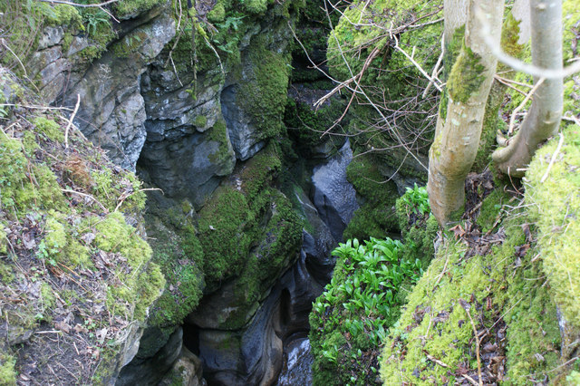
The walk starts from the car parking area at the atmospheric ruins of the ancient Pendragon Castle. From here you can pick up the Lady Anne's Way long distance walk and follow it south through the region. The bridle tracks and footpaths will take you to Hell Gill where you can enjoy views of the Hellgill Force waterfall.
The route then turns north following trails running along the old Settle to Carilise Railway.
To continue your walking around Mallerstang head up to Wild Boar Fell. It's a popular climb with fabulous views over the Eden Valley and the Mallerstang Valley from the summit.
Mallerstang Ordnance Survey Map  - view and print off detailed OS map
Mallerstang Open Street Map  - view and print off detailed map
Mallerstang OS Map  - Mobile GPS OS Map with Location tracking
Mallerstang Open Street Map  - Mobile GPS Map with Location tracking
Walks near Mallerstang
- Pendragon Castle - This walk visits the ruins of the ancient Pendragon Castle in Mallerstang Dale, Cumbria
- Lady Anne's Way - This long distance trail runs for about 100 miles from Skipton in Yorkshire to Penrith in Cumbria.
- Kirkby Stephen River Circular - This circular walk takes you along a section of the Pennine Journey long distance trail before returning along the River Eden.
The small market town of Kirkby Stephen is located in Cumbria, near the border of the Yorkshire Dales National Park - Wild Boar Fell - This circular walk climbs Wild Boar Fell in the Mallerstang area of the Yorkshire Dales National Park
- Ravenstonedale - There are lots of nice walks to try around the pretty Cumbrian village of Ravenstonedale
- Brough - This Cumbrian town includes a historic castle, waterside trails along the Swindale Beck and some lovely Eden countryside scenery.
- Newbiggin On Lune - This Cumbrian village is located just north west of Ravenstonedale in the Eden district of the county.


