Nunnington Hall and the River Rye Walk

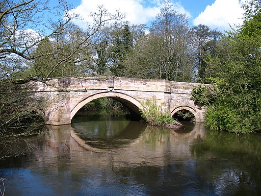
 This pretty village on the fringe of the Howardian Hills includes the National Trust owned Nunnington Hall and nice footpaths along the River Rye which runs through the village. This easy circular walk starts at the old hall and takes you along the Rye to the village of Ness, passing a pretty weir and Ness Bridge on the way. You then head into the countryside, climbing Caulkleys Lane and Caulkleys Bank which reaches a height of over 300ft. From here you can enjoy splendid views over the surrounding area which includes the Howardian Hills.
The route then passes Caulkleys Wood before turning north and returning to the village.
You can also explore Nunnington Hall although this does require an entrance fee. The splendid 17th century manor house includes period rooms with exquisite funiture and artwork. The grounds are also delightful with an organic walled garden and spring-flowering meadows with resident peacocks.
To extend your walking in the area you could head west and pick up the Ebor Way long distance trail. This will take you towards Helmsley where you can try the Helmsley to Rievaulx Abbey Walk and explore the fascinating ruins of the former Cistercian abbey and the wonderful gardens at Rievaulx Terrace. The area also includes the splendid Duncombe Park with its landscape garden and National Centre for Birds of Prey.
Postcode
YO62 5UY - Please note: Postcode may be approximate for some rural locationsPlease click here for more information
Nunnington and the River Rye Ordnance Survey Map  - view and print off detailed OS map
Nunnington and the River Rye Open Street Map  - view and print off detailed map
Nunnington and the River Rye OS Map  - Mobile GPS OS Map with Location tracking
Nunnington and the River Rye Open Street Map  - Mobile GPS Map with Location tracking
Explore the Area with Google Street View 
Pubs/Cafes
There's a nice on site tea room at the hall where you can enjoy afternoon tea with a view across the gardens.
Dog Walking
The area makes for a pleasant dog walk though you are not allowed to take your dog inside the actual hall building.
Further Information and Other Local Ideas
Just a few miles south west of the village there are miles of good walking and cycling trails in the expansive Yearsley Woods.
Just a few miles to the south there's the delightful villages of Slingsby and Hovingham to visit. It's an idyllic and appealing place with a historic Saxon Church, a picturesque cricket pitch by the 18th century Hovingham Hall, a pretty beck and two fine hotels to relax in after your exercise. From here you can follow two local waymarked trails to one of the major highlights of the area at Castle Howard near Welburn.
For more walking ideas in the area see the Howardian Hills Walks page.
Cycle Routes and Walking Routes Nearby
Photos
Old Wash House, Ryemoor. External view of the old wash house at Ryemoor, in the village. Contains a large copper with fireplace beneath. The floor is tiled, with a central drain. Used in the 18th century for boiling clothing. There are still meat hooks attached to the oak beams inside, suggesting that some meat preparation (from the domestic piggery) may also have taken place in here.
Ryemoor. Converted in 1990, Ryemoor was once two cottages; Rye Cottage and Moor view. Built circa 1750, Ryemoor has solid stone walls, plaster and lath interior walls and ceilings, and an original clay pantile over lath roof. In the yard there is a converted pig shed, and the old wash house, complete with boiler and chimney.


