Parwich Circular Walk - Tissington - Thorpe Cloud - Dovedale
![]()
![]() This attractive Peak District village has a nice village green, picturesque old limestone cottages, an historic church and a fine 17th century pub to relax in after your walking.
This attractive Peak District village has a nice village green, picturesque old limestone cottages, an historic church and a fine 17th century pub to relax in after your walking.
It's in a great spot for starting a walk with two long distance trails and some National Park highlights easily reachable on foot.
This circular walk from the village visits some of the highlights of the area including the neighbouring village of Tissington, the splendid viewpoint at Thorpe Cloud at the popular stepping stones in Dovedale.
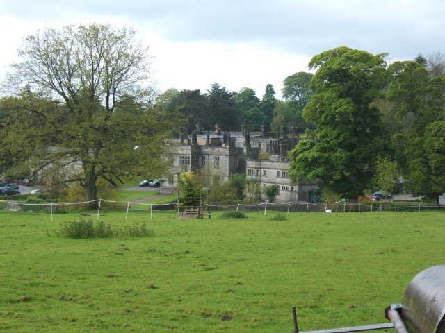
The walk starts in the village where you can pick up the Limestone Way and follow it south west to Tissington. Here you can see the early 17th-century Jacobean Mansion of Tissington Hall. The Hall is open to the public on certain days and is available for wedding hire.
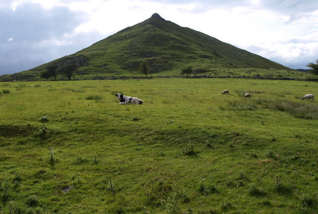
The route then continues south west to Thorpe before turning north to climb to Thorpe Cloud. The distinctive hill top provides fine views over the surrounding countryside of the White Peak.
From here you continue north into Dovedale where you can enjoy riverside walks, interesting rock formations and the photogenic stepping stones.
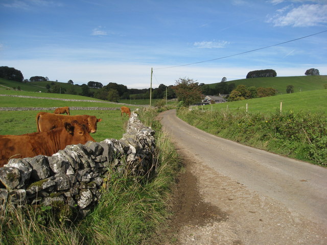
At Dove Holes you head north east towards Alsop en le Dale and follow Dam Lane back to Parwich. Near Alsop en le Dale you can pick up the Tissington Trail. This shared cycling and walking route runs along a disused railway line towards Tissington and links up with the Limestone Way near Parwich. You could return this way if you prefer.
Postcode
DE6 1QL - Please note: Postcode may be approximate for some rural locationsParwich Ordnance Survey Map  - view and print off detailed OS map
Parwich Open Street Map  - view and print off detailed map
Parwich OS Map  - Mobile GPS OS Map with Location tracking
Parwich Open Street Map  - Mobile GPS Map with Location tracking
Walks near Parwich
- Limestone Way - Travel through the beautiful Peak District National Park on this walk through Derbyshire and into Staffordshire.
The walk starts at Castleton, passing through the scenic Cave Dale and past the remains of Peverill Castle - Tissington Trail - The Tissington trail is a 13 mile off road path following the trackbed of a disused railway line through the stunning Peak District National Park.
The trail is shared by walkers and cyclists offering fabulous views of the Derbyshire countryside - Thorpe Cloud - This short walk climbs to the top of Thorpe Cloud in the Peak District
- Dovedale - The beautiful Dovedale is one of the must see areas in the Peak District
- Dovedale Circular Walk - This popular circular walk takes you from Dovedale to Milldale using sections of the Tissington Trail and Limestone Way to take you on a tour of this popular area of the Peak District
- Ilam Park - Ilam Country Park is a delightful open space owned by the National Trust
- Ashbourne - The Derbyshire Dales town of Ashbourne is a fantastic base for walkers looking to explore the southern end of the Peak District
- High Peak Trail - This splendid, shared walking and cycle trail follows a disused railway line from Cromford to Dowlow through the beautiful Peak District.
The trail starts near Cromford railway station and climbs through the stunning High Peak area of Derbyshire giving fabulous views of the area.
The trail links with the popular Tissington Trail at High Peak Junction
Pubs/Cafes
The Sycamore Inn dates all the way back to the 1600s and is in a lovely spot close to the village green. They serve good quality home cooked food and a fine ranges of ales. You can find them at postcode DE6 1QL for your sat navs. The inn also serves as the village shop so you can pick up various bits and pieces here too.
Dog Walking
The country and woodland trails are ideal for fit dogs. The Sycamore Inn mentioned above is also dog friendly.
Further Information and Other Local Ideas
The High Peak Trail runs past the village. The shared cycling and walking route follows a disused railway line from Cromford to Dowlow. You can follow it to Minninglow where you will find a fine hill climb and some interesting ancient tombs.
For more walking ideas in the area see the White Peak Walks page.
Photos
The Sycamore Inn at Parwich dates back to the 17th Century, and its extension (to the rear) to the 19th Century. It is located close to the village green and nearby you will usually be able to find ducks swimming on ‘The Dam’.


