Ragleth Hill
![]()
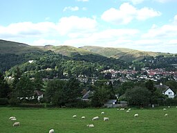
![]() This walk climbs to Ragleth Hill above Church Stretton in the Shropshire Hills. It's a fairly steep climb but only about a 1.5 mile walk from the town centre. Though not as popular a climb as its neighbour of Caer Caradoc, the hill provides some truly excellent views.
This walk climbs to Ragleth Hill above Church Stretton in the Shropshire Hills. It's a fairly steep climb but only about a 1.5 mile walk from the town centre. Though not as popular a climb as its neighbour of Caer Caradoc, the hill provides some truly excellent views.
The walk starts from the train station in Church Stretton where you can pick up the Jack Mytton Way. This waymarked footpath will take you south toward Dryhill Farm before climbing to Ragleth Hill. The hill stands at a height of just under 400 metres, offering fine views over the town below and the surrounding countryside. If you look to the north you can see Caer Caradoc which offers an opportunity for extending your walking in the area.
Ragleth Hill Ordnance Survey Map  - view and print off detailed OS map
Ragleth Hill Open Street Map  - view and print off detailed map
Ragleth Hill OS Map  - Mobile GPS OS Map with Location tracking
Ragleth Hill Open Street Map  - Mobile GPS Map with Location tracking
Pubs/Cafes
Back in Church Stretton head to the historic Kings Arms on the High Street. It dates back to 1593 and is one of the oldest pubs in the area. It has a cosy interior with original beams and a log burner to warm yourself by on colder days. Outside there's a patio and a pretty garden area if the sun is shining. You can find the old pub on the High Street with a postcode of SY6 6BY for your sat navs. The inn is also dog friendly if you have your canine friend in tow.
You could also head south west from the hill and visit the pretty village of Little Stretton. Here you can pay a visit to the appropriately named Ragleth Inn. The historic pub dates from 1663 and includes one of the finest pub gardens in Shropshire. They do very good food and also have an interior full of character and charm. You can find the inn at postcode SY6 6RB for your sat navs.
Dog Walking
The hills and woods make for a fine walk for fit dogs. The Ragleth Inn mentioned above also welcomes dogs so you'll probably meet other owners in there.
Further Information and Other Local Ideas
To continue your walking in the area head west to the wonderful Long Mynd or north east to visit Wenlock Edge. The circular Little Stretton Walk visits the hill before heading to the Carding Mill Valley and then up to the Long Mynd.
From Little Stretton there's also the Ashes Hollow Walk which will take you along the Quinny Brook in a stunning V shaped valley.
For more walking ideas in the area see the Shropshire Hills Walks page.
Cycle Routes and Walking Routes Nearby
Photos
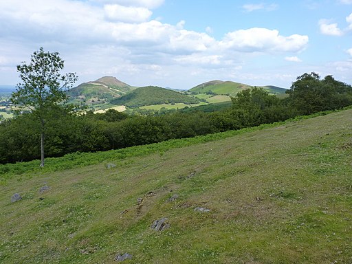
View northeast from Ragleth Hill summit pole Caer Caradoc peeps over the far end of the Ragleth on a glorious late summer day.


