Semer Water
![]()
![]() Semerwater is the second largest natural lake in North Yorkshire, England after Malham Tarn. This lovely circular walk in the Yorkshire Dales takes you around the pretty lake and through the heart of Raydale. You'll pass rivers, becks, a nature reserve and some beautiful countryside. It's a hidden gem so you should enjoy a peaceful and tranquil walk.
Semerwater is the second largest natural lake in North Yorkshire, England after Malham Tarn. This lovely circular walk in the Yorkshire Dales takes you around the pretty lake and through the heart of Raydale. You'll pass rivers, becks, a nature reserve and some beautiful countryside. It's a hidden gem so you should enjoy a peaceful and tranquil walk.
The walk starts at the car park near Countersett, on the northern end of the lake. You then follow a good footpath past the lake to Marsett, passing Keld Scar waterfall, Crooks Beck and Marsett Beck on the way. You then follow Marsett Lane back to Countersett.
The lake is located close to the market town of Hawes where there are nice footpaths to follow to a series of pretty waterfalls.
Postcode
DL8 3DJ - Please note: Postcode may be approximate for some rural locationsSemer Water Ordnance Survey Map  - view and print off detailed OS map
Semer Water Open Street Map  - view and print off detailed map
Semer Water OS Map  - Mobile GPS OS Map with Location tracking
Semer Water Open Street Map  - Mobile GPS Map with Location tracking
Explore the Area with Google Street View 
Further Information and Other Local Ideas
Just to the north there's the worthy village of Askrigg. The pretty settlement is notable as the fictional Darrowby in the BBC TV series All Creatures Great and Small. From the village you can visit the pretty Mill Gill and Whitfield Force Waterfalls.
The circular Bainbridge Walk visits the reservoir from the nearby settlement. The village is worthy of a visit with pleasant views of the River Bain and a 15th century hotel which is one of the oldest in Yorkshire.
The climb to Wether Fell also starts in the village. You can follow the old Roman Road south to Horton Gill Force Waterfall and then on to the summit of this excellent local viewpoint.
The hugely popular Aysgarth Falls lies a little further to the east.
For more walking ideas in the area see the Yorkshire Dales Walks page.
Cycle Routes and Walking Routes Nearby
Photos

Semerwater sports

The lake from High Force. A long distance shot of Semerwater in Raydale with an 8x zoom

From near Stalling Busk

Grassy footpaths near the lake

Bridge at edge of the lake and start of river Bain

Car Park Owned and operated by Low Blea Farm.

Ford, Marsett. Busk Lane enters Cragdale Water

Ford through Raydale Beck
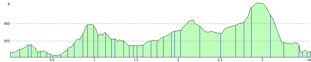
Elevation Profile