Shepreth Walks

 This South Cambridgeshire village is located south of Cambridge and north of Royston.
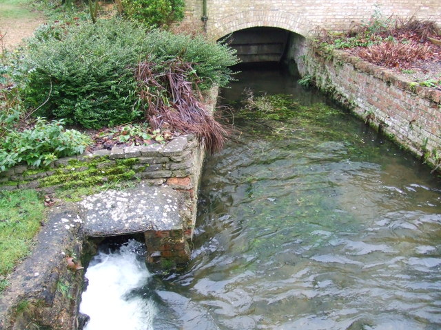
The small settlement has its own train station on the Great Northern Line, the main line between Cambridge and London. As such its a nice place to visit for a stroll with some pleasant public footpaths running off in different directions. It's also well known for Shepreth Wildlife Park where you can see a wide variety of animals including red pandas, llamas, monkeys and tigers. It's a nice place for a walk with little streams and good footpaths taking you around the site.
This walk takes you north along public footpaths to the neighbouring village of Barrington. On the way there's some nice countryside and views of the River Rhee (or Cam) as you approach Barrington. You'll also pass along the outskirts of the wildlife park and the site of some ancient Roman buildings on the eastern side of Shepreth.
To continue your walking in the area head south to neighbouring Melbourn where you can pick up the Harcamlow Way and the Icknield Way Path. These popular long distance trails are a great way of further exploring the countryside around the village.
Another local walking highlight is Royston Heath where there's miles of trails and fine viewpoints with views over Hertfordshire and Cambridgeshire.
Postcode
SG8 6PZ - Please note: Postcode may be approximate for some rural locationsShepreth Ordnance Survey Map  - view and print off detailed OS map
Shepreth Open Street Map  - view and print off detailed map
Shepreth OS Map  - Mobile GPS OS Map with Location tracking
Shepreth Open Street Map  - Mobile GPS Map with Location tracking
Walks near Shepreth
- Royston Heath - This large area of heathland is located just to the south west of the town of Royston in Hertfordshire
- Haslingfield - This attractive village in South Cambridgeshire is a pleasant place for an easy riverside stroll
- Therfield - A circular walk from the village of Therfield in Hertfordshire
- Cambridge Backs Walk - This circular city walk takes you around the highlights of Cambridge, visiting The Backs, a picturesque area where several colleges of the University of Cambridge back on to the River Cam
- Cambridge to Grantchester - This is a popular riverside walk from Cambridge to the nearby village of Grantchester
- Cambridge to Ely Walk - Enjoy a lovely waterside walk along the River Cam and River Great Ouse from Cambridge to Ely
- Cambridge to St Ives along the Busway - Enjoy a walk or cycle along this disused railway line which now forms part of National Cycle Network Route 51
- Milton Country Park - This lovely park in Cambridge boasts nearly 100 acres of lakes and gardens interlaced with footpaths and cycle trails
- Anglesey Abbey - Explore 114 acres of beautiful gardens surrounding this Jacobean mansion in Cambridge
- Wandlebury Country Park - This walk takes you around the delightful Wandlebury Country Park in Cambridge
- Gog Magog Hills - This walk explores the Gog Magog Downs, a ridge of low chalk hills extending for several miles to the southeast of Cambridge
- Fen Rivers Way - This is a teriffic riverside walking route running from Cambridge to King's Lynn in Norfolk
- Wimpole Hall - This 17th century country house near Cambridge is surrounded by 3,000 acres of parkland and farmland
- Wimpole Way - Follow the Wimpole way through Cambridgeshire's farmland, ancient woodland and gentle rolling countryside from Cambridge to Wimpole Hall
- Hardwick Wood - This walk takes you from the Cambridgeshire village of Hardwick to the nearby Hardwick Wood Nature Reserve
- Cambourne - This walk visits the Cambourne Nature Reserve before heading to the neighbouring villages of Caxton and Bourn.
- Harcamlow Way - This long distance walk takes you to some of the most beautiful countryside, interesting historical sites and delightful country parks in the counties of Cambridgeshire, Essex and Hertfordshire.
The route is a figure-of-eight, starting in Harlow and first heading to Saffron Walden where you will pass the splendid Jacobean mansion and gardens at Audley End - Icknield Way Path - The Icknield Way Path starts at Ivinghoe Beacon in Buckinghamshire and heads to Knettishall Heath in Suffolk along prehistoric pathways
Further Information and Other Local Ideas
Just to the west is the National Trust's Wimpole Hall. This historic estate is surrounded by a large park with lakes, woodland, old ruins and beautiful gardens. You can also pick up the Wimpole Way long distance trail here.


