Talgarth Walks

 This ancient market town sits on the edge of the Black Mountains in the Brecon Beacons National Park.
There's some great local history with local highights including the 12th century Bronllys Castle, a 14th century church and Talgarth Mill, an 18th-century water mill in the centre of the town. Bronllys Castle is well worth a visit as you can climb to the top of the tower and enjoy some excellent views over the surrounding hills and mountains.
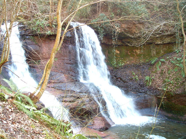
This walk from the town takes you south to visit the Pwll-y-Wrach Nature Reserve. It's a lovely place for a walk with ancient woodland, riverside trails along the River Ennig and pretty waterfalls. The reserve has some interesting flora and fauna including the lesser butterfly-orchid and the lesser horseshoe bat. In the spring you can see lots of bluebells while wildflowers appear in the summer months.
To continue your walking in the area head south where you can try the more challenging climbs to Waun Fach and Mynydd Troed. The waterside paths around Llangorse Lake are also located near here.
To the north you can pick up the Wye Valley Walk and enjoy more riverside trails along the River Wye around Glasbury.
Postcode
LD3 0BW - Please note: Postcode may be approximate for some rural locationsTalgarth Ordnance Survey Map  - view and print off detailed OS map
Talgarth Open Street Map  - view and print off detailed map
Talgarth OS Map  - Mobile GPS OS Map with Location tracking
Talgarth Open Street Map  - Mobile GPS Map with Location tracking
Walks near Talgarth
- Bronllys - This walk visits Bronllys Castle just south of the village of Bronllys in Powys
- Waun Fach - Climb to the highest mountain in the Black Mountains on this challenging walk in the Brecon Beacons
- Grwyne Fawr Reservoir - This is a lovely waterside walk along the Grwyne Fawr to Grwyne Fawr Reservoir in the Brecon Beacons
- Mynydd Du Forest - This large area of woodland in the Black Mountains has miles of forest tracks suitable for walking and mountain biking
- Dragons Back - Climb the Dragons Back on this challenging circular walk in the Black Mountains, Wales
- Mynydd Troed - This circular walk climbs to Mynydd Troed and Cockit Hill in the Black Mountains section of the Brecon Beacons National Park
- Sugarloaf Mountain - Climb to the summit of this iconic mountain on this challenging circular walk in Monmouthshire, Wales
- Llangorse Lake - Follow good footpaths around the western side of this beautiful lake in the Brecon Beacons National Park
- Wye Valley Walk - This walk takes you through the beautiful Wye Valley in Gloucestershire, Herefordshire and Wales.
The walk begins on the mouth of the River Wye at Chepstow Castle in Monmouthshire and follows the River Wye north to Monmouth, passing the fascinating ruins of Tintern Abbey on the way - Brecon Beacons Way - Follow the Beacons Way through the centre of the stunning Brecon Beacons National Park
- Talybont Reservoir - This circular cycling and walking route takes you around the lovely Talybont Reservoir in the Brecon Beacons National Park
- Monmouthshire and Brecon Canal - Follow the Monmouthshire and Brecon Canal from Brecon to Newport on this super waterside walking and cycling route
- Builth Wells - This small market town in Powys has some nice river trails and a pleasant local park to stroll through
- Glasbury - This pretty riverside village is located in Powys near Hay on Wye.
Pubs/Cafes
Back in the town head to Talgarth Mill for some post walk refreshments. Here you'll find a nice cafe with views over the river. There's also a shop selling local arts and crafts.


