Black Mountains Walks

Use the links to view full route information including elevation profiles, interactive maps and GPS downloads.
You can also view an overview map of all the routes in the using the Black Mountains Walk Map>>
*New* - Walks and Cycle Routes Near Me Map - Waymarked Routes and Mountain Bike Trails>>
| Route Name | Photo | Distance | Description |
| Abergavenny Sugarloaf Walk | 7.1 miles (11.5 km) | This epic circular walk takes you to the summit of Sugarloaf Mountain from the town of Abergavenny. The distinctive hill is a prominent landmark in all directions and a very worthy climb. It's a challenging 7 mile hike with tremendous views for most of the way. Start the walk in the centre of Abergavenny, near to the bus station and priory. You can then follow roads north through the town to Cantref and Llywyndu. Country lanes here will lead you to the footpaths which will take you up to the Sugarloaf summit which stands at a height of 1,955 feet (596 metres). The far ranging views encompass the Usk Valley, Severn Estuary, the Cotswolds to the east, the Brecon Beacons including Pen y Fan and Corn Du to the west and the Bristol Channel to the south. After taking in the views you descend to the west and then south to the lovely Mynydd Llanwenarth ridge. After descending the ridge you then pick up the same country lanes and roads to take you back into the centre of Abergavenny. To continue your walking around the town you could try the climb to Skirrid Fawr which starts in Abergavenny. You could also pick up the long distance Brecon Beacons Way which runs through the area. For an alternative circular route try our Sugarloaf Mountain Walk which starts from the car park at the base of the hill. View Full Details>> | |
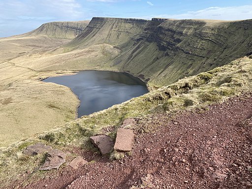
| Carmarthen Fans | 8.1 miles (13 km) | This walk climbs to Picws Du and Fan Brycheiniog in the Carmarthen Fans area of the Brecon Beacons Walks National Park. View Full Details>> | |
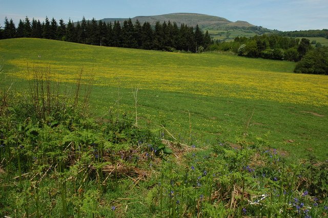
| Cats Back | 7.8 miles (12.5 km) | This circular walk climbs to the Cat's Back, a wonderful ridge on Black Hill in the Black Mountains region of the Brecon Beacons. View Full Details>> | |
| Dragons Back | 7.1 miles (11.5 km) | Climb the Dragons Back on this challenging circular walk in the Black Mountains, Wales. The route runs for just over 7 miles and includes a visit to the highest point of the Black Mountains at Waun Fach. The views along the ridge are breathtaking in all directions. The walk starts from the parking area near Pengenffordd. Head north from here toward the village where you can pick up a trail heading east to Castell Dinas. This Iron Age hillfort has the highest castle in England and Wales. A Norman castle was built here in the 11th century. What remains now are crumbling walls mainly covered with earth and the outlines of ditches and ramparts from the original Iron Age fortifications, commanding extensive views up into the Black Mountains and over Talgarth towards Brecon. After exploring the fort the route continues east to Y Grib and Pen Y Manllwyn. Here you turn south to Waun Fach which stands at a height of 811 m (2,661 ft). From here there are views over the Brecon Beacons including Rhos Fawr and the Radnor Forest. You may also see some wild ponies wandering around the area. The walk then descends to the south west toward Pen Trumau. Soon after you turn west along Rhiw Trumau and Cwmmfforest. The route then returns to the car park. You can enjoy well earned refreshments at the Castle Inn in Pengenffordd after your exercise. View Full Details>> | |
| Golden Valley Herefordshire | 11.2 miles (18 km) | This walk takes you through the beautiful Golden Valley in western Herefordshire. It's a very scenic area with the rolling countryside of the valley of the River Dore and a number of pretty villages to enjoy. The valley stretches from Ewyas Harold in the south to Dorstone in the north. There are several interesting historical sites to visit on the way including a former mediaeval Cistercian monastery and a chamber tomb from the Neolithic Period. This walk starts from the village of Ewyas Harold which lies on the site of Ewyas Harold Castle, of which only the motte remains. From here you can pick up the Herefordshire Trail and follow it north through Ewyas Harold Common. The common contains an ancient greenway, meadow saffron (left over from cultivation by the monks at Dore Abbey), and lots of interesting wildlife. Soon after leaving the common you will come to Abbey Dore and the remains of Dore Abbey. This former mediaeval Cistercian monastery was built between 1175 and 1220 and restored in the 1630s. After exploring the atmospheric ruins the route continues past Abbey Dore Court which includes lovely gardens which are open to the public on certain days. At this point you pick up a nice footpath running along the River Dore to Blackbush Farm. Here you cross the river on Moorhampton Bridge and follow another path toward Turnastone, Vowchurch and Peterchurch. The final section of the walk follows a quiet country lane north west to the finish point at Dorstone. You can extend the walk slightly by continuing through the village north east to Arthur's Stone. The Neolithic chambered tomb, or Dolmen, dates from 3,700 BC – 2,700 BC. It is situated on the ridge line of a hill overlooking both the Golden Valley and the Wye Valley. View Full Details>> | |
| Hatterrall Hill | 3.5 miles (5.6 km) | This circular walk climbs to Hatterrall Hill which lies in an interesting spot on the England/Wales border in the Black Mountains. View Full Details>> | |
| Hay Bluff | 0.9 miles (1.5 km) | This is a popular climb to Hay Bluff hill in the Black Mountains. The hill straddles the border of Wales and England. Most of the area lies within Powys with the eastern flanks in Herefordshire. From the summit there are wonderful views over the Wye Valley and the Welsh Mountains. This walk starts from the Hay Bluff car park located just half a mile north west of the hill. However, you could also start the walk from Hay on Wye. Just follow the Offa's Dyke Path south from the town centre for about three miles and you will reach the hill. The path passes Cusop and Tack Wood before arriving at the car park and Stone Circle at the foot of the climb. The route to the 677 m (2,221 ft) passes Ffynnon y Parc on a good path. You can further explore the area as the entire hill is designated as open country so walkers have the freedom to roam at will. View Full Details>> | |
| Llangynidr | 3.7 miles (6 km) | This pretty village in Powys is in a fine location for exploring the surrounding hills and countryside of the Black Mountains, the Brecon Beacons and the Usk Valley. There's also nice local trails along the canal and river which flow through this picturesque area. View Full Details>> | |
| Llanthony Priory Circular Walk | 3.1 miles (5 km) | This walk visits the historic Llanthony Priory in the Vale of Ewyas, Brecon Beacons. The former Augustinian priory dates back to 1100 and is a Grade I listed building. The picturesque ruins are now under the care of Cadw and entrance is free to the public. The Brecon Beacons Way long distance trail runs past the abbey so this route uses part of the waymarked path to create a circular walk around the abbey. You can start from the car park next to the priory and then follow footpaths east to pick up the long distance trail. Follow the trail south east and the path will join with the Offa's Dyke Path. The National Trail runs just to the east of the priory and is a great way of exploring this area on the English-Welsh border. This route heads west along public footpaths to Maes-y-Beran before turning north west to return to the car park. View Full Details>> | |
| Lord Hereford's Knob (Twmpa) | 1.2 miles (2 km) | This is a short climb to Lord Hereford's Knob or Twmpa in the Black Mountains. The scenery is stunning with magnificent views over the Brecon Beacons National Park on one side and the Herefordshire countryside on the other. You can park at the Gospel Pass car park about 1 mile to the east of the hill. From here you can pick up the footpath to the 690 m (2,260 ft) summit. View Full Details>> | |
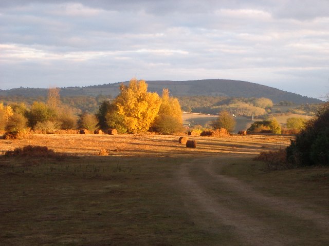
| Michaelchurch Escley | 7.5 miles (12 km) | This little Herefordshire village is located on the eastern side of the Brecon Beacons, in the Black Mountains region. It's a nice place to start a walk with some significant hills to climb to the west. The village itself is also very pretty with a little brook running through it and a fine local pub for refreshments after your exercise. View Full Details>> | |
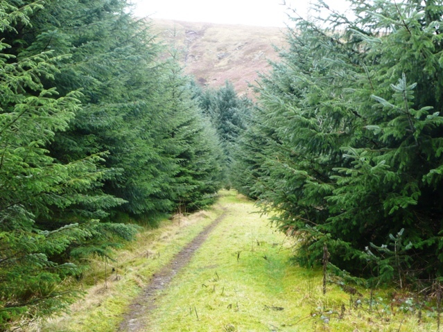
| Mynydd Du Forest | 8.1 miles (13 km) | This large area of woodland in the Black Mountains has miles of forest tracks suitable for walking and mountain biking. The waters of the Grwyne Fawr run through the woods so there is the option of a waterside walk to the nearby Grwyne Fawr Reservoir along the river. You can start your exercise from the Mynydd Du car park at the northern end of the woods, a few miles west of the splendid Llanthony Priory. It's situated in a nice spot at the end of a country lane just next to the river. From here you can pick up the forest trails through the western side of the woods before crossing the river at Pont Cadgwan and returning on the eastern side of the river. There's lots of attractive trees and plants and some steep climbs with great views of the surrounding hills. The riverside sections are lovely too with lots of pretty waterfalls to enjoy. View Full Details>> | |
| Mynydd Troed | 6.8 miles (11 km) | This circular walk climbs to Mynydd Troed and Cockit Hill in the Black Mountains section of the Brecon Beacons National Park. You'll also pass through the attractive valley of the River Rhiangoll on the return leg. View Full Details>> | |
| Olchon Valley | 4.8 miles (7.8 km) | This circular walk takes you through the Olchon Valley in the Black Mountains. View Full Details>> | |
| Pen Cerrig Calch | 5.5 miles (8.8 km) | This walk climbs to Pen Cerrig Calch from the town of Crickhowell in the Black Mountains area of the Brecon Beacons National Park. View Full Details>> | |
| Skirrid Fawr | 9 miles (14.5 km) | Climb this 486m (1594 feet) mountain in the Brecon Beacons on this challenging walk. Skirrid Fawr (or Ysgyryd Fawr) forms part of the Black Mountains range. The walk starts in Abergavenny, next to the tourist information centre and follows the Marches Way long distance trail to the summit. Here you will find the ruins of an iron–age hill fort and St Michael's medieval Roman Catholic church. There are splendid views across the Brecon Beacons, Black Mountains, Abergavenny and the surrounding countryside. The walk descends through woodland areas before rejoining the Marches Way and returning to Abergavenny. If you'd like to climb another black mountain then the iconic Sugarloaf is also near Abergavenny. The Brecon Beacons Way also runs through the area so you could pick this up to continue your walk. View Full Details>> | |
| St Illtyd's Walk | 59.7 miles (96 km) | A religous walk from Pembrey Country Park (Carmarthenshire) to Margam Country Park (Neath). The path runs through Hendry, Pontardawe and Bryn.
You will visit Penlle'r Castell ruin on the summit of Mynydd y Betws (with fabulous views), the spectacular Melincourt Falls on the Neath River and the Vale of Neath. There are also splendid views of the Black Mountains and peaceful wooded sections near Abercregan. The two splendid country parks at either end of the walk are also real highlights on this challenging walk. Near Swansea the route also skirts the edge of the wonderful Cwm Clydach National Nature Reserve. View Full Details>> | |
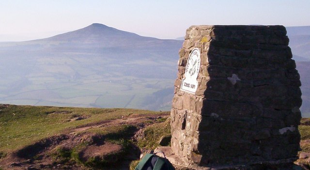
| Sugarloaf Mountain | 5 miles (8 km) | Climb to the summit of this iconic mountain on this challenging circular walk in Monmouthshire, Wales. Sugarloaf is part of the Black Mountains range and stands at a height of 1,955 feet (596 metres). The walk starts at the car park to the south of the summit near the town of Abergavenny. You head towards the lovely oak woodland of St Mary's Vale where you will pass pretty streams and a variety of woodland wildlife. You continue on to the summit where there are fabulous views of the Severn Estuary, the Cotswolds to the east, as far as the Brecon Beacons including Pen y Fan and Corn Du to the west and the Bristol Channel to the south. There are also great views over the nearby Usk River Valley and Abergavenny. On a clear day you could also see the Shropshire Hills and Somerset. You descend towards Mynydd Llanwenarth, passing ancient medieval ditches before returning to the finish point, back at the car park. If you'd like to continue your climbing in the area then the Skirrid Fawr walk also starts in Abergavenny. You could also pick up the splendid Brecon Beacons Way which runs through the area. To start the hike from the town see our alternative Abergavenny Sugarloaf Walk which starts from the bus station in the town centre and uses an alternative path to climb to the summit. View Full Details>> | |
| Table Mountain | 3.7 miles (6 km) | Enjoy wonderful views over the Brecon Beacons on this moderate climb to the 451m peak of Table Mountain (Crug Hywel). The walk starts from the pretty town of Crickhowell with its ruined Norman castle and 18th century 13-arched bridge across the river Usk. You then follow the Table Mountain footpath which starts at the northern end of the town. It passes through fields and woodland to the unusual flat top of the mountain. At the top you will find an Iron Age Hill Fort and wonderful views in all directions. If you would like to extend the walk then you could continue north along the Cambrian Way to the summit of Pen Cerrig Calch, a subsidiary summit of Waun Fach, standing at a height of 701 metres. You could also pick up the Usk Valley Walk which runs past Crickhowell. The long distance Brecon Beacons Way also passes Table Mountain so you can easily pick this up too. View Full Details>> | |
| Talgarth | 2.5 miles (4 km) | This ancient market town sits on the edge of the Black Mountains in the Brecon Beacons National Park. View Full Details>> | |
| Waun Fach | 7.5 miles (12 km) | Climb to the highest mountain in the Black Mountains on this challenging walk in the Brecon Beacons. The walk starts from Castell Dinas just of the A479. View Full Details>> |