Toddbrook Reservoir
![]()
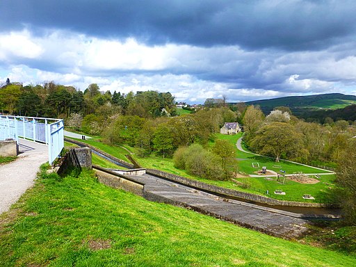
![]() Enjoy a short waterside walk along this pretty reservoir in Whaley Bridge. Toddbrook was built in 1831 to supply water for the Peak Forest Canal which you can pick up at Whaley Bridge Basin. You can easily reach the reservoir from the train station/centre of the town. There is a nice footpath running along the reservoir with views of the surrounding woodland, countryside and Peak District hills. Look out for birds including herons and ducks on the water.
Enjoy a short waterside walk along this pretty reservoir in Whaley Bridge. Toddbrook was built in 1831 to supply water for the Peak Forest Canal which you can pick up at Whaley Bridge Basin. You can easily reach the reservoir from the train station/centre of the town. There is a nice footpath running along the reservoir with views of the surrounding woodland, countryside and Peak District hills. Look out for birds including herons and ducks on the water.
If you would like to extend your walk then the Midshires Way runs past the reservoir so you could pick this up and head south through the Goyt Valley to the nearby Errwood and Fernilee Reservoirs. You can also explore the Errwood Estate with its old ruined hall and peaceful woodland with azaleas and rhododendrons. Another good option is the climb Eccles Pike for far reaching views over the Peak District. This walk also starts from Whaley Bridge. Also in the town you can pick up the Peak Forest Canal and head east to the restored Bugsworth Basin or north toward North Mills.
Postcode
SK23 7BL - Please note: Postcode may be approximate for some rural locationsToddbrook Reservoir Ordnance Survey Map  - view and print off detailed OS map
Toddbrook Reservoir Open Street Map  - view and print off detailed map
Toddbrook Reservoir OS Map  - Mobile GPS OS Map with Location tracking
Toddbrook Reservoir Open Street Map  - Mobile GPS Map with Location tracking
Pubs/Cafes
After your walk head to the The White Hart pub on Market St in Whaley Bridge (postcode SK23 7HN). It's a popular and friendly pub with a beer garden overlooking the stream.
The Cock is another really good option and can be found on Buxton Road at postcode SK23 7JE. It has a nice interior and a beer garden to relax in during the warmer months.
Just to the south west is the village of Kettleshulme where you could visit The Swan Inn. The historic pub dates back to the 15th Century and includes timber beams and an open log fire in Winter. There are two outdoor patio areas for warmer weather. You can find them at postcode SK23 7QU. They also provide car parking.
Dog Walking
The reservoir is a nice place for a dog walk. The White Hart pub mentioned above is also dog friendly.
Further Information and Other Local Ideas
A few miles to the south east of the lake there's Combs Reservoir near Chapel en le Frith. Here you can also enjoy some splendid rock formations and an excellent viewpoint at Castle Naze. The Promontory fort on Combs Edge commands fine views to the surrounding Peak District hills.
For more walking ideas in the area see the Peak District Walks page.
Cycle Routes and Walking Routes Nearby
Photos
From the western end looking east; most of the reservoir area is within square SK0080, though the dam is in SK0081. The reservoir was built in 1831 to supply water for the Peak Forest Canal, which terminates in nearby Whaley Bridge.


