Turvey Circular Walk
![]()
![]() This attractive Bedfordshire village is situated in a lovely rural spot close to the River Great Ouse.
This attractive Bedfordshire village is situated in a lovely rural spot close to the River Great Ouse.
This circular walk explores the countryside and woodland to the south of the village using a mixture of waymarked trails, country lanes and public footpaths.
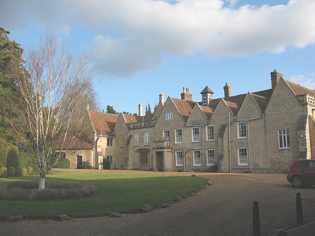
The walk starts in the village centre where you can pick up the Milton Keynes Boundary Walk. Follow the waymarked trail south and it will take you to Mossy Bank Wood, Turvey Hall, Gullet Wood and Gorwelle. Here you turn east to Ramacre Wood before turning north to Horseclose Spinney, Hill Spinney and Abbey Park. You'll then pass Turvey Abbey before returning to the village. The abbey dates from the early 15th century and was formerly a country house. It now belongs to the "Priory of Our Lady of Peace", a Benedictine order of nuns.
The start/finish point for the walk is very close to Turvey House. The 18th century house is set in 150 acres of surrounding parkland and is open to visitors on certain days of the year.
Turvey Ordnance Survey Map  - view and print off detailed OS map
Turvey Open Street Map  - view and print off detailed map
Turvey OS Map  - Mobile GPS OS Map with Location tracking
Turvey Open Street Map  - Mobile GPS Map with Location tracking
Pubs/Cafes
Head to the excellent Three Fyshes pub for some refreshments after your walk. The friendly country pub does good food and is in a great location next to the river on the medieval Turvey Bridge. There's more history too with the building dating back to the 15th century and the inn back to 1624. Inside there's a charming olde worlde interior with a flagstone floor and inglenook fireplace. Outside there's a lovely seating area with views over the river. You can find them on Bridge Street with a postcode of MK43 8ER for your sat navs.
Dog Walking
The country and woodland trails on the walk are a nice one to do with your dog. The Three Fyshes mentioned above is also very dog friendly with a lovely doggy bar in the garden.
Further Information and Other Local Ideas
A few miles north of the village you'll find Harrold Odell Country Park. The park has a lovely walking trail around a large lake to try. The park is also located very close to the worthy villages of Felmersham and Sharnbrook where you'll find pleasant riverside trails, a Norman church, a wildlife rich local nature reserve and a delightful mill theatre converted from the historic old water mill.
The North Bedfordshire Heritage Trail also passes through the village. The waymarked trail explores the countryside and villages of North Bedfordshire.
Due east of the village you can pick up the circular Stevington Country Walk. This uses sections of the John Bunyan Trail and the Ouse Valley Way to visit the restored Stevington Windmill and the villages of Oakley and Pavenham. Near here there's also the neighbouring village of Bromham where you can visit the old 18th century mill.
For more walking ideas in the area see the Bedfordshire Walks page.
Cycle Routes and Walking Routes Nearby
Photos
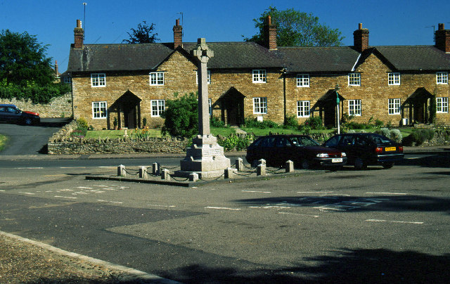
Turvey. This picture was taken from the church gate looking at the war memorial which is at the centre of the village.
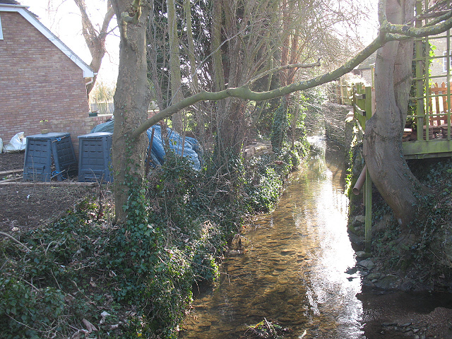
Stream in Turvey. This minor stream, unnamed on the map, flows through Turvey village and is a minor tributary of the nearby Great Ouse.
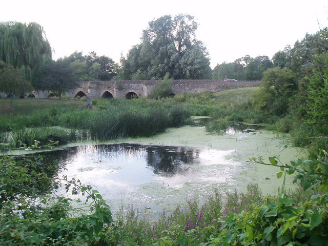
Turvey Bridge. The 11-arch bridge dates from the medieval period and is the oldest crossing of the River Great Ouse in Bedfordshire.
Statue of Jonah at Turvey. This statue, known as Jonah, is one of two on the small island that can be seen from the south side of Turvey Bridge - see also Jonah's wife in this square. Jonah is a male with a dolphin at his feet, 10ft tall and Grade II listed. Apparently he came from the monastery of the Bonhommes founded at Ashridge and was erected on this site by John Higgins, a worthy of nearby Turvey Abbey.
Turvey Abbey: front of main building The Abbey was originally a private house but has been the home of an Olivetan Benedictine monastic community since 1980. This, the main house, is the nuns' quarters and not open to visitors. It dates in part from the 17th century and is grade 2 listed.
