John Bunyan Trail
![]()
![]() Follow in the footsteps of John Bunyan, the Puritan Evangelist and author of the book 'Pilgrim's Progress'. The walk visits many historic villages associated with Bunyan. It starts at Streatley and visits Sharpenhoe, Harlington, Westoning, Steppingley, Flitwick, Ampthill, Millbrook, Ridgmont, Cranfield, Bromham, Stevington, Pavenham, Oakley, Clapham, Bedford, Elstow, Shefford, Meppershall, Shillington, Hexton and Barton le Clay before returning to Streatley. There's some beautiful Bedfordshire countryside to enjoy including Sharpenhoe Clappers, the Barton Hills, the Pegsdon Hills and views of the Chiltern Hills for much of the walk.
Follow in the footsteps of John Bunyan, the Puritan Evangelist and author of the book 'Pilgrim's Progress'. The walk visits many historic villages associated with Bunyan. It starts at Streatley and visits Sharpenhoe, Harlington, Westoning, Steppingley, Flitwick, Ampthill, Millbrook, Ridgmont, Cranfield, Bromham, Stevington, Pavenham, Oakley, Clapham, Bedford, Elstow, Shefford, Meppershall, Shillington, Hexton and Barton le Clay before returning to Streatley. There's some beautiful Bedfordshire countryside to enjoy including Sharpenhoe Clappers, the Barton Hills, the Pegsdon Hills and views of the Chiltern Hills for much of the walk.
The walk is waymarked with a white disc featuring a silhouette of John Bunyan.
John Bunyan Trail Ordnance Survey Map  - view and print off detailed OS map
John Bunyan Trail Open Street Map  - view and print off detailed map
John Bunyan Trail OS Map  - Mobile GPS OS Map with Location tracking
John Bunyan Trail Open Street Map  - Mobile GPS Map with Location tracking
Pubs/Cafes
One nice place to stop off at on the trail is the delightful village of Barton le Clay near Sharpenhoe. Here you'll find the 19th century Royal Oak which has good facilites with a car park and a lovely garden area to relax in on warmer days. There's also a good menu and fine selection of real ales. Highly recommended are their delicious pizzas! You can find the pub on the Bedford Road with postcode of MK45 4JX for your sat navs.
The Swan is located close to the river and mill in the pretty Bedfordshire village of Bromham. The Georgian Inn serves a good Sunday lunch and has a good selection of ales. You can find them at Bridge End with postcode MK43 8LS for your sat navs.
In Flitwick you can stop off at The Crown. They have a good menu and a lovely large garden area for warmer days. You can find them on Station Road at postcode MK45 1LA for your sat navs. The village is also worth exploring with a medieval church and the Georgian Flitwick Manor, which is Grade II listed. Just to the east there's also the Flitwick Moor Nature reserve to explore. The Site of Special Scientific Interest is the largest area of wetland in Bedfordshire. The circular walk from the village also visits Flitton where you'll find the De Grey Mausoleum. The English Heritage run site is one of the largest sepulchral chapels in the country. The Grade I listed Mausoleum contains over twenty monuments to the de Grey family who lived in nearby Wrest Park in Silsoe.
Further Information and Other Local Ideas
Some of the trail is suitable for cyclists with decent off road paths. See the video below for more details.
For more walking ideas in the area see the Bedfordshire Walks and Chilterns Walks pages.
Cycle Routes and Walking Routes Nearby
Photos
Across The John Bunyan Trail near Shefford. Looking down to a river/irrigation canal from Rowney Warren Wood with the trail in the foreground. This area is also near to Chicksands Wood. There's lots of flora and fauna here with pretty bluebells in the spring and a variety of woodland birds.
Besides The Pilgrim's Progress, Bunyan authored nearly sixty works, many of which were expanded sermons.
Bunyan hailed from the village of Elstow, near Bedford. He received some schooling and, at sixteen, joined the Parliamentary Army at Newport Pagnell during the first phase of the English Civil War. After three years in the army, he returned to Elstow and took up his father's trade of tinker. His interest in religion grew after his marriage, initially attending the parish church and then joining the Bedford Meeting, a nonconformist group at St John's church in Bedford. He eventually became a preacher.
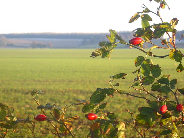
Looking south on the trail near Warden Hill and Galley Hill in Luton. Taken right in the middle of the grid square looking south. The square is almost entirely cultivated farmland, so I've added a splash of colour from the hedgerows!
Following the restoration of the monarchy, when nonconformist freedoms were restricted, Bunyan was arrested and spent the next twelve years in prison for refusing to cease preaching. During this imprisonment, he wrote his spiritual autobiography, Grace Abounding to the Chief of Sinners, and began his most renowned work, The Pilgrim's Progress.
In 1676, Charles II revoked his Act of Indulgence, leading to Bunyan's imprisonment again four years later, though this time for only six months. During this period, he completed The Pilgrim's Progress.
Bunyan spent his later years in relative comfort, continuing to be a popular author and preacher, serving as the pastor of the Bedford Meeting. He died at the age of 59 after falling ill on a journey to London and is buried in Bunhill Fields. The Pilgrim's Progress became one of the most published books in the English language, with 1,300 editions printed by 1938, 250 years after Bunyan's death.
Bunyan is commemorated in the Church of England with a Lesser Festival on 30 August. Some other churches within the Anglican Communion, such as the Anglican Church of Australia, honour him on the anniversary of his death (31 August).
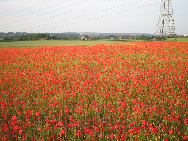
Field of poppies between Steppingley and Flitwick from near the trail. Steppingley road in the distance; electric pylon gives a link to the OS map; white building on right is part of Maulden Road industrial estate in Flitwick.
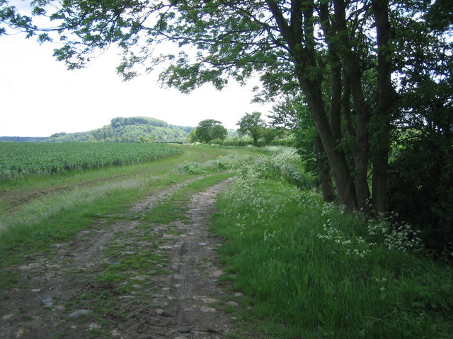
The trail enters Wootton. View from the footpath as it comes into Hall End, Wootton.
The Pilgrim's Progress from This World is considered one of the most important works of theological fiction in English literature and a precursor to the narrative aspect of Christian media. The book has been translated into over 200 languages and has remained in print continuously. It was first translated into Dutch in 1681, into German in 1703, and into Swedish in 1727. The first North American edition was published in 1681. It has also been cited as the first novel written in English. Literary editor Robert McCrum has stated that, apart from the Bible, no other English book rivals Bunyan's masterpiece for its broad readership and its influence on a diverse array of writers, including William Hogarth, C. S. Lewis, Nathaniel Hawthorne, Herman Melville, Charles Dickens, Louisa May Alcott, George Bernard Shaw, William Thackeray, Charlotte Brontë, Mark Twain, John Steinbeck, and Enid Blyton. The hymn "To be a Pilgrim" is based on words from the novel.
Towards Sharpenhoe. Sharpenhoe Clappers in the distance.
Bunyan began writing The Pilgrim's Progress while imprisoned in Bedfordshire county jail for violating the Conventicle Act of 1664, which banned religious services outside the Church of England. Early Bunyan scholars like John Brown believed the work was started during Bunyan's second, shorter imprisonment of six months in 1675. However, more recent scholars, such as Roger Sharrock, believe it was begun during his initial, longer imprisonment from 1660 to 1672, shortly after he wrote his spiritual autobiography Grace Abounding to the Chief of Sinners.
The English text of The Pilgrim's Progress contains 108,260 words and is divided into two parts, each presented as a continuous narrative without chapter divisions. The first part was completed in 1677 and registered with the Stationers' Register on 22 December 1677. It was licensed and included in the "Term Catalogue" on 18 February 1678, which is considered the date of first publication. Following the first edition in 1678, an expanded edition with additions written after Bunyan's release appeared in 1679. The second part was published in 1684. During Bunyan's lifetime, there were eleven editions of the first part, published annually from 1678 to 1685 and in 1688, and two editions of the second part, published in 1684 and 1686.


