Tynemouth Walks

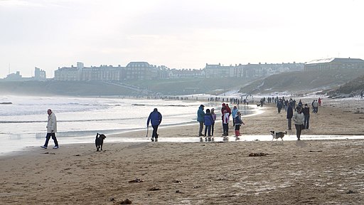
 This North Tyne town is a fine place for a historic coastal walk. There's splendid Georgian and Victorian architecture, an ancient priory and castle, and two lovely beaches to explore.
This walk in the town takes you to the Spanish Battery and the Admiral Lord Collingworth Monument before heading out onto the North Pier for some great views of the town.
You'll then explore Tynemouth Priory and Castle before heading along the coast to Sharpness Point, Long Sands, Tynemouth Park and North Point.
You can start the walk from the Priory Haven Car Park or the Spanish Battery Car Park near the pier.
Near the car parks you will also pass the Watch House Museum where you can learn all about the history of the local volunteer life brigade.
Along the way there are splendid views of the dramatic castle ruins and the local beaches around Cullercoats Bay.
Tynemouth Ordnance Survey Map  - view and print off detailed OS map
Tynemouth Open Street Map  - view and print off detailed map
Tynemouth OS Map  - Mobile GPS OS Map with Location tracking
Tynemouth Open Street Map  - Mobile GPS Map with Location tracking
Walks near Tynemouth
- Souter Lighthouse and Whitburn Coastal Park - Enjoy a coastal walk around the Souter Lighthouse, Whitburn Coastal Park and Lizard Point on the South Shields coast
- Whitley Bay to Tynemouth - Enjoy a coastal walk along the North East coast from Whitley Bay to Tynemouth
- Great North Forest Heritage Trail - This circular cycle and walking route takes you through the countryside of this former mining area in Tyne and Wear
- Newcastle - Newcastle upon Tyne is the most populous city in the North East of England
- Cleadon Hills - This circular walk climbs to the Cleadon Hills viewpoint above South Shields in Tyne and Wear.
- Seaton Sluice - This pretty village sits in a lovely spot on the Northumberland coast near Whitley Bay and Blyth.
- Blyth - This Northumberland based town has some nice coastal trails and paths along the River Blyth estuary to try.
- Newcastle To Tynemouth - This easy walk or cycle takes you from Newcastle to Tynemouth along the River Tyne.
- South Shields - This coastal town in Tyne and Wear sits in a fine spot at the mouth of the River Tyne.
- River Tyne Trail - This waymarked long distance trail runs from the coast at Tynemouth to the source of the Tyne at Tyne Head, just south of Garrigill in the North Pennines.
Pubs/Cafes
The Gibraltar Rock is a nice place to stop off for some refreshments on the walk. The pub is located in an excellent spot with views to the coast and the priory. They have a popular carvery and also serve fine fish and chips.
You can find them on East Street with a postcode of NE30 4EB for your sat navs.
Further Information and Other Local Ideas
The town marks the start of the River Tyne Trail an epic 80 mile route taking you along the river to Newcastle, Hexham, Haltwhistle and the source of the Tyne at Tyne Head, just south of Garrigill in the North Pennines.


