Upper Hulme Walks

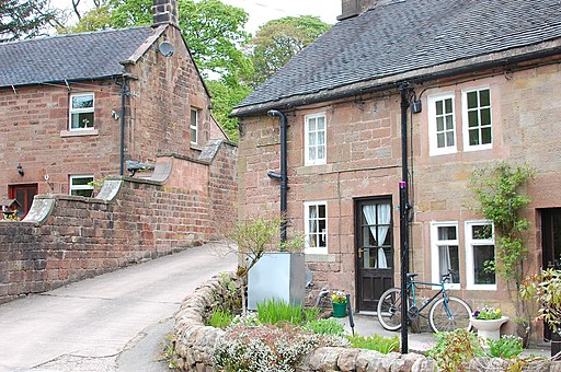
 This little hamlet in North Staffordshire is in a fine spot for exploring the south western corner of the Peak District National Park. It's a pretty place with views of the River Churnet, a picturesque weir and an old mill with a working water wheel.
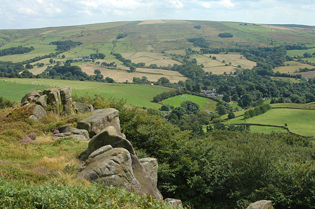
The settlement sits just to the south of two of the local highlights at Hen Cloud and The Roaches. This walk from Upper Hulme takes you up to these two notable hills where you can enjoy some fabulous views over the area. It's also great for wildlife with Wallaby to look out for on the Roaches, and the successful annual breeding of peregrine falcons.
To continue your walking in the area head just over a mile south west to visit Tittesworth Reservoir where you can enjoy a pleasant waterside walk along the water.
Scroll down for a list of other walks in and around Upper Hulme.
Postcode
ST13 8TY - Please note: Postcode may be approximate for some rural locationsUpper Hulme Ordnance Survey Map  - view and print off detailed OS map
Upper Hulme Open Street Map  - view and print off detailed map
Upper Hulme OS Map  - Mobile GPS OS Map with Location tracking
Upper Hulme Open Street Map  - Mobile GPS Map with Location tracking
Walks near Upper Hulme
- Hen Cloud - Enjoy a short climb to Hen Cloud on this circular walk in the Staffordshire Peak District
- The Roaches - This circular walk is one of the most popular in the Peak District and a favourite for many
- Tittesworth Reservoir - Enjoy a circular walk around this lovely reservoir on the edge of the Peak District
- Lud's Church - This walk visits the fascinating deep chasm of Lud's Church on the edge of the Staffordshire Peak District
- Three Shires Head - Explore this beautiful section of the Dane Valley and enjoy rivers, old stone bridges and waterfalls on this lovely walk in the Peak District.
Three Shires Head is a point on Axe Edge Moor where the counties of Cheshire, Derbyshire and Staffordshire meet - Wincle - With an excellent local pub and some fine Peak District scenery this little village is a fine place to start a walk.
- Caldon Canal - Follow the Caldon Canal through the beautiful River Churnet Valley on this easy walk in Staffordshire.
The walk starts at the lovely Froghall Wharf where you will find a good sized car park - Ladderedge Country Park - Explore 70 acres of wetland, meadows and woodlands on this short circular walk in Leek
- Rudyard Lake - Enjoy a cycle or walk around this large lake in the Staffordshire Moorlands near Leek
- Staffordshire Way - Travel through Staffordshire, Cheshire, Derbyshire, Worcestershire and enjoy canals, lakes, country parks and a series of pretty towns and villages
- Blackshaw Moor - This scenic area of the Peak District is close to a number of walking highlights and includes an excellent local inn for post walk refreshment.
- Staffordshire Moorlands Walks - This walk starts in Leek and uses sections of the waymarked Staffordshire Moorlands Walks trail to visit some of the highlights of the area including Tittesworth Reservoir, Rudyard Lake, Ladderedge Country Park, Deep Hayes Country Park, the Churnet Valley, Consall Nature Park, Coombes Valley RSPB Nature Reserve and the Caldon Canal.
- Coombes Valley - This circular walk explores the lovely Coombes Valley RSPB Nature reserve near Leek in Staffordshire.
- Leek - This town in the Staffordshire Peak District has lots of good options for walkers
Pubs/Cafes
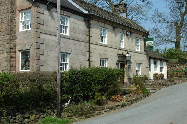
After your exercise you can enjoy some well earned refreshment at Ye Olde Rock Inn. The historic pub dates back over 200 years while the original part of the building dates back further and is believed to have been constructed in the late 17th Century. It was originally used as a house for the Mill Manager, responsible for the production of textiles in the working part of the village in the valley below.
The pub serves a fine Sunday lunch and also have pool room to the rear of the pub.
The inn is dog friendly too.


