Walks in Watford - Parks and Canal
![]()
![]() This pleasant waterside walk from Watford takes you through Cassiobury Park and along the Grand Union Canal to Uxbridge. You'll also use a section of the waymarked Colne Valley Trail where you can enjoy fine views of the River Colne. The route runs for a distance of about 11 miles along flat paths so can be completed in a day.
This pleasant waterside walk from Watford takes you through Cassiobury Park and along the Grand Union Canal to Uxbridge. You'll also use a section of the waymarked Colne Valley Trail where you can enjoy fine views of the River Colne. The route runs for a distance of about 11 miles along flat paths so can be completed in a day.
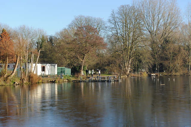
The walk starts in the pretty Cassiobury Park located just to the west of the town centre. The 190 acre park includes a waymarked nature trail where you can look out for a variety of wildlife including Herons, Kingfishers, Woodpeckers and Butterflies in the summer months. At the western end of the park you can cross the River Gade and link up with the canal. Follow the towpath south and it will take you to Rickmansworth. Here you'll pass the Rickmansworth Aquadrome, a public park and Local Nature Reserve with a series of attractive lakes.
The route continues south through Harefield where there's more lakes and Denham Country Park. The rivers Colne and Misbourne pass through the park where there is a variety of wildlife, including herons, kingfishers and dragonflies. The Colne Valley Park Visitor Centre is also located in the park and well worth a visit. There's a wealth of information about the area and a nice cafe which is a good place to stop for refreshments on the walk. Shortly after passing through the park you arrive in Uxbridge where the route finishes.
Watford Ordnance Survey Map  - view and print off detailed OS map
Watford Open Street Map  - view and print off detailed map
Watford OS Map  - Mobile GPS OS Map with Location tracking
Watford Open Street Map  - Mobile GPS Map with Location tracking
Further Information and Other Local Ideas
Uxbridge has an underground station on the Metropolitan Line which you can use with other rail services to return to Watford. There is also a direct bus service from the Greenway in Uxbridge.
To continue your walking around the Watford area head to the peaceful Whippendell Woods. There's 165 acres of ancient woodland to see here, with a noteable avenue of lime trees dating back to 1672. Similarly Bricket Wood Common, Abbots Langley and Leavesden Country Park and Oxhey Woods are also nearby with the latter including an excellent sculpture trail.
On the western side of the town you can pick up the Croxley Green Boundary Walk. This waymarked circular walk explores the area around the worthy village, visiting the canal and the River Gade on the way.
For more walking ideas in the area see the Hertfordshire Walks page.
Cycle Routes and Walking Routes Nearby
Photos
Cassiobury Park, Watford. Logs of that size are scattered around to break up the monotony of grass. The dark green of the trees denotes the line of the River Gade.
Grand Union Canal: Batchworth Lock, Rickmansworth. Lock Number 81 on the Grand Union Canal is the one on the right, as viewed from the London Road overbridge. The lock on the left is Salter's Cut Lock leading to a short stub of canal along the River Chess. It was built in 1805 by the brewer Samuel Salter to enable access by canal to his brewery, and was later used to allow boats to reach the Rickmansworth gasworks. Compare this image with Neil's 460073 taken from more or less the same location in 1977.


