Wycoller Country Park
![]()
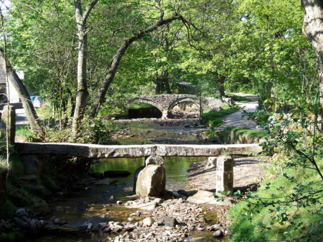
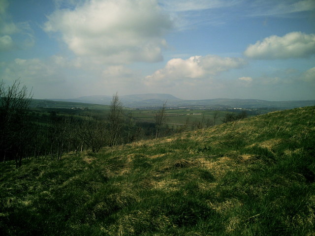
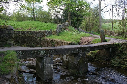
![]() Enjoy a lovely walk through the beauitful Wycoller Country Park in Pendle. The park has a number of footpaths taking you along Wycoller Beck to Bank House and the remains of Wycoller Hall. There are great views of the Pendle Hill and a stroll through the delightful Wycoller Village to enjoy. No cars are allowed in the village and many of the old buildings remain preserved, making it a particularly peaceful and special place. The area has strong links with the Bronte sisters who referred to many of the nearby landmarks in books such as 'Wuthering Heights' and 'Jane Eyre'. The park is located just a couple of miles east of Colne.
Enjoy a lovely walk through the beauitful Wycoller Country Park in Pendle. The park has a number of footpaths taking you along Wycoller Beck to Bank House and the remains of Wycoller Hall. There are great views of the Pendle Hill and a stroll through the delightful Wycoller Village to enjoy. No cars are allowed in the village and many of the old buildings remain preserved, making it a particularly peaceful and special place. The area has strong links with the Bronte sisters who referred to many of the nearby landmarks in books such as 'Wuthering Heights' and 'Jane Eyre'. The park is located just a couple of miles east of Colne.
If you wish to continue your walk both the Pendle Way and Bronte Way walking routes run through the park.
Postcode
BB8 8SX - Please note: Postcode may be approximate for some rural locationsWycoller Country Park Ordnance Survey Map  - view and print off detailed OS map
Wycoller Country Park Open Street Map  - view and print off detailed map
Wycoller Country Park OS Map  - Mobile GPS OS Map with Location tracking
Wycoller Country Park Open Street Map  - Mobile GPS Map with Location tracking
Pubs/Cafes
The Wycoller Craft Centre has some nice tea rooms where you can enjoy refreshments after your walk. It's in a lovely spot with a pretty garden area where you can sit outside and enjoy a scone with views of the little stream. The family run business can be found in the heart of Wycoller village at postcode BB8 8SY for your sat navs.
Dog Walking
The park and surrounding area is a great place for a dog walk so you'll probably bump into plenty of other owners on a fine day. The tea rooms mentioned above are also dog friendly.
Further Information and Other Local Ideas
The climb to Boulsworth Hill starts from Wycoller. The hill is located a few miles south of the park and includes the summit of Lad Law, which stands at 1,696 ft (517 m). It's a great viewpoint and well worth the climb.
To the west of the park there are some nice waterside trails around the two Foulridge Reservoirs.
To the west of the reservoir there's an interesting monument and viewpoint in the shape of the 19th century Blacko Tower, located just north of the village of Blacko. The long distance Pendle Way can also be picked up here.
For more walks in the area see the South Pennines Walks page.
Cycle Routes and Walking Routes Nearby
Photos
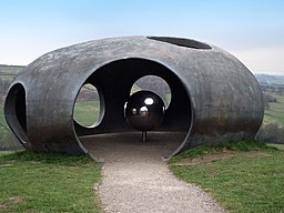
Pendle's Panopticon, 'Atom', rests on the hillside above Wycoller village in the park. Constructed in ferro-cement with a surface coating of metal-based paint, it is both a striking contemporary viewing point and shelter from which to enjoy Pendle's glorious scenery, and an intriguing and beautiful object which can be viewed from afar. From inside, its circular viewing spaces frame spectacular views of the surrounding countryside, and an initially hidden, polished steel ball reflects back those views to the visitor.
Wycoller Hall. The ruins of the old hall thought to be the inspiration for 'Ferndean Manor' in Charlotte Bronte's novel Jane Eyre.


