Broadway Tower Short Walk
![]()
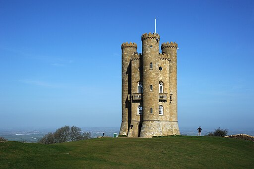
![]() Enjoy fabulous views of the Cotswolds AONB in this beautiful park in Broadway, Worcestershire. This 5 mile circular walk takes you up to the focal point of the park at the 65ft high Broadway Tower. The tower was the brainchild of Capability Brown and designed by James Wyatt in 1794 in the form of a Saxon castle. It is the second highest point in the Cotswolds so there are wonderful views as far as the Welsh Mountains in one direction and Buckinghamshire in the other. From the top of the tower, on a clear day, as many as 16 English counties can be identified. The park is also home to a herd of Red Deer and includes several peaceful woodland trails.
Enjoy fabulous views of the Cotswolds AONB in this beautiful park in Broadway, Worcestershire. This 5 mile circular walk takes you up to the focal point of the park at the 65ft high Broadway Tower. The tower was the brainchild of Capability Brown and designed by James Wyatt in 1794 in the form of a Saxon castle. It is the second highest point in the Cotswolds so there are wonderful views as far as the Welsh Mountains in one direction and Buckinghamshire in the other. From the top of the tower, on a clear day, as many as 16 English counties can be identified. The park is also home to a herd of Red Deer and includes several peaceful woodland trails.
The circular trail starts from the Fish Hill car park, just to the north east of the tower, at a postcode of WR12 7LD for your sat navs. From here you can pick up the Cotswolds Way National Trail to take you south up to the tower before exploring the woodland and country trail around the wider park.
The Cotswold Way provides and opportunity for continuing your walking in the area. The nearby Chipping Campden is a good option or you could visit the delightful Snowshill village and manor house on the Broadway to Snowshill Circular Walk. Our 10 mile Cotswold Way Circular Walk from Chipping Campden uses a lovely section of the national trail to visit the tower and nearby Dover's Hill.
Postcode
WR12 7LD - Please note: Postcode may be approximate for some rural locationsPlease click here for more information
Broadway Tower Country Park Ordnance Survey Map  - view and print off detailed OS map
Broadway Tower Country Park Open Street Map  - view and print off detailed map
*New* - Walks and Cycle Routes Near Me Map - Waymarked Routes and Mountain Bike Trails>>
Broadway Tower Country Park OS Map  - Mobile GPS OS Map with Location tracking
Broadway Tower Country Park Open Street Map  - Mobile GPS Map with Location tracking
Pubs/Cafes
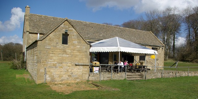
Head to the Morris & Brown cafe for some refreshments on the walk. Inside there's a cosy log fire or you can relax outside on the terrace and enjoy great views with your meal. You can find the cafe at postcode WR12 7LB. It also provides an alternative start point for the walk.
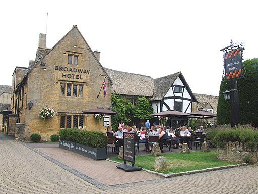
You could also head into the village and visit The Broadway Hotel. The hotel is in a lovely spot on the quaint village green, alongside beautiful boutiques and honey-coloured cottages. It includes a brasserie and a racing themed bar, inspired by the nearby Cheltenham Racecourse and its famous Gold Cup. The Broadway dates all the way back to 1575 and also has a fine garden area to relax in on warmer days. You can find it in the village at a postcode of WR12 7AA.
Dog Walking
The tower park is a good place for a dog walk. You are requested to keep them on leads because of the deer. The cafe mentioned above and the Broadway Hotel are also dog friendly.
Further Information and Other Local Ideas
The Donnington Way - Cotswolds Pub Walk passes through the village. The long circular walk visits 15 fine old Donnington Brewery pubs in the Cotswolds.
Less than a mile to the south of Chipping Campden there's the neighbouring village of Broad Campden where you'll find the 18th century pub known as the 'local' of Father Brown, the crime-solving priest who stars in the BBC drama filmed in the Cotswolds.
To the south there's the worthy neighbouring village of Stanton. From here you could continue south along the waymarked trail and visit Stanway House. The Jacobean manor house, was originally constructed in the late 16th and early 17th century for the Tracy family. It is designated as a Grade I listed building. Stanton is also well worth exploring too. It's generally considered to be one of the loveliest Cotswolds villages and includes a Norman church, a fine 17th century pub and several ancient houses built from the honey coloured limestone quarried from the nearby Shenberrow Hill.
Cycle Routes and Walking Routes Nearby
Photos
Broadway Tower, a folly in the English county of Worcestershire. The "Saxon" tower was designed by James Wyatt in 1794 to resemble a mock castle, and built for Lady Coventry in 1799. Broadway Tower sits on the edge of the second highest point in the Cotswolds overlooking the village of Broadway and the Severn Vale. From the top of the tower, on a clear day, as many as 16 English counties can be identified.
The park is also home to a variety of mammals. Roe deer are occasionally seen grazing in the quieter areas, while rabbits and hares can often be spotted darting through the grasslands. Foxes and badgers are present but tend to be more elusive, emerging mostly during the twilight hours. The Tower itself and the surrounding stone walls provide shelter for bats, which can be seen on summer evenings as they hunt for insects.
Broadway Tower pictured in the summer of 2007. From 1822 to 1862, the tower housed the private printing press of Sir Thomas Phillipps. By the mid-1870s, it was being rented by C. J. Stone and Cormell Price. Price was headmaster of the United Services College at Westward Ho! and a friend of artists William Morris, Edward Burne-Jones, and Dante Gabriel Rossetti; in 1876 Morris wrote in a letter to Aglaia Coronio that he was "up at Crom Price's Tower among the winds and the clouds".
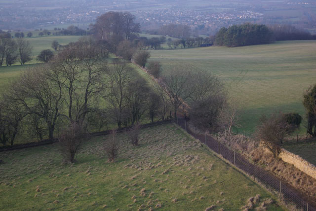
Looking down from the Tower. The footpath, part of the Cotswold Way, heads down towards Broadway village which can be seen in the distance at the foot of the escarpment.
The park's grasslands are rich in wildflowers, particularly during spring and summer when species such as cowslips, buttercups, and oxeye daisies are in full bloom. These wildflowers provide a valuable source of nectar for insects, including bees, butterflies, and hoverflies. Notable butterfly species in the area include the marbled white and common blue, which thrive in the meadows.
The surrounding woodlands feature a mix of deciduous trees like oak, ash, and beech, creating a habitat for numerous bird species. Woodland birds such as blue tits, great tits, and robins are commonly seen flitting between the branches. In more open areas, skylarks and meadow pipits are often heard singing, and red kites or buzzards may be spotted soaring overhead. During the autumn months, the trees offer a spectacular display of colours, with their leaves turning vibrant shades of gold, orange, and red.
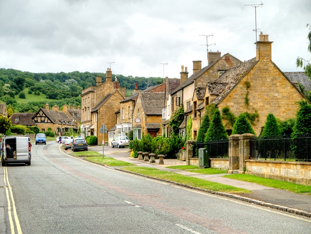
Broadway High Street. A view down the high street of the pretty village which lies just to the north of the park. The "broad way" is the wide grass-fringed main street, centred on the Green, which is lined with red chestnut trees and honey-coloured Cotswold limestone buildings, many dating from the 16th century. The wide High Street feature here is lined with a wide variety of shops and cafes, many housed in listed buildings. It's a fine place for a stroll after your visit to the park.
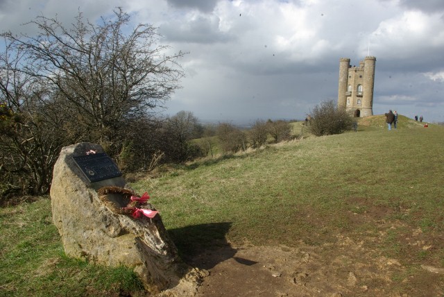
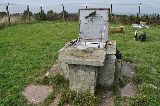
Entrance to Broadway ROC nuclear bunker. In the late 1950s, the tower monitored nuclear fallout in England; an underground Royal Observer Corps bunker was built 50 yards (46 m) from the Tower. Staffed continuously from 1961 and designated as a master post, the bunker was one of the last such Cold War bunkers constructed and, although officially stood down in 1991, the bunker is now one of the few remaining fully equipped facilities in England.
Broadway Hotel in the village. A fine place to relax after your exercise. Pictured here is the attractive outdoor area. Today, Broadway is a centre for arts and antiques. The village's accommodation includes the Broadway Hotel, Russell's "a restaurant with rooms", the 1600s Cotswold inn the Lygon Arms, a caravan site, holiday cottages, bed and breakfast lodges, old pubs including the Swan Inn and Crown & Trumpet, shops, restaurants and tea rooms. This former school, Grade II Listed, at 67 High St. was part of a shop in 1856 and was enlarged in 1869. It again houses a shop. Local attractions include the Gordon Russell Design Museum (celebrating the work of the 20th-century furniture maker Sir Gordon Russell MC), the Ashmolean Museum Broadway displaying objects from the 17th to the 21st centuries in 'Tudor House', a former 17th-century coaching inn, the 65-foot-high Broadway Tower on its hilltop site in the Broadway Tower Country Park, Chipping Campden, Snowshill village, Snowshill Manor (owned by the National Trust), horse riding and, for the many ramblers, the Cotswold Way.
