Broad Campden Walks
![]()
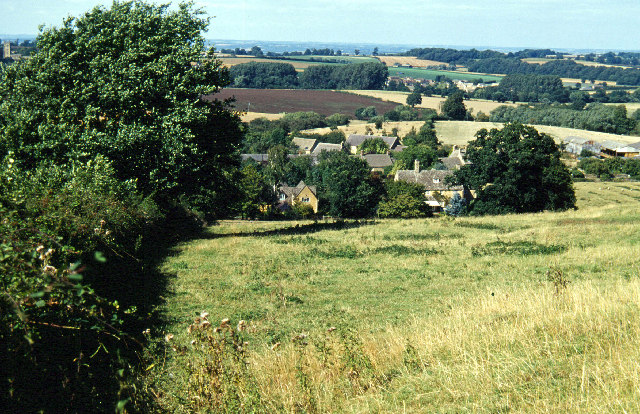
![]() This splendid Cotswolds village includes a number of picturesque thatched buildings, a photogenic old church and a noteworthy pub dating back to the early 18th century.
This splendid Cotswolds village includes a number of picturesque thatched buildings, a photogenic old church and a noteworthy pub dating back to the early 18th century.
This circular walk from the village visits the neighbouring village of Chipping Campden before exploring a lovely section of the Monarch's Way to the south west of the settlement.
The walk starts in the village and follows the Monarch's Way north to visit the more well known village of Chipping Campden, crossing the pretty River Cam as you go. Head through the village and you can pick up the Heart of England Way and follow it south towards Briar Hill Farm. The route then head south west through some attractive countryside to Campden Hill Farm before returning to the village.
Postcode
GL55 6UR - Please note: Postcode may be approximate for some rural locationsBroad Campden Ordnance Survey Map  - view and print off detailed OS map
Broad Campden Open Street Map  - view and print off detailed map
Broad Campden OS Map  - Mobile GPS OS Map with Location tracking
Broad Campden Open Street Map  - Mobile GPS Map with Location tracking
Walks near Broad Campden
- Cotswold Way Circular Walk - Chipping Campden - This splendid circular walk uses the Cotswold Way and the Donnington Way to explore the countryside and landmarks surrounding the Cotswold villages of Chipping Campden and Broadway
- Broadway Tower Country Park - Enjoy fabulous views of the Cotswolds AONB in this beautiful park in Broadway, Worcestershire
- Chipping Campden to Dover's Hill - This walk climbs to Dover's Hill from the lovely market town of Chipping Campden in the Cotswolds
- Ebrington and the Foxcote Estate - This circular walk takes you around some beautiful countryside on the Gloucestershire/Warwickshire border in the Cotswolds AONB
- Blockley - This walk explores the Cotswolds countryside to the south of the pretty village of Blockley
- Hidcote Manor Garden - Explore these stunning National Trust owned gardens on this short walk in the Cotswolds
- Ilmington - This walk from Ilmington makes use of three waymarked trails to create a fine circular route through the countryside surrounding the Cotswolds village
- Mickleton - This pretty Cotswolds village is the northernmost village in the county of Gloucestershire
- Upper Quinton - This pretty Warwickshire village sits on the edge of the Cotswolds, just south of Stratford Upon Avon
- Honeybourne - This rural Worcestershire based village is located near the Vale of Evesham, the Cotswolds and the village of Mickleton
- Bretforton - This attractive rural village is located in Worcestershire, near the village of Honeybourne, the town of Evesham and the beautiful Cotswolds.
Pubs/Cafes
The award winning Baker's Arms is a fine place for rest and refreshment after your exercise. It's a classic Cotswolds pub dating back to 1724 and including Cotswold stone walls, exposed beams and a fine inglenook. They serve good quality food and have a lovely garden area for warmer days. You can find them at postcode GL55 6UR for your sat navs.
The pub is also known as the 'local' of Father Brown, the crime-solving priest who stars in the BBC drama filmed in the Cotswolds.
Dog Walking
The country trails make for a fine dog walk and the Baker's Arms mentioned above is also dog friendly.
Further Information and Other Local Ideas
The circular Upper Quinton Walk also visits Hidcote from the village to the north. The sister village of Lower Quinton includes a noteworthy 16th century pub once owned by Henry VIII.
Photos
Broad Campden. Looking along the main street towards the church in this picturesque Cotswold village. The building on the right is The Malt House, now a guest house but originally the village malt house and associated cottages.
The Mount, Broad Campden. Some interesting roof lines on this cottage alongside the minor road which runs through the village.


