Fingle Bridge and Woods Walk
![]()
![]() Explore the delightful woods around Fingle Bridge and visit the Iron Age Hill Fort of Wooston Castle on this woodland walk in Dartmoor. The area is actually made up of a series of woods including Charles Wood, Hore Wood, Butterdon Ball Wood and Houndsmoor Wood. It covers over 400 acres with waymarked trails and lots of wildlife to look out for. From the high points there are wonderful views over Dartmoor and the option of continuing your walk through the Teign Gorge towards Castle Drogo.
Explore the delightful woods around Fingle Bridge and visit the Iron Age Hill Fort of Wooston Castle on this woodland walk in Dartmoor. The area is actually made up of a series of woods including Charles Wood, Hore Wood, Butterdon Ball Wood and Houndsmoor Wood. It covers over 400 acres with waymarked trails and lots of wildlife to look out for. From the high points there are wonderful views over Dartmoor and the option of continuing your walk through the Teign Gorge towards Castle Drogo.
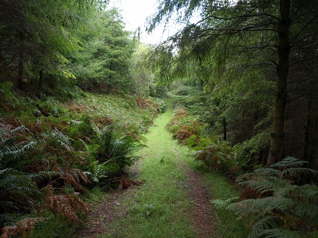
This circular walk starts at the Fingle Bridge car park and takes you along the River Teign which runs through the northern part of the woods. It's a lovely riverside path with the peaceful river surrounded by pretty bluebells and attractive woodland. The path then climbs to Wooston Castle which overlooks the Teign Valley. You then descend the hill fort and return to the car park on other trails in the southern section of the woods.
It's easy to extend your walk by heading west along the river and visiting Castle Drogo. You can pick up the fantastic Hunters Path and enjoy fabulous views across Dartmoor before exploring the wider estate of the country house of Castle Drogo.
You could also head east along the river on our Fingle Bridge to Clifford and Steps Bridge Walk. This walk visits the nearby Dunsford Nature Reserve where there are daffodils, bluebells, woodland glades and many different types of butterfly to look out for in the summer months.
The Dartmoor Way also starts at Fingle Bridge so you can follow this along the Teign towards Chagford to further stretch your legs.
Postcode
EX6 6PW - Please note: Postcode may be approximate for some rural locationsFingle Bridge and Woods Ordnance Survey Map  - view and print off detailed OS map
Fingle Bridge and Woods Open Street Map  - view and print off detailed map
Fingle Bridge and Woods OS Map  - Mobile GPS OS Map with Location tracking
Fingle Bridge and Woods Open Street Map  - Mobile GPS Map with Location tracking
Explore the Area with Google Street View 
Pubs/Cafes
The Fingle Bridge Inn is in a great location right next to the river. You can sit outside in the large garden area which overlooks the woods and the river, which is just a few feet away from the tables. On a fine day it's the perfect place to relax with a cream tea after your exercise. Inside there's a cosy interior with a stone hearth and wood ceiling beams. You can find the inn right next to the old bridge at postcode EX6 6PW for your sat navs.
Dog Walking
The area is great for dog walking and the Fingle Bridge Inn mentioned above is also dog friendly where dogs (on leads) are welcome on the terraces and in the bar.
Further Information and Other Local Ideas
About 1.5 miles north west of the bridge is the delightful Stone Lane Gardens. Here you'll find botanical gardens and an arboretum with many different types of trees and a series of lovely wooden sculptures. It's a tranquil place to go for a stroll and another of the area's worthy attractions. You can find the gardens about 1 mile due west of Drewseignton. The postcode is TQ13 8JU for your sat navs.
The Moretonhampstead Walk visits the site from the nearby town. The fine market town is well worth a visit with a number of historic buildings including the old Alms Houses and the Parish Church of St Andrew, which dates back to the 15th century.
For more walking ideas in the area see the Dartmoor Walks page.
Cycle Routes and Walking Routes Nearby
Photos
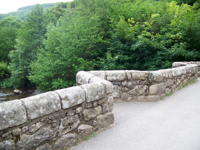
Fingle Bridge is a narrow road bridge over the River Teign. It dates from between the 16th and 17th century. The packhorse bridge is Grade II listed.
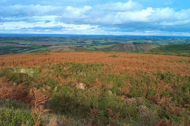
The Teign Valley looking west from Wooston hillfort. From the elevated position of the fort there are commanding views to the Teign Gorge and towards Dartmoor. The hill also surrounded by pretty heather in the late summer months.
Charles Wood, located just south of the bridge. Mature trees edge a clearing on the wood's steep slopes on the southern side of the Teign gorge. This is National Trust land. Across the valley in the background rises Prestonbury Common.
There has probably been a crossing point over the River Teign here since time immemorial as it is on the route that links Moretonhampstead with Drewsteignton and the north side of the river. The old narrow packhorse bridge with its triangular refuges has certainly been in existence since the 17th century. This is the upstream face viewed looking downstream with the roof of The Fingle Bridge Inn just visible over the top of the bridge parapet.
Drewsteignton: The Fingle Bridge Inn. In late Victorian times the many visitors to Fingle Bridge over the River Teign were catered for by a tea room in the corn mill. When the corn mill burnt down in 1894, the owner of the cottage nearest the bridge took over the business, and provided a tea shelter. This gradually metamorphosed into a tea room, then a cafe, then The Anglers Rest Public House, and finally today's Fingle Bridge Inn. This view was taken from the bridge on a very wet mid-week afternoon.


