Flamborough Head Circular Walk
![]()
![]() Enjoy some spectacular coastal views on this circular walk along Flamborough Head in the North York Moors. On the walk you'll pass towering white chalk cliffs, coves, caves, pretty bays and the oldest surviving lighthouse in Britain. The area is also designated as a nature reserve so look out for large seabird colonies including auks, gannets and gulls. In summer you may also see fulmars, herring gulls, kittiwakes, guillemots, razorbills and puffins. In the Holmes area there are also interesting plants and flowers which attract a variety of butterflies.
Enjoy some spectacular coastal views on this circular walk along Flamborough Head in the North York Moors. On the walk you'll pass towering white chalk cliffs, coves, caves, pretty bays and the oldest surviving lighthouse in Britain. The area is also designated as a nature reserve so look out for large seabird colonies including auks, gannets and gulls. In summer you may also see fulmars, herring gulls, kittiwakes, guillemots, razorbills and puffins. In the Holmes area there are also interesting plants and flowers which attract a variety of butterflies.
This walk starts at the village of Flamborough and picks up a footpath south to the coast. You then head along the coast passing Cross Bow Hill and a radio station beacon. You continue past Selwicks Bay to Thornwick Bay before returning to Flamborough via another countryside footpath.
The headland is located near to the popular town of Bridlington so you could walk along the coast to the site. See the Bridlington to Flamborough Head Coastal Walk for more details.
The East Riding Heritage Way also passes through Flamborough Head so you could continue along this path to the nearby Bempton Cliffs where you can see more seabirds. See the Flamborough to Bempton Cliffs Walk for details of how to reach the site.
Also nearby is the pretty Dane's Dyke. These pretty woods have peaceful trails with lots of flora and fauna to look out for.
Postcode
YO15 1JS - Please note: Postcode may be approximate for some rural locationsFlamborough Head Ordnance Survey Map  - view and print off detailed OS map
Flamborough Head Open Street Map  - view and print off detailed map
*New* - Walks and Cycle Routes Near Me Map - Waymarked Routes and Mountain Bike Trails>>
Flamborough Head OS Map  - Mobile GPS OS Map with Location tracking
Flamborough Head Open Street Map  - Mobile GPS Map with Location tracking
Explore the Area with Google Street View 
Pubs/Cafes
On the headland itself you can visit the 19th century North Star Hotel and enjoy fine sea views. lt has an award-winning restaurant renowned for its fresh Flamborough seafood and wild game caught on the Yorkshire Wolds.
You could also head west from the headland to Thornwick Bay and enjoy wonderful views from the cliff top cafe. The cafe's speciality is locally caught crab which you can enjoy with a glass of wine or cup of tea. It's a great place to relax with some refreshments and enjoy the views at the same time.
Cycle Routes and Walking Routes Nearby
Photos
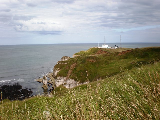
The coastline at Flamborough Head, renowned for its dazzling white chalk cliffs and stacks, with the Fog Signal Station situated on the most easterly point of the headland. The cliffs provide nesting sites for seabirds, including puffins, guillemots, razorbills, and kittiwakes, with Bempton Cliffs hosting one of the UK’s largest mainland gannet colonies. The area also attracts fulmars, shags, and herring gulls. Peregrine falcons can sometimes be seen hunting along the cliffs.
The surrounding waters support grey seals, which are often spotted resting on rocky shores or swimming near the cliffs. Harbour porpoises and occasionally minke whales are also seen offshore.
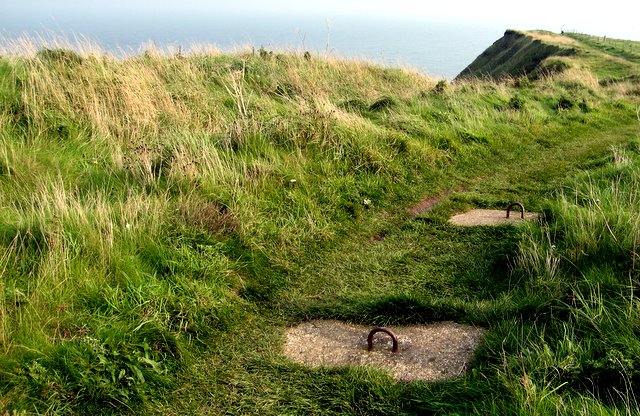
Footpath to South Landing from Flamborough Head, Flamborough, East Riding of Yorkshire, England.
This shows the start of the public footpath along the coast to South Landing from Flamborough Head.
The grasslands atop the cliffs contain wildflowers such as thrift, common rock-rose, and bird’s-foot trefoil, which attract butterflies including the small copper and common blue. Other insects, such as burnet moths and hoverflies, are common in summer. The area also supports small mammals like voles and field mice, which in turn attract barn owls and kestrels.
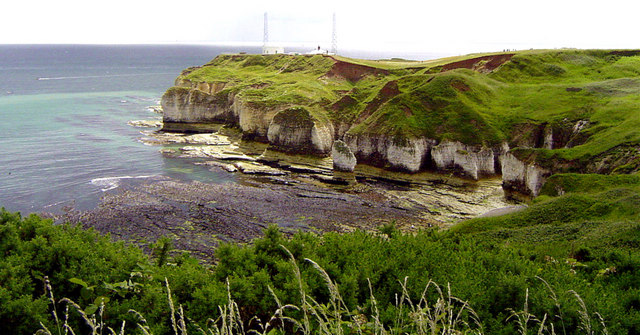
The North Sea turns a Turquoise/Blue colour around Flamborough Head on a calm sunny day and the beaches of Selwicks Bay become more inviting! Intertidal rock pools host marine life such as crabs, anemones, and small fish, while the chalk reef offshore is home to sea slugs, sponges, and corals, making it an important area for marine biodiversity.
Village street in Flamborough with local bus. Known for its historic fishing heritage, the village features traditional cottages, a small harbour at North Landing, and a range of local amenities, including pubs, shops, and guesthouses catering to visitors. The village also has a Norman-era church, St Oswald’s, with a distinctive tower.
Elevation Profile


