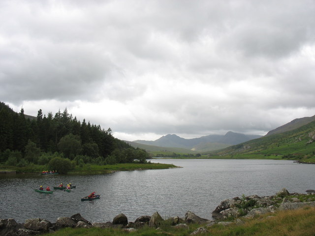
Llynnau Mymbyr
![]()
![]() Enjoy a short walk along this picturesque lake in the Dyffryn Mymbyr valley area of the Snowdonia National Park.
Enjoy a short walk along this picturesque lake in the Dyffryn Mymbyr valley area of the Snowdonia National Park.
The walk starts from the car park at Capel Curig and follows a track to the lake. There are footpaths on either side of the lake with the ones on the southern side passing the woodland of Coed Bryn-Engan. There are lovely views across the water to the surrounding mountains. It is a particularly good spot to get a photo of the Snowdon Horseshoe across the water.
If you'd like to continue your walking in the area then you could climb to Moel Siabod or visit the nearby Llyn Cowlyd.
Postcode
LL24 0ET - Please note: Postcode may be approximate for some rural locationsLlynnau Mymbyr Ordnance Survey Map  - view and print off detailed OS map
Llynnau Mymbyr Open Street Map  - view and print off detailed map
Llynnau Mymbyr OS Map  - Mobile GPS OS Map with Location tracking
Llynnau Mymbyr Open Street Map  - Mobile GPS Map with Location tracking
Explore the Area with Google Street View 
Pubs/Cafes
At the eastern end of the lake you will find Plas Y Brenin, a National Outdoor Centre for Rock Climbing, Mountaineering, Hiking & Hillwalking, Canoeing, Kayaking and Mountain Biking. Within the centre there's the Yr Wyddfa Bar and Restaurant which is a great place for some post walk refreshments. The bar boasts the best view in Britain as it looks down to the lake and the Snowdon Horseshoe. There's a good menu with locally sourced food and drink.
Further Information and Other Local Ideas
For some interesting local history try the Dolgarrog Pipeline Walk. This explores the area around the little village, visiting the impressive pipeline structure and the Coedty reservoir. Near here there's also the beautiful Llyn Eigiau where the reservoir dam was breached leading to the Dolgarrog Dam disaster of 1925.
Cycle Routes and Walking Routes Nearby
Photos
The lake from Moorland Heather. This Southwesterly view of Llynnau Mymbyr was taken from surrounding heather above Llyn y Coryn.


