Brockenhurst to Burley - The Old Railway Cycle Route New Forest
![]()
![]() This route follows National Cycle Route 2 from Brockenhurst to Burley. The route is also known as the Castleman's Corkscrew.
This route follows National Cycle Route 2 from Brockenhurst to Burley. The route is also known as the Castleman's Corkscrew.
The route runs for just over 8 miles following a series of country lanes and off road forest trails between the two New Forest towns. Much of the route is traffic free along an old railway line so also makes for a pleasant walk.
Starting off near the train station in Brockenhurst follow a country lane south to the golf course and Lymington Junction. Here you pick up a traffic free trail running west along the old Southampton to Dorchester Railway Line. It will pass Blackhamsley Hill and Wilverley Plain to Holmsley. You then turn north to follow another country lane north to Holmsley Bog and Goatspen Plain before coming into Burley.
Brockenhurst to Burley Ordnance Survey Map  - view and print off detailed OS map
Brockenhurst to Burley Open Street Map  - view and print off detailed map
Brockenhurst to Burley OS Map  - Mobile GPS OS Map with Location tracking
Brockenhurst to Burley Open Street Map  - Mobile GPS Map with Location tracking
Further Information and Other Local Ideas
Head a few miles west to Ringwood and you can continue your riding along the railway on the Castleman Trailway. The 15 mile trail will take you to the south coast town of Poole, passing some lovely country parks on the way.
Cycle Routes and Walking Routes Nearby
Photos
The Old Mill, Brockenhurst, New Forest. View across a pasture field from a field gate on Mill Lane, towards the timbered Old Mill buildings alongside the Lymington River. The mill is marked as a "saw mill" on the 1940s OS map, and nowadays is a private residence.
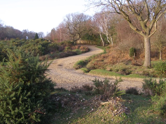
Off-road cycle path, near Cater's Cottage, New Forest. Here the cycle path from Lymington Junction makes a sharp right and left and joins the route of the old railway line through Hincheslea Bog towards Holmsley. The waymarked gravel paths are permitted routes for cycling in the open Forest - the Forest by-laws prohibit cycling off these routes, although this doesn't stop a significant number of people from doing it.
Ponies grazing in Longslade Bottom. These ponies are grazing on the edge of heathland in Longslade Bottom. The tree-covered embankment on the left is the disused railway line, which now serves as an off-road cycle-route to Lymington Junction south of Brockenhurst.


