Kidderminster to Bridgnorth
28 miles (45 km)

 This route follows National Cycle routes 54 and 45 from Worcestershire into Shropshire. You start in Kidderminster near the train station and then head south along National Cycle route 54 and the Staffordshire and Worcestershire Canal to Stourport-on-Severn. The route then turns north west along National Cycle Route 45 to Bewdley where you will cross the River Severn. A lovely off road stretch through the Wyre Forest follows before heading into the beautiful Severn Valley Country Park with a pleasant stretch along the River Severn to enjoy.
Quiet roads take you past Hampton Loade before an off road section around Chelmarsh Reservoir then takes you into Bridgnorth, finishing at the train station.
Kidderminster to Bridgnorth Ordnance Survey Map  - view and print off detailed OS map
Kidderminster to Bridgnorth Open Street Map  - view and print off detailed map
Kidderminster to Bridgnorth OS Map  - Mobile GPS OS Map with Location tracking
Kidderminster to Bridgnorth Open Street Map  - Mobile GPS Map with Location tracking
Cycle Routes and Walking Routes Nearby
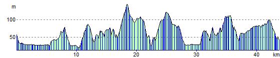
Elevation Profile