Manchester to Altrincham
14.3 miles (23 km)
![]()
![]() This ride follows National Cycle Route 62 through Manchester to Altrincham. You start by Manchester Oxford Road station heading south through Chorlton to the River Mersey. A lovely off road section along the river follows, passing Sale Water Park on the way. More off road paths and quiet roads take you through Trafford to Altrincham where you finish at the train station.
This ride follows National Cycle Route 62 through Manchester to Altrincham. You start by Manchester Oxford Road station heading south through Chorlton to the River Mersey. A lovely off road section along the river follows, passing Sale Water Park on the way. More off road paths and quiet roads take you through Trafford to Altrincham where you finish at the train station.
Manchester to Altrincham Ordnance Survey Map  - view and print off detailed OS map
Manchester to Altrincham Open Street Map  - view and print off detailed map
Manchester to Altrincham OS Map  - Mobile GPS OS Map with Location tracking
Manchester to Altrincham Open Street Map  - Mobile GPS Map with Location tracking
Cycle Routes and Walking Routes Nearby
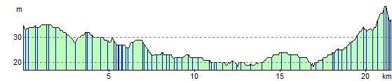
Elevation Profile