National Cycle Route 11
![]()
![]() Travel from Essex to the Cambridgeshire Fens on this signed National Cycle Route.
Travel from Essex to the Cambridgeshire Fens on this signed National Cycle Route.
The area is great for easy cycling with lots of flat paths and a lovely stretch along the Fen Rivers Way.
Route highlights include the wildlife at the Wicken Fen Nature Reserve, sections along the River Cam and the famous university city of Cambridge.
Towns on the route include Stansted Mountfitchet, Cambridge, Ely and Downham Market.
See below for a list of manageable day rides on the route. Scroll further down for route videos and the complete gpx file.
Cycle Routes on National Cycle Route 11
- Cambridge to Stansted Mountfitchet - Travel from Cambridgeshire to Essex along National Cycle route 11
- Cambridge to Waterbeach - Follow the River Cam and National Cycle route 11 on this lovely easy ride
- Cambridge to Ely - This route follows National Cycle routes 11 and 51 through Cambridgeshire
- Ely to Downham Market - This easy route follows National Cycle route 11 from Cambridgeshire to Norfolk
- Downham Market to King's Lynn - This easy route through Norfolk follows National Cycle route 11 & 1 from Downham Market to King's Lynn
- Lodes Way - This circular cycling trail runs through the Cambridgeshire Lodes on National Cycle Route 11 from the Wicken Fen Nature Reserve to Bottisham.
National Cycle Route 11 Ordnance Survey Map  - view and print off detailed OS map
National Cycle Route 11 Open Street Map  - view and print off detailed map
National Cycle Route 11 OS Map  - Mobile GPS OS Map with Location tracking
National Cycle Route 11 Open Street Map  - Mobile GPS Map with Location tracking
Further Information and Other Local Ideas
Around Downham Market you can link up with National Cycle Network Regional Route 30. The circular loop explores Norfolk, visiting several major towns and exploring the Norfolk coast.
In King's Lynn you could pick up the long distance Rebellion Way Cycle Route. The epic 232 mile circular ride visits some of the other major highlights of Norfolk, using a series of quiet country lanes and traffic free paths.
The long distance London To Edinburgh Cycle Route uses part of NCN 13 to take you between the two capital cities.
Cycle Routes and Walking Routes Nearby
Photos
Geographer’s Steed and Route 11. This is National Cycle Route 11 as it passes beside the perimeter fence of Stansted Airport. The venerable old cycle is a 1973 Carlton Corsa.
Wicken Fen. Wicken Fen is a remaining fragment of the original fenland landscape, which was an almost impenetrable wilderness. Everywhere else the fens have been drained and are now rich farmland. Wicken Fen is in the hands of the National Trust.
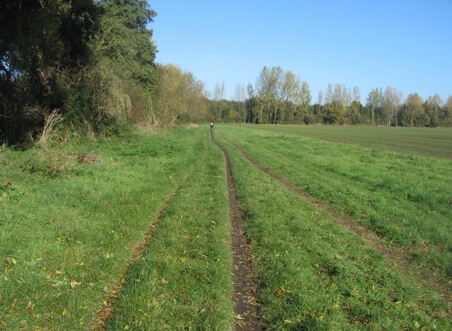
Footpath & National Cycle Route 11. Heading towards Cambridge centre. To the left, running parallel, is Hobson's Brook.


