Rainford Walks
![]()
![]() This village is in a good spot for exploring the Mersey Forest. The village has some nice country trails, a local nature reserve and is also very close to the highest point in the county.
This village is in a good spot for exploring the Mersey Forest. The village has some nice country trails, a local nature reserve and is also very close to the highest point in the county.
This walk from the village heads east to climb to the viewpoint at Billinge Hill before visiting Orrell Water Park.
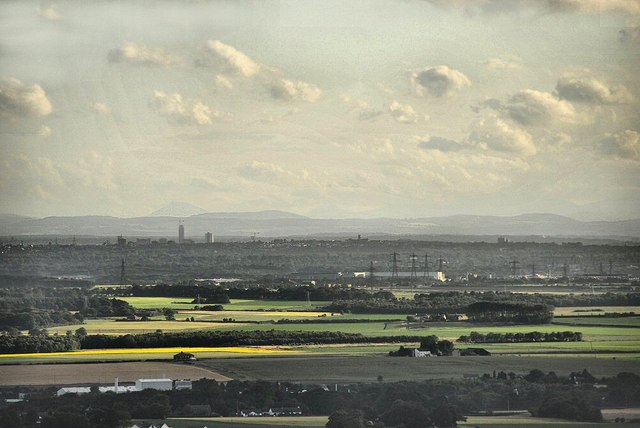
The walk starts in the village and heads east through the Mersey Forest to Kings Moss. You continue north east past Brownlow before turning south to climb to Billinge Hill, the highest point in Merseyside. From the 179 m (587 ft) summit there are excellent views towards Great Orme in Wales, Blackpool tower, Greater Manchester, Winter Hill and the Derbyshire Peak District. You'll also see a beacon tower at the summit and several large transmitter masts nearby.
After taking in the views head north past Longshaw to visit Orrel Water Park. Here you'll find footpaths taking you to two pretty reservoirs surrounded by attractive woodland and a buttercup meadow.
Postcode
WA11 8EZ - Please note: Postcode may be approximate for some rural locationsRainford Ordnance Survey Map  - view and print off detailed OS map
Rainford Open Street Map  - view and print off detailed map
Rainford OS Map  - Mobile GPS OS Map with Location tracking
Rainford Open Street Map  - Mobile GPS Map with Location tracking
Walks near Rainford
- Orrell Water Park - This park in the Orrell area of Greater Manchester includes two pretty reservoirs surrounded by attractive woodland and a buttercup meadow
- Billinge Hill - Climb to the highest point on Merseyside and enjoy fantastic views as far as Snowdonia in Wales on this walk in St Helens.
The walk starts in Longshaw where there is a footpath into the woods of the Billinge Plantation, just off Crank Road - Wigan Canal Walk - An easy walk along the Leeds and Liverpool Canal from Wigan to Parbold
- Leeds and Liverpool Canal - Enjoy waterside cycling and walking along Britain's longest single canal
- St Helens - This large town in Merseyside has some nice waterside footpaths along the St Helens Canal and the nearby Carr Mill Dam to try
- Sankey Valley Park - Enjoy a super, waterside cycle or walk in this country park in Warrington
- Carr Mill Dam - Enjoy a circular walk around Carr Mill Dam on this easy walk in St Helens.
- Warrington - This circular walk around Warrington includes nice waterside stretches along the River Mersey, the Woolston Cut Canal and the Manchester Ship Canal
- Sutton Manor - This walk visits the popular Sutton Manor Woodland Park in St Helens.
- Clock Face Country Park - This walk explores Clock Face Country Park in St Helens on Merseyside.
- Wigan Flashes - This walk explores the Wigan Flashes National Nature Reserve in the town of Wigan, Greater Manchester.
- Moore Nature Reserve - This walk visits the Moore Nature Reserve in the village of Moore in Halton, Cheshire.
Pubs/Cafes
Head to the Derby Arms for some post walk refreshment. The friendly pub serves a good Sunday lunch and has a fine selection of ales. You can find them at 47 Church Rd with postcode WA11 8EZ.
Dog Walking
The country trails make for a fine dog walk. The Derby Arms mentioned above is also dog friendly.
Further Information and Other Local Ideas
Continue east and you could enjoy an easy waterside walk on the Wigan Canal Walk which runs along the Leeds and Liverpool Canal through the town. Here you can visit the Wigan Flashes Nature Reserve where there's an abundance of water loving wildlife to see.
For more walking ideas in the area see the Merseyside Walks page.
Photos
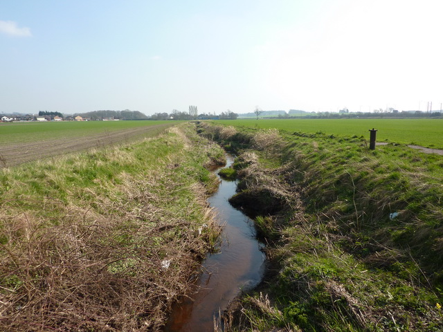
Rainford Village in early spring. Taken from the West of the village, the A570 is in the foreground. A field of winter barley is just beginning its growth.
Site of Rainford Colliery (Siding Lane Local Nature Reserve). Siding Lane Local Nature Reserve occupies the site of the former Rainford Colliery which is located just to the north west of the village. The shaft was sunk through sixteen feet of wet gravel and sand in 1860 and operated until the 1926 coal strike which caused the decline of the pit, finally closing in 1928. There's some nice footpaths here around a small pond.
Crank Rainford Hall. Crank was the original home of Col. J.P. Pilkington of the famous family of glass manufacturers. It's located to the south east of the village.


