Swansea to Bridgend
![]()
![]() Follow National Cycle Route 4 on this lovely ride which has splendid views of the South Wales coast and a fantastic stretch through Margam Country Park.
Follow National Cycle Route 4 on this lovely ride which has splendid views of the South Wales coast and a fantastic stretch through Margam Country Park.
You start by the marina in Swansea and head east through the docks towards the village of Briton Ferry. The ride then heads to the Port Talbot sea front where you can enjoy a lovely traffic free section along the prom. A run along the River Avan follows before heading to Margam where you will pass Margam Country Park - this is well worth a visit with its 1000 acres of parkland and Victorian Mansion house.
The ride continues through Pyle before joining a dismantled railway line taking you through the attractive Parc slip nature reserve and then on to Tondu. Here you join the River Ogmore for the pleasant final stretch to Bridgend.
Swansea to Bridgend Ordnance Survey Map  - view and print off detailed OS map
Swansea to Bridgend Open Street Map  - view and print off detailed map
Swansea to Bridgend OS Map  - Mobile GPS OS Map with Location tracking
Swansea to Bridgend Open Street Map  - Mobile GPS Map with Location tracking
Cycle Routes and Walking Routes Nearby
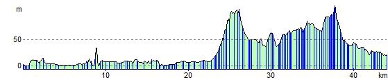
Elevation Profile