Aberford Walks
![]()
![]() This circular walk from Aberford explores the countryside to the east of the village, visiting the Lotherton Hall Estate on the way.
This circular walk from Aberford explores the countryside to the east of the village, visiting the Lotherton Hall Estate on the way.
The walk starts in the village and heads north east through the village to the Cock Beck. You can follow a footpath east along the beck to Lead Hall Farm and the Crooked Billet Inn. From here you head south to Coldhill Pond before turning north west along Copley Lane to return to visit Lotherton Hall. The estate includes nice footpaths taking you to woodland, parkland and gardens with the resident deer to see on the way. There's also an intersting museum, artworks, a 12th century Norman chapel and a colourful bird garden to see. The hall was bequeathed to Leeds Council in 1968 by Sir Alvary Gascoigne and his wife, last of the Gascoigne family. The Hall and parkland were opened for public access by its new owners on 6 August 1969.
After exploring the hall you head north to Collier Lane and then turn east to meet with The Rein. These Linear earthworks are known as Woodhouse Moor Rein and South Dyke, and are part of the Aberford Dyke system. You can follow a bridleway north west along the earthworks before heading west along Stocks Lane and Lotherton Lane to return to the village.
At the northern section the route coincides with the Hazlewood Castle Walk where you can visit the nearby estate. Here you'll find bluebell woods and a mountain bike trail to the west of the 18th century mansion which is now run as a hotel.
Please click here for more information
Aberford Ordnance Survey Map  - view and print off detailed OS map
Aberford Open Street Map  - view and print off detailed map
Aberford OS Map  - Mobile GPS OS Map with Location tracking
Aberford Open Street Map  - Mobile GPS Map with Location tracking
Pubs/Cafes
There's a decent cafe at Lotherton Hall or you could stop off at the Crooked Billet, just to the east of the hall. The pub does lovely home cooked food and is famous for its giant Yorkshire puddings. There's also a nice garden area for warmer days. You can find the inn just west of Saxton village at a postcode of LS24 9QN for your sat navs.
Further Information and Other Local Ideas
Near Saxton you can pick up the popular Towton Battlefield Walk. The historical walk explores the site of the 15th century Battle of Towton, a significant conflict during the English Wars of the Roses. Just to the north of the site you could visit the impressive Tadcaster Viaduct. Here you can also pick up the Ebor Way and follow a riverside path along the River Wharfe.
South west of the town you will find the neighbouring settlement of Garforth. The Garforth Walk starts from the train station and visits the Aire and Calder Navigation Canal and the lovely RSPB St Aidan's nature reserve. There's excellent birdwatching opportunities and fine scenery here.
Also nearby is the noteworthy Temple Newsam Country Park. There's 1500 acres of parkland to explore here with a series of woodland trails, pretty ponds, landscaped gardens and the Dunstan Hills. The expansive estate surrounds a fine Tudor-Jacobean house with hundreds of years of history.
Just to the south west of the settlement there's Parlington Woods to explore. The historic woods are part of the old Parlington Estate, seat of the Gascoigne family. There's an interesting grade II* listed Triumphal Arch and some picturesque old cottages here.
Just to the west you can explore the villages of Barwick-in-Elmet and Thorner. Here you could visit Bramham Park where there are hundreds of acres of parkland, gardens, woodland and countryside to explore. The landscaped park surrounds the historic 18th century Bramham House which is a Grade I listed building.
Cycle Routes and Walking Routes Nearby
Photos
Part of The Rein boundary works. It's actually quite hard to make out the earthwork itself when you're on them, due to the preponderance of trees and scrub. In this area, it consists of a 15-foot wide ridge, with a shallow ditch on the southwest side. The Aberford Dykes have been identified as defences of the British kingdom of Elmet against the Anglo-Saxons in the late sixth and early seventh centuries. They have also been interpreted as dykes built to defend the territories of the Brigantes against the advance of the Roman Empire in the first century AD.
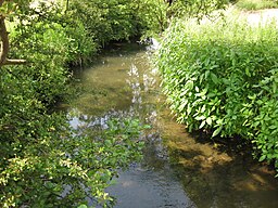
Cock Beck from the bridge near the Crooked Billet Inn on the B1217, North Yorkshire. Part of the Battle of Towton battlefield 1461.


