Circular Walk around Alton
![]()
![]() The Hampshire town of Alton is nicely positioned on the northern edge of the South Downs National Park. Several waymarked walking trails pass the town providing the opportunity to explore the surrounding area on well maintained footpaths. The town is also close to the popular Alice Holt Forest
The Hampshire town of Alton is nicely positioned on the northern edge of the South Downs National Park. Several waymarked walking trails pass the town providing the opportunity to explore the surrounding area on well maintained footpaths. The town is also close to the popular Alice Holt Forest
This circular walk from the town takes you up onto the Downs where you can enjoy some fine country views.
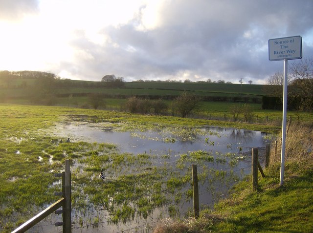
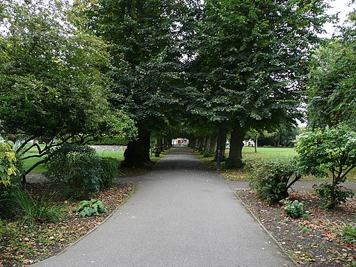
The walk starts at the Source of the River Wey, just to the west of the town centre and train station. Head east along the river and it will take you past Alton Public Gardens where there's a bandstand, cafe and some nice footpaths.
In the centre of town you then pick up the Hangers Way and follow the waymarked path past King's Pond before heading out into the countryside on Neatham Down.
The path continues past Monk Wood and Clay's Farm before coming to the village of East Worldham.
The route continues south east past King John's Hill before coming to Binswood. Here you leave the trail to turn west through Pheasant Wood towards West Worldham. You then follow the Water Lane track back into the town.
Alton Ordnance Survey Map  - view and print off detailed OS map
Alton Open Street Map  - view and print off detailed map
*New* - Walks and Cycle Routes Near Me Map - Waymarked Routes and Mountain Bike Trails>>
Alton OS Map  - Mobile GPS OS Map with Location tracking
Alton Open Street Map  - Mobile GPS Map with Location tracking
Walks near Alton
- Hangers Way - Travel through Hampshire from Alton to the Queen Elizabeth Country Park along this 21 mile walking path.
The route passes through the delightful village of Selborne where you can take a detour to visit the lovely Selborne Common - Selborne Common - This circular walk visits Selborne Common and Selborne Hill, one of the highest points in the county of Hampshire
- St Swithun's Way - Follow the St Swithun's Way from Winchester to Farnham on this historical walk through the Hampshire and Surrey countryside
- Shipwrights Way - A long distance cycling and walking trail running from Alice Holt Forest to Portsmouth along the imagined route a tree may have taken from forest to warship
- Alice Holt Forest - Explore the peaceful Alice Holt Forest on this pleasant circular route in Farnham
- Woolmer Forest - This large area of heathland and woodland has public footpaths to follow from the hamlet of Conford in the north eastern part of the site.
- Bramshott Common - Explore this large expanse of heathland on this walk near Liphook in Hampshire
- Chawton Park Wood - Enjoy a circular walk around this large area of woodland in Hampshire
- Hogmoor Inclosure Bordon - This walk visits the Hogmoor Inclosure in Bordon, East Hampshire.
- Liphook - This large Hampshire based village is a great place to start a walk
Pubs/Cafes
The George in Alton is a nice place for some refreshments after your walk. The pub has a lovely beer garden to sit out in if the weather is fine. You can find it on Butts Road at a postcode of GU34 1LH for your sat navs.
Dog Walking
The country trails and the woodland areas on the route are ideal for dog walking. The George pub mentioned above is also dog friendly. Just to the west of the town there's also some nice trails in Chawton Park Wood which is popular with dog walkers.
Further Information and Other Local Ideas
You could extend the walk by continuing south along the Hanger's Way to visit the village of Selborne. Here you'll find Selborne Common where there's miles of nice woodland trails to try.
The expansive Alice Holt Forest is also nearby. The popular forest has several cycling and walking trails to explore.
Chawton Park Wood is another popular place for walkers. The neighbouring village of Chawton is also well worth a visit. Here you'll find the noteworthy Chawton House where Jane Austen wrote some of her novels. There's also a very fine Elizabethan pub to visit here.
For more walking ideas in the area see the South Downs Walks pages.
Photos
Source of the River Wey - route start. Located on the B3349 just north of its junction with a local road to Alton town centre. This is looking north-west with the setting sun having about 10 minutes to go on the western horizon. The water meadows here means that the actual source will vary depending on the amount of rainfall we have had. There is a culvert under the road (to the right) which becomes the actual river.
Footpaths crossing on Neatham Down. On Hangers Way outside Alton - note green waymark on the signpost


