Anderton Boat Lift Walk
![]()
![]() This photogenic Cheshire based site is one of the highlights of the UK's waterways.
This photogenic Cheshire based site is one of the highlights of the UK's waterways.
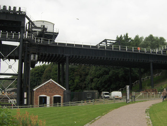
The device lifts boats 50 feet from the River Weaver Navigation to the Trent and Mersey Canal. This 'Cathedral of the Canals' has been listed as one of the Seven Wonders of the British Waterways and won experience of the year 2019. You can enjoy a boat trip along the river which uses the lift on the way. On the trips you can learn all about the history of the area and the structure itself. The easy canal and riverside paths also make for a fine walk.
After admiring the structure you can head south east along the water to visit the Anderton Nature Park. Here there are some nice woodland trails and ponds to see.
You can find the site just to the north of Northwich.
Postcode
CW9 6FW - Please note: Postcode may be approximate for some rural locationsAnderton Boat Lift Ordnance Survey Map  - view and print off detailed OS map
Anderton Boat Lift Open Street Map  - view and print off detailed map
*New* - Walks and Cycle Routes Near Me Map - Waymarked Routes and Mountain Bike Trails>>
Anderton Boat Lift OS Map  - Mobile GPS OS Map with Location tracking
Anderton Boat Lift Open Street Map  - Mobile GPS Map with Location tracking
Pubs/Cafes
The site includes a visitor centre and a cafe for some post walk refreshment. From here you can enjoy fine views of the boat lift with your meal.
Dog Walking
The canal, park and woods make for a fine dog walk. You are requested to keep them on leads on the canal paths. Some areas around the lift are not open to dogs.
Further Information and Other Local Ideas
Head north from the site and you can enjoy more waterside walking around Budworth Mere in the lovely Marbury Country Park in Great Budworth. To the east of the park there's also Pickmere Lake. The pretty lake is a popular spot with swimmers and has some nice footpaths along the southern side of the water.
A little further north there's Arley Hall where you'll find a fine stately home and some stunning gardens which are amongst the best in the country.
For more walking ideas in the area see the Cheshire Walks page.
Cycle Routes and Walking Routes Nearby
Photos
This lift transfers boats from the lower River Weaver up to the Trent and Mersey Canal. The two caissons today are supported by hydraulic rams rather than the previous ropes and pulleys on the earlier structure. This picture shows the far caisson raised where the hydraulic ram is difficult to discern from the "A" frame supports. One of the many interesting facts related by the tour guide was that Messieur Citroen developed the distinct chevron gearing, the shape of which later became the symbol of cars bearing his name. It was a triumph of Victorian engineering when first constructed.
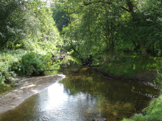
Anderton Nature Park - Lesley's Leap: North Cheshire Way in the park. View from beside the bridge over Marbury Brook at Lesley's Leap. This small brook flows through typical clough woodland to join the River Weaver.


