Barbury Castle Walks

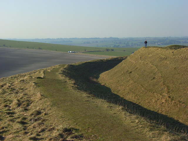
 Barbury Castle Country Park is a Scheduled Ancient Monument, Local Nature Reserve in the North Wessex Downs Area of Outstanding Natural Beauty. Part of the iron-age hillfort situated in the park has remained undisturbed since ancient times and is one of the best examples of its type.
This circular walk takes you on a tour of the park which commands a splendid view across the Cotswolds and the River Severn. The walk can be started from the on site car park which can be found at postcode SN4 0QH for your sat navs.
To continue your walking in the area you could enjoy a climb to the nearby Liddington Hill and enjoy fine views over the countryside of the North Wessex Downs Area of Outstanding Natural Beauty.
Postcode
SN4 0QH - Please note: Postcode may be approximate for some rural locationsBarbury Castle Country Park Ordnance Survey Map  - view and print off detailed OS map
Barbury Castle Country Park Open Street Map  - view and print off detailed map
Barbury Castle Country Park OS Map  - Mobile GPS OS Map with Location tracking
Barbury Castle Country Park Open Street Map  - Mobile GPS Map with Location tracking
Pubs/Cafes
The little village of Broad Hinton is located just over a mile west of the park. Here you can pay a visit to The Crown. They do excellent food and also have a lovely large garden area with fabulous views. It's the perfect place to relax after your exercise on warmer days. Inside is very attractive too with a cosy fire for the winter. You can find them at a postcode of SN4 9PA. At the park there's a nice picnic area if you'd like to bring your own food.
Dog Walking
The park is a great place to bring your dog for a bracing walk. You're likely to see plenty of other owners on a fine weekend day. The Crown mentioned above is also dog friendly.
Further Information and Other Local Ideas
The Ridgeway National Trail runs through the park. You could pick up the waymarked trail and follow it south east for about a mile to visit Hackpen Hill. Here you'll find a 19th century White Horse Hill figure and more excellent views. The circular walk starts from the car park at the hill and visits Barbury Castle before heading to nearby Rockley.
The area was a favourite of local writer Richard Jeffries who was inspired by the rolling hills. If you head a few miles north east from the hill you could visit the fascinating Richard Jeffries Museum. Jeffries was a Victorian nature writer with a passion for the English countryside. He even gave us a name for it all: wild life. He was born in Coate at the delightful 17th century thatched house which is now a museum to his life and work. The house is also surrounded by lush gardens making it a lovely place for a stroll after your climb. You can find the museum at postcode SN3 6AA, just to the north east of Coate Water Country Park. The expansive park also has some fine waterside trails to try.
The Sarsen Way passes the site. The long distance trail runs through Wiltshire from Coate Water Country Park in Swindon to Salisbury Cathedral. It passes many other fascinating ancient sites including Old Sarum Castle and the Alton Barnes White Horse on Milk Hill.
For more walking ideas in the area see the North Wessex Downs Walks page.
Cycle Routes and Walking Routes Nearby
Photos
View west from the Castle. The road in the immediate foreground leads down to the village of Wroughton, passing a number of farms on its way. The other road, which intersects it, is the pre-historic track known as The Ridgeway.
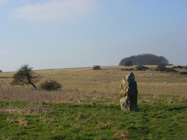
Jefferies Stone. Looking NW from near Jefferies Stone towards Wroughton Airfield in Wiltshire. The standing stone is located to the east of Barbury Castle, just below the ridge of Burderop Down, on the northern slopes below the wood. From here there are great views over the plains to the north of the downs. Closer inspection shows it to be concreted in place, and with two plaques mounted on it, as a memorial to Richard Jefferies and Alfred Williams, two local authors, and erected in 1939.


