Belstone Walks
![]()
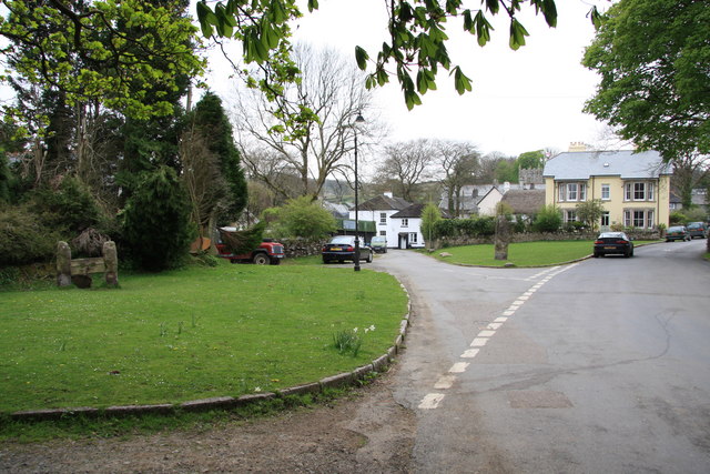
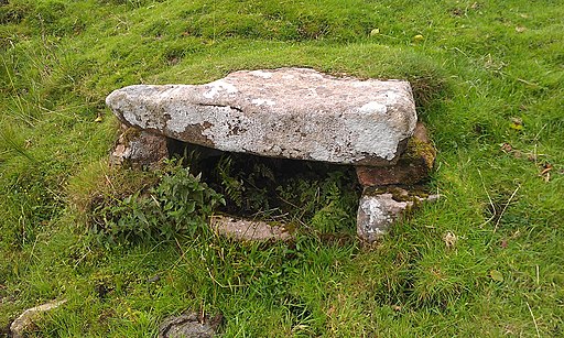
![]() This pretty Devon village is located in a lovely spot on Dartmoor. There's nice walks along the River Taw and some fine hill climbs to the surrounding tors. The village itself is also very pretty with a village green, thatched cottages, the old stocks, a holy well and a splendid pub.
This pretty Devon village is located in a lovely spot on Dartmoor. There's nice walks along the River Taw and some fine hill climbs to the surrounding tors. The village itself is also very pretty with a village green, thatched cottages, the old stocks, a holy well and a splendid pub.
This circular walk from Belstone visits the neighbouring village of Sticklepath before climbing to the viewpoints at Ramsley Hill, Higher Tor and Belstone Tor.
The walk starts in the village where you can pick up the Dartmoor Way and follow it east through Belstone Cleave to Sticklepath. This section takes you through a wooded gorge along the River Taw, passing Ivy Tor on the way.
From Sticklepath you follow the trail to South Zeal and Ramsley Hill where there is a nice viewpoint. Here the route turns west, passing below Cosdon Hill before climbing to Higher Tor and Belstone Tor where there are some interesting rock formations.
The route then descends north across Belstone Common, passing the Nine Stones Circle and Watchet Hill before returning to the village.
Postcode
EX20 1QZ - Please note: Postcode may be approximate for some rural locationsBelstone Ordnance Survey Map  - view and print off detailed OS map
Belstone Open Street Map  - view and print off detailed map
Belstone OS Map  - Mobile GPS OS Map with Location tracking
Belstone Open Street Map  - Mobile GPS Map with Location tracking
Walks near Belstone
- Sticklepath - The village of Sticklepath is located in a lovely spot on the River Taw in the north eastern section of Dartmoor National Park
- South Zeal - This attractive Devon based village is located in the Dartmoor National Park next to the village of Sticklepath.
- Meldon Viaduct - This short walk visits Meldon Viaduct in the Dartmoor National Park
- Two Castles Trail - Follow the Two Castles trail from Devon into Cornwall and enjoy beautiful countryside, woodland and downland
- High Willhays - Climb to the highest point on Dartmoor on this splendid circular walk in the Dartmoor National Park
- Black A Tor Copse - This walk explores the Black-a-Tor Copse National Nature Reserve in the Dartmoor National Park, near Okehampton.
- Meldon Reservoir - Enjoy a waterside walk around this lovely reservoir on Dartmoor
- Dartmoor Way - This epic long distance circular walk takes you on a tour of the wonderful Dartmoor National Park.On the circular route you will pass Okehampton, Chagford, Moretonhampstead, Buckfastleigh, Princetown, Foggintor Quarry and Tavistock as you make your way around this circular route
Pubs/Cafes
Head to the Tors Inn for some well earned post walk refreshment. The large pub is situated 1000ft above sea level in the village centre. They have a lovely garden area with an outside kitchen/BBQ that operates from Easter to the end of September. It's a lovely spot with great views over the surrounding countryside. Inside there's a cosy interior with a blazing fire for the winter months. You can find them at postcode EX20 1QZ for your sat navs.
Dog Walking
The woodland, countryside and hill climbs are ideal for fit dogs. The Tors mentioned above is also very dog friendly.
Further Information and Other Local Ideas
To continue your walking in the area you could pick up the Sticklepath Walk and enjoy a climb to Cosdon Hill and Little Hound Tor.
A few miles south west of the village you'll find another great climb to Yes Tor and High Willhays. The hill is notable as the highest on Dartmoor at 621 metres (2,039 feet) above sea level.
For more walking ideas in the area see the Dartmoor Walks page.
Photos
Belstone Village Green. The village stocks, stay animal pound, and Methodist chapel (see other photos for this grid square) are all beside the lane on the left.
The Tors Inn, Belstone. This enormous inn extends a welcome to locals and walkers--provided the latter remove their muddy boots.


