Boddington Reservoir
![]()
![]() Enjoy a peaceful walk around this pretty reservoir near Banbury.
Enjoy a peaceful walk around this pretty reservoir near Banbury.
There's a car park at the northern end of the water where you can start your walk. It's less than a mile east of Upper Boddington and also very close to the village of Byfield. You could easily start the walk from there if you prefer. A footpath then leads you around the reservoir to the smaller Byfield Reservoir on the eastern side of Boddington Reservoir. Around here there is some woodland and footpaths heading east to Byfield.
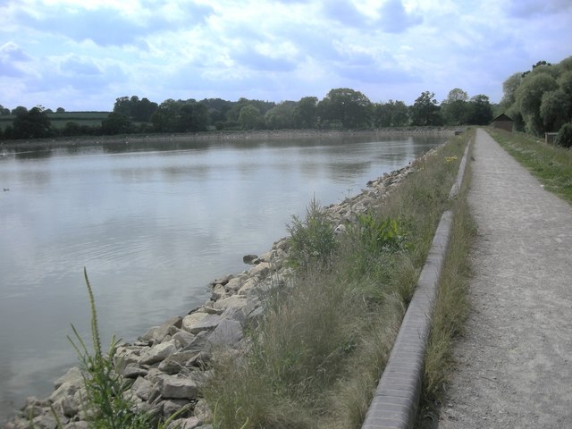
As you make your way round the water there are lovely views of the surrounding Northamptonshire countryside and lots of wildlife to see. Look out for ducks, green woodpeckers and dragonflies as you make your way along the 1.5 mile trail. You should also see lots of fishermen as it is a great location for carp fishing.
The site is located a few miles north of Chipping Warden where you can pick up the Macmillan Way long distance trail. This links with the Oxford Canal Walk where you can further explore the Cherwell Valley and head towards Banbury.
Postcode
NN11 6UD - Please note: Postcode may be approximate for some rural locationsBoddington Reservoir Ordnance Survey Map  - view and print off detailed OS map
Boddington Reservoir Open Street Map  - view and print off detailed map
Boddington Reservoir OS Map  - Mobile GPS OS Map with Location tracking
Boddington Reservoir Open Street Map  - Mobile GPS Map with Location tracking
Pubs/Cafes
Just to the west of the reservoir is the Plough Inn in the little village of Upper Boddington. It's an attractive 18th century stone-built and thatched village pub with a good menu and friendly atmosphere. You can find them at 32 Warwick Rd, NN11 6DH.
Dog Walking
The reservoir is a pleasant place to bring your dog for an easy waterside walk. The Plough Inn mentioned above is also dog friendly.
Further Information and Other Local Ideas
On the eastern side of the water is the little Byfield Pool which is another good place for wildlife spotting.
A few miles to the south west there's the smaller Clattercote Reservoir. The lake is a bit of a hidden gem and includes a nice circular boardwalk trail.
For more walking ideas in the area see the Northamptonshire Walks page.
Cycle Routes and Walking Routes Nearby
Photos
Boddington Reservoir. Looking across the reservoir towards the sailing club on the far shore just after a spring shower. The fishermen are still sheltering under their umbrellas.
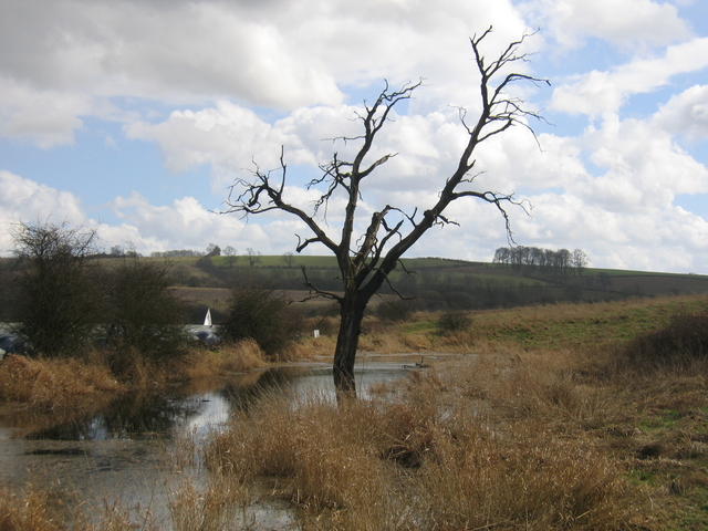
Lagoon at the reservoir. This reservoir was built to provide water for the Oxford Canal. It does not occupy whole width of the valley however and is formed by a dam running along as well as across the valley floor. In places the land between the reservoir and the adjacent hillside has also filled with water and become boggy and it all seems to have been too much for this tree!
Fisherman. The sun has come out just after a heavy spring shower so the umbrellas have started to disappear.


