Brenchley Walks
![]()
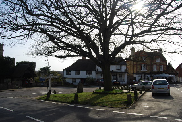
![]() This Kent based village is located close to Tunbridge Wells, Matfield and Pembury. It's a good place to start a walk with lots of footpaths to follow through the surrounding countryside of the High Weald.
This Kent based village is located close to Tunbridge Wells, Matfield and Pembury. It's a good place to start a walk with lots of footpaths to follow through the surrounding countryside of the High Weald.
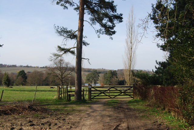
This walk from the village takes you along a section of the High Weald Landscape Trail to neighbouring Goudhurst, via the Furnace Pond and Rectory Park. The village is considered historically significant as it was closely involved in post medieval iron making.
The walk starts in the village where you can pick up the waymarked footpath and follow it south to the Furnace Pond, passing a number of orchards on the way. You continue south past Horsmonden, Sprivers Wood and Shirrenden Wood before passing through Rectory Park where there are more pretty ponds.
You'll then pass Parsonage Wood and Lordship Wood before turning east to Small bridge and Goudhurst. Here you can enjoy refreshments at the local pub before heading back to Brenchley on the same paths.
Brenchley Ordnance Survey Map  - view and print off detailed OS map
Brenchley Open Street Map  - view and print off detailed map
Brenchley OS Map  - Mobile GPS OS Map with Location tracking
Brenchley Open Street Map  - Mobile GPS Map with Location tracking
Walks near Brenchley
- High Weald Landscape Trail - Explore the High Weald AONB on this fabulous 90 mile walk that links the ridge-top villages and historic gardens for which the area is famous
- Goudhurst - This pretty Kent based village is located in a fine spot in the Weald
- Tunbridge Wells Circular Walk - Explore the beautiful countryside around Royal Tunbridge Wells on this circular walk through the High Weald AONB
- Tunbridge Wells Common - Explore this large green space on this pleasant walk in Tunbridge Wells
- Pembury - This circular walk around Pembury takes you through some of the woodland to the north of the village before picking up a waymarked trail to explore the countryside
- Dunorlan Park - This large park in Royal Tunbridge Wells covers nearly 80 acres with some nice walking trails to try
- Tonbridge - This long circular walk explores the parks, woods, commons, rivers and countryside surrounding the market town of Tonbridge in Kent
- Sissinghurst Castle - Explore the 460 acres of gorgeous Wealden countryside in the Sissinghurst Castle Estate on this walk in Kent
- Bedgebury Forest - Bedgebury is a great place for cyclists with miles of family cycle tracks and a more challenging mountain bike trail
- Bewl Water - This is a walking and cycling route around the beautiful Bewl Water reservoir near Lamberhurst
- Scotney Castle - Explore the 770 acres of woodland and parkland surrounding this 14th century moated castle near Tunbridge Wells
- Burwash - This picturesque East Sussex based village is surrounded by some lovely High Weald countryside.
- Lamberhurst - This Kent based village has some nice walking trails through the valley of the River Teise and two noteworthy historic ruins to visit nearby
- Tudeley Woods - This walk explores the Tudeley Woods RSPB Nature Reserve, near the village of Tudeley in Kent.
- Marden - This Kent based village has some pleasant countryside footpaths to explore.
- Paddock Wood - This Kent based town is located in the Tunbridge Wells area of the county, just north of Brenchley.
- Matfield - This Kent based village sits in a lovely rural location near Tunbridge Wells and Brenchley
Pubs/Cafes
The Halfway House is a good choice for some post walk refreshment. The pub serves fine food which you can enjoy in their lovely large garden area. You can find them on Horsmonden Road at postcode TN12 7AX for your sat navs.
Dog Walking
The country and woodland trails make for a fine dog walk. The Halfway House mentioned above is also dog friendly.
Further Information and Other Local Ideas
Just to the north of the village there's a fine viewpoint at Hill Top.
You could follow the High Weald Landscape Trail west to visit Pembury. Here you could pick up the waymarked Tunbridge Wells Circular Walk to visit Brakeybank Wood, Tadley Nature Reserve and Tunbridge Wells Common.
For Cyclists National Cycle Route 18 passes through the village. It will take you towards Canterbury in the east or Tunbridge Wells to the west.
For more walking ideas in the area see the High Weald Walks page.


