Paddock Wood Walks
6 miles (10 km)

 This Kent based town is located in the Tunbridge Wells area of the county, just north of Brenchley and Matfield.
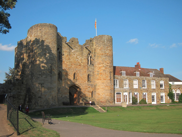
This waterside walk from the town takes you along the Tudeley Brook and the River Medway to the neighbouring town of Tonbridge, where you can explore the historic castle.
The walk starts at the train station and heads north and then west to meet up with the pretty brook. Follow this north and it will take you to the River Medway where you can pick up the Medway Valley Walk. The waymarked riverside footpath will take you west into Tonbridge where you will finish at the castle.
Scroll down for a list of walks near and around Paddock Wood.
Paddock Wood Ordnance Survey Map  - view and print off detailed OS map
Paddock Wood Open Street Map  - view and print off detailed map
Paddock Wood OS Map  - Mobile GPS OS Map with Location tracking
Paddock Wood Open Street Map  - Mobile GPS Map with Location tracking
Walks near Paddock Wood
- Medway Valley Walk - This is a lovely, easy riverside walk along the River Medway from Tonbridge to Rochester
- Brenchley - This Kent based village is located close to Tunbridge Wells, Matfield and Pembury
- High Weald Landscape Trail - Explore the High Weald AONB on this fabulous 90 mile walk that links the ridge-top villages and historic gardens for which the area is famous
- Goudhurst - This pretty Kent based village is located in a fine spot in the Weald
- Tunbridge Wells Circular Walk - Explore the beautiful countryside around Royal Tunbridge Wells on this circular walk through the High Weald AONB
- Tunbridge Wells Common - Explore this large green space on this pleasant walk in Tunbridge Wells
- Pembury - This circular walk around Pembury takes you through some of the woodland to the north of the village before picking up a waymarked trail to explore the countryside
- Dunorlan Park - This large park in Royal Tunbridge Wells covers nearly 80 acres with some nice walking trails to try
- Tonbridge - This long circular walk explores the parks, woods, commons, rivers and countryside surrounding the market town of Tonbridge in Kent
- Sissinghurst Castle - Explore the 460 acres of gorgeous Wealden countryside in the Sissinghurst Castle Estate on this walk in Kent
- Bedgebury Forest - Bedgebury is a great place for cyclists with miles of family cycle tracks and a more challenging mountain bike trail
- Bewl Water - This is a walking and cycling route around the beautiful Bewl Water reservoir near Lamberhurst
- Scotney Castle - Explore the 770 acres of woodland and parkland surrounding this 14th century moated castle near Tunbridge Wells
- Burwash - This picturesque East Sussex based village is surrounded by some lovely High Weald countryside.
- Lamberhurst - This Kent based village has some nice walking trails through the valley of the River Teise and two noteworthy historic ruins to visit nearby
- Tudeley Woods - This walk explores the Tudeley Woods RSPB Nature Reserve, near the village of Tudeley in Kent.
- Marden - This Kent based village has some pleasant countryside footpaths to explore.
- Matfield - This Kent based village sits in a lovely rural location near Tunbridge Wells and Brenchley


