Cheshunt Walks - Near and Around
![]()
![]() This Hertfordshire based town is a great place to start a walk with miles of varied trails to try. There's riverside and canalside trails, several local lakes, and miles of woodland to explore in the nearby Epping Forest.
This Hertfordshire based town is a great place to start a walk with miles of varied trails to try. There's riverside and canalside trails, several local lakes, and miles of woodland to explore in the nearby Epping Forest.
This circular walk explores the Lee Navigation canal and the River Lee Country Park on the eastern side of the town.
The walk starts from the train station where you can directly pick up a shared cycling and walking trail to take you north along the River Lee and a series of pretty lakes. You'll pass the Turnbrook Brook and Turnbrook Marsh before coming to Nazeing Marsh. Here you pick up the Lea Valley Walk and follow the canal path south towards Holyfield. The route then heads through the River Lee Country Park, passing along the Horsemill Stream and Waltham Marsh towards Holdbrook. You then turn north following the waymarked footpath past Cheshunt Marsh, Bowyer's Water and Cheshunt Lake before returning to the train station.
Cheshunt Ordnance Survey Map  - view and print off detailed OS map
Cheshunt Open Street Map  - view and print off detailed map
Cheshunt OS Map  - Mobile GPS OS Map with Location tracking
Cheshunt Open Street Map  - Mobile GPS Map with Location tracking
Walks near Cheshunt
- Lea Valley Walk - A super walk with a series of delightful waterside sections along the River Lea
- New River Path - Follow the man made New River from Hertford to Islington on this easy waterside walk
- Ware - This Hertfordshire based town has some nice canal and river trails to try.
- Forty Hall - This manor house in Enfield is surrounded by lovely parkland and gardens
- Waltham Abbey - Enjoy a circular walk around Waltham Abbey and Lee Valley Park on this lovely route
- London Loop - Also known as the London Outer Orbital Path, this walk takes you on a tour of the parks, woods and fields around the edge of Outer London
- Epping Forest Centenary Walk - Follow the Epping Forest Centenary Walk fom Manor Park to Epping on this pleasant 15 mile walk
- Walthamstow Reservoirs - Enjoy a waterside walk or cycle along this series of reservoirs in the Walthamstow Wetlands Nature Reserve
- Whitewebbs Park - This pretty country park in Enfield has some nice footpaths to follow around the parkland and woodland
- Little Berkhamsted - This Hertfordshire based village lies just to the south west of Hertford
- Tottenham Marshes - This North London based nature reserve includes some pleasant cycling and walking trails taking you around grassland, wildflower meadows, scrubland, waterways and a lake.
- Amwell Nature Reserve - This nature reserve is located in village of Great Amwell just to the south of Ware in Hertfordshire.
Pubs/Cafes
The Red Cow is a good choice for some post walk refreshment. The historic pub dates back 200 years and has a nice interior with an Olde worlde feel. Here you'll find wood beams & original features, plus a large bright conservatory area. Outside there's a lovely decked garden area for warmer weather. Quality of the food is also high with an excellent Sunday roast particularly popular. You can find them near the train station and river at 198 Windmill Lane with a postcode of EN8 9AF for your sat navs.
Dog Walking
The waterside trails make for a fine dog walk and the Red Cow mentioned above is also dog friendly.
Further Information and Other Local Ideas
On the south western side of the town you can visit the lovely gardens at the historic Forty Hall and the adjacent Whitewebbs Park.
For more walking ideas in the area see the Hertfordshire Walks page.
Photos
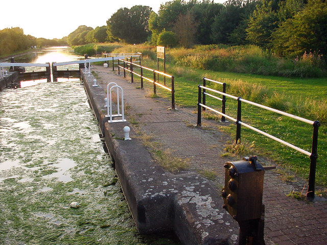
Lee Valley Country Park. Raised walk way over marsh land in Lee Valley Country Park, by Cheshunt Lock on the River Lea.
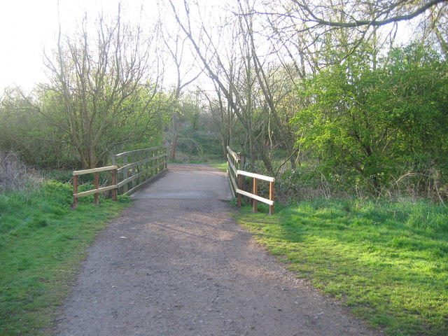
Bridge over Small River Lea. The bridge crosses the Small River Lea, which at this point isn't much bigger than a brook. Turnford Brook joins the Small River Lea just downstream to the right of the picture. Just over the bridge the path goes right towards Cheshunt Station and left to the Lea Navigation at Aqueduct Lock or Fishers Green.
Olympic aquatics centre, Lee Valley. This building is the "main stand" referred to in the construction-strange photo TL3700 : Olympic White Water Canoe Centre. The aquatics centre (including white-water facilities) was built on Cheshunt Marsh, intended mainly for the London 2012 Olympics but by this time (May 2011) was already open to the public.
The New River near Cheshunt. The New River is something of a misnomer since it is neither a river nor new. It is an aqueduct built under the direction of Sir Hugh Myddleton between 1607 and 1612 to bring fresh drinking water from Chadwell and Amwell Springs near Ware about 40 miles down the Lee Valley to London. In the middle distance is a footbridge carrying a public footpath over the aqueduct, while Bury Green is visible on the horizon.


