Clydach Gorge Walk
![]()
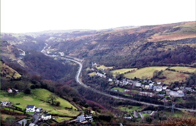
![]() This beautiful gorge in the Brecon Beacons includes a steep-sided valley down which the River Clydach flows to the River Usk.
This beautiful gorge in the Brecon Beacons includes a steep-sided valley down which the River Clydach flows to the River Usk.
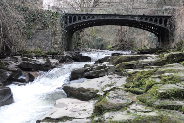
On the way there's peaceful woodland trails and a series of beautiful waterfalls to enjoy.
You can start the walk from the public car park in the village of Gilwern, located just to the west of Abergavenny. From here it is a short stroll down to the river where you can pick up footpaths heading south west into the reserve. The route heads to Brynmawr before turning around to retrace your steps. There are various paths to explore both sides of the river if you wish.
On the southern side of the route you will link up with the Clydach Gorge Cycle Route. The Sustrans route is largely traffic free with nice surfaced paths to follow. You can see it mapped in orange on the Ordnance Survey Map below.
Postcode
NP7 0HT - Please note: Postcode may be approximate for some rural locationsClydach Gorge Ordnance Survey Map  - view and print off detailed OS map
Clydach Gorge Open Street Map  - view and print off detailed map
Clydach Gorge OS Map  - Mobile GPS OS Map with Location tracking
Clydach Gorge Open Street Map  - Mobile GPS Map with Location tracking
Pubs/Cafes
The Cambrian Inn is located on the walk in the village of Clydach. The friendly village pub has a good range of beers and an outdoor area. You can find it at postcode NP7 0LY for your sat navs.
Near the start/end in Gilwern there's The Towpath Inn to consider. It's located in a fine spot, next to the canal so you can sit outside next to the water and watch the world go by. On Friday's they have Street Food pop ups where traders bring their exciting and varied menus with dishes from all over the world. You can also hire ebikes here to explore the area in comfort. The inn can be found at 49 Main Rd, NP7 0AU.
Dog Walking
The woodland and river paths in the reserve are good for dog walking. The Cambrian Inn mentioned above is also dog friendly.
Further Information and Other Local Ideas
The Monmouthshire and Brecon Canal passes Gilwern so you could pick up the towpath and head north towards Crickhowell. It's a popular area for walkers with the Crickhowell River Walk taking you along the River Usk.
Head into Abergavenny and you can continue your walking at the lovely Abergavenny Castle Meadows and Linda Vista Gardens. You can also enjoy a climb to the popular Sugarloaf and enjoy wonderful views over the area.
Just to the north is Llangattock where you can climb to the Llangattock Escarpment for more great views. Here you can also explore the Craig y Cilau National Nature Reserve with its wonderful limestone scenery and rare plantlife.
For more walking ideas in the area see the Brecon Beacons Walks pages.
Cycle Routes and Walking Routes Nearby
Photos
Clydach Gorge. View from Gilwern Hill towards Brynmawr showing Heads of the Valleys Road, Cheltenham, Black Rock and Clydach Gorge
View across the Gorge. The newly developed National Cycleway route follows the former rail line which runs across the far slope. An extraordinarily interesting area where man and nature, beauty and despoliation lie cheek by jowl.
Clydach Gorge Iron works built 1793.The Ironworks remained in production for about 65 years. In 1841 over 1,350 people were employed.
A rain-swollen Afon Clydach rushes past the old Forge House at Maesygwartha towards the bottom of the Clydach Gorge.
Waterfall near Gilwern. This waterfall is man made. It is formed by the overflow from the Monmouthshire Brecon Canal. The outfall is flowing into the River Clydach. If you look carefully you can just see the abutment of the aqueduct that carries the Canal over the river. The waterfall can be reached via a precarious walk up the River Clydach embankment.


