Conyer Walks

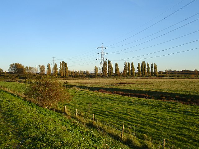
 This little Kent based village has some nice waterside walks along the Conyer Creek and the Swale River.
This circular walk from the village takes you east along the Saxon Shore Way and the Swale River to the Little Murston Nature Reserve near Sittingbourne. You can then return on country lanes and a section of the Swale Heritage Trail.
The walk starts in the village and heads north west along the Conyer Creek to the Swale. You can then follow a waymarked footpath east to visit the Nature Reserve at Little Murston. There's a number of pretty pools and lots of wading wildlife to look out for here.
The route then heads south to Tonger Corner and Cheke's Court where you pick up the Swale Heritage Trail. You can follow this long distance footpath east to Blacketts Cottages before returing to Conyer.
Conyer Ordnance Survey Map  - view and print off detailed OS map
Conyer Open Street Map  - view and print off detailed map
Conyer OS Map  - Mobile GPS OS Map with Location tracking
Conyer Open Street Map  - Mobile GPS Map with Location tracking
Walks near Conyer
- Swale Heritage Trail - Travel through Kent along the Swale Heritage Trail from Murston to Goodnestone
- Saxon Shore Way - Explore Kent's ancient coastline as you visit Iron Age hill forts, cathedrals, Martello towers, historic ports and castles on this incredible 160 mile walk
- Faversham - This lovely Kent based town has nice trails to follow along Faversham Creek and the Swale Estuary
- Faversham to Whitstable - A popular walk along a section of the Saxon Shore Way from Faversham to Whitstable
- Oare Marshes - This beautiful nature reserve near Faversham has nice trails to follow along the Swale estuary and Oare Creek
- Sittingbourne - This Kentish town has some fine river and coastal walking to try nearby.
- Leeds Castle Maidstone - Explore the stunning grounds of this 19th century castle and former residence of Catherine of Aragon. There are 500 acres of beautiful parkland, open water and formal gardens to explore on well laid out walking paths
- Maidstone River Walk - A nice riverside walk along the Medway from Maidstone to Leybourne Lakes Country Park
- Isle of Sheppey - The Isle of Sheppey is located of the north coast of Kent
- Leybourne Lakes Country Park - Enjoy peaceful, waterside walking and cycling at Leybourne Lakes Country Park, near Maidstone in Kent
- Bearsted - This attractive Kent based village has a pretty village green, a local community run woodland park and easy access to the footpaths on the North Downs.
Further Information and Other Local Ideas
Head east along the Saxon Shore Way and you could visit Faversham and explore the Oare Marshes. You can also pick up the Faversham to Whitstable Walk here.
For more walking ideas in the area see the Kent Walks page.
Photos
Reflections in Conyer Creek. Housing on the Creek, as viewed from Saxon shore Way footpath on other riverbank side.
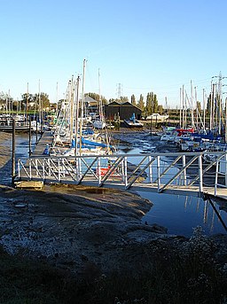
Swale Marina Swale Marina, at the head of Conyer Creek, has 150 pontoon berths, accessible for one and a half hours either side of high water.


