Faversham Walks

 This lovely Kent based town has nice trails to follow along Faversham Creek and the Swale Estuary. The surrounding marshland also has a number of nature reserves where you can look out for a large variety of wildlife.
Two long distance trails pass through the town. The Swale Heritage Trail and Saxon Shore Way are both great options for exploring the surrounding area on foot.
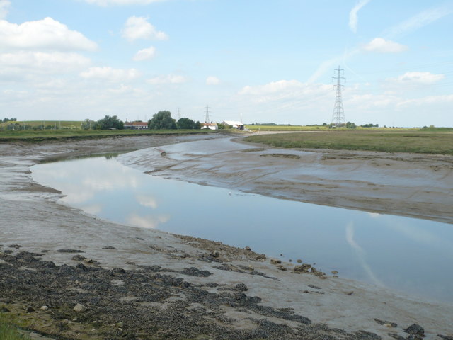
This circular walk makes use of both trails to take you through the town and around Ham Marshes. The route passes along the pretty Oare and Faversham Creeks with lovely countryside views on the way.
After the walk enjoy a stroll around the town with its attractive market square and Fleur-de-Lis centre, which provides tourist information and houses a museum. There's also the Grade I listed Faversham Parish Church which was established in 1147 by King Stephen and dissolved by Henry VIII.
To continue your walking in the Faversham area, head east to the splendid Blean Woods National Nature Reserve. The site is one of the most extensive areas of broadleaf woodland in Britain and home to a wide variety of wildlife.
You can also try the popular Faversham to Whitstable Walk which takes you along the estuary on the epic Saxon Shore Way long distance trail.
Postcode
ME13 7SJ - Please note: Postcode may be approximate for some rural locationsFaversham Ordnance Survey Map  - view and print off detailed OS map
Faversham Open Street Map  - view and print off detailed map
Faversham OS Map  - Mobile GPS OS Map with Location tracking
Faversham Open Street Map  - Mobile GPS Map with Location tracking
Walks near Faversham
- Swale Heritage Trail - Travel through Kent along the Swale Heritage Trail from Murston to Goodnestone
- Saxon Shore Way - Explore Kent's ancient coastline as you visit Iron Age hill forts, cathedrals, Martello towers, historic ports and castles on this incredible 160 mile walk
- Blean Woods National Nature Reserve - Enjoy miles of cycling and walking paths in the ancient woodland of Blean Woods near Canterbury
- Stour Valley Walk - Follow the River Stour from its source near Lenham to the estuary at Pegwell Bay on the Kent coast
- North Downs Way - This beautiful trail starts in Farnham, Surrey and heads east through the stunning North Downs to the historic city of Canterbury in Kent
- Faversham to Whitstable - A popular walk along a section of the Saxon Shore Way from Faversham to Whitstable
- Oare Marshes - This beautiful nature reserve near Faversham has nice trails to follow along the Swale estuary and Oare Creek
- Sittingbourne - This Kentish town has some fine river and coastal walking to try nearby.
- Milton Creek Country Park - A short circular cycle or walk around Milton Creek Country Park in Sittingbourne in Kent
- Conyer - This little Kent based village has some nice waterside walks along the Conyer Creek and the Swale River.
- Perry Woods - This walk explores a lovely area of ancient woodland in Kent.
Pubs/Cafes
The Anchor is an historic pub where you can enjoy some rest and refreshment after your walk. You can find the inn in a lovely spot near the creek and at the end of the noteworthy Abbey Street, one of the finest preserved medieval streets in England. Some of the beams in the pub are reported to be from the old Abbey in Faversham. The pub serves a good selection of real ales and good quality, locally source food. There is also a delightful garden area for warmer days. They are located at postcode ME13 7BP for your sat navs.
Dog Walking
The waterside trails make for a fine dog walk and the Anchor mentioned above is also dog friendly.
Further Information and Other Local Ideas
Head west along the trail and you can visit Conyer, Sittingbourne and the pretty Milton Creek Country Park.
For more walking ideas in the area see the Kent Walks page.


