Cottingham Walks - Near and Around
![]()
![]() This village is located in East Riding of Yorkshire on the edge of the Yorkshire Wolds near Hull.
This village is located in East Riding of Yorkshire on the edge of the Yorkshire Wolds near Hull.
This circular walk from the town explores the countryside to the north, visiting Skidby Mill and Risby Park on the way.
The walk starts in the town and heads north through Cottingham Parks to Hall Ings and Beverley Parks.
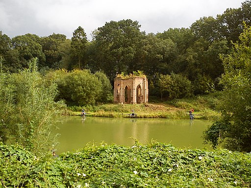
Here you pick up a section of the Beverley Twenty and follow the waymarked trail west to Low Daw Hill. Turn south and the trail takes you along the edge of Risby Park where there's lakes, old follies, woodland and the ruins of Risby Hall to see. You can take a detour west to explore this area.
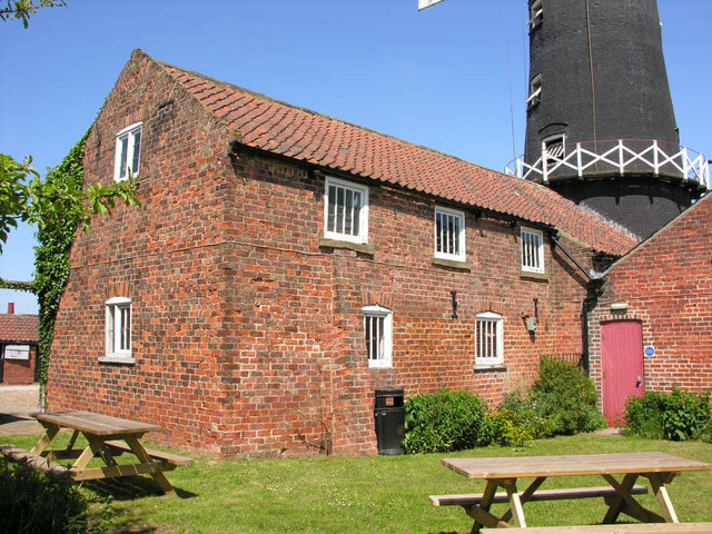
This route continues south along the Beverley Twenty to Skidby village where you can visit the historic Skidby Mill. The Grade II listed mill dates back to 1821 and is a popular local attraction. Inside there's an interesting museum where you can learn all about the history of the area.
The route then follows country lanes and roads south east to return to Cottingham.
Postcode
HU16 5QG - Please note: Postcode may be approximate for some rural locationsCottingham Ordnance Survey Map  - view and print off detailed OS map
Cottingham Open Street Map  - view and print off detailed map
Cottingham OS Map  - Mobile GPS OS Map with Location tracking
Cottingham Open Street Map  - Mobile GPS Map with Location tracking
Walks near Cottingham
- Skidby Mill - This circular walk visits Skidby Windmill near Beverley, in the East Riding of Yorkshire
- Risby Round - This circular walk explores the deserted village of Risby in East Riding of Yorkshire
- Beverley Twenty - This 20 mile walk runs from Hessle to Beverley through the Yorkshire wolds.
The walk starts near Hull in Hessle, at Humber Bridge Country Park and takes you to the Humber Estuary with fine views of the Humber Bridge - Beverley Beck - Enjoy a short stroll along the Beverley Beck on this easy walk in the Yorkshire town
- River Hull - Enjoy a walk along the Beverley Beck and the River Hull on this pleasant waterside walk in Beverley
- Humber Bridge - Follow the footpath across the Humber Bridge and enjoy fine views over the River Humber and the city of Hull in East Riding of Yorkshire
- Humber Bridge Country Park - This Country Park and Local Nature Reserve consists of woods, meadows, ponds and cliffs
- Welton Dale - A circular walk around Welton Dale in East Riding of Yorkshire
- Hessle Foreshore Walk - This walk takes you along a section of the Trans Pennine Trail from Hessle to Hull in East Riding of Yorkshire
- High Hunsley Circuit - Travel through the beautiful Yorkshire Wolds on this delightful circular walk.
The walk starts and ends in Brantingham Thorpe park and visits the villages of Walkington, Skidby, Brantingham, South Cave and Bishop Burton - Hull - This Yorkshire port city has some fine riverside trails and pictureque local parks to explore on foot.
- Barton Upon Humber - This Lincolnshire based market town sits in a nice location for waterside walks on the banks of the Humber Estuary.
Pubs/Cafes
The Duke Of Cumberland is a good choice for some post walk refreshment. They serve good quality food and have a nice garden area to relax in on warmer days. You can find them at Market Green with a postcode of HU16 5QG for your sat navs.
Further Information and Other Local Ideas
For more walking ideas in the area see the Yorkshire Wolds Walks page.
Photos
Cottingham Pumping Station. This is the end of the engine house that once contained three 1930 built Worthington-Simpson triple expansion pumping engines. This picture is from inside the security fence on an officially sanctioned visit.


