Droitwich Canal
![]()
![]() Enjoy an easy stroll along the Droitwich Barge Canal and the Droitwich Junction Canal, on this waterside walk in Worcestershire. There's much to enjoy with views of the River Salwarpe, pretty villages and the attractive countryside of the Wychavon district of Worcestershire.
Enjoy an easy stroll along the Droitwich Barge Canal and the Droitwich Junction Canal, on this waterside walk in Worcestershire. There's much to enjoy with views of the River Salwarpe, pretty villages and the attractive countryside of the Wychavon district of Worcestershire.
The walk starts where the canal meets the Worcester and Birmingham Canal just to the east of Droitwich (you could also start in Droitwich, if you prefer and miss out the first mile). The canal then heads west passing Hanbury Wharf and heading through the town. Just to the south there's the option of taking a small detour and visiting the Droitwich Spa Lido Park, one of the few remaining inland, open-air salt-water swimming pools in the UK.
At Westacre the canal turns south west, heading to the village of Salwarpe by the river of the same name. The final section runs to Hawford where the canal joins with the River Severn. Here you have the option of extending your walk by picking up the Severn Way and following it south into Worcester.
Our Hanbury Circular Walk visits the town's canals and includes a climb to Hanbury Hill Church where you'll find the St Mary the Virgin church which dates from 1200.
The canal also links with the Wychavon Way long distance trail. This is another great way of exploring the area on foot.
Droitwich Canal Ordnance Survey Map  - view and print off detailed OS map
Droitwich Canal Open Street Map  - view and print off detailed map
Droitwich Canal OS Map  - Mobile GPS OS Map with Location tracking
Droitwich Canal Open Street Map  - Mobile GPS Map with Location tracking
Further Information and Other Local Ideas
You could turn it into a longer circular walk by heading north from Hawford Grange and meeting up with the Wychavon Way near Ombersley. You can then follow the waymarked path east through Hadley and Westwood Park back into Droitwich. Ombersley is also worth exploring with a number of interesting timber framed properties, an ancient 15th century pub and the historic Ombersley House Estate to see.
The Hadzor Circular Walk passes through the town. This will take you along the Worcestershire Canal and the Droitwich Canal before visiting the pleasant Lido Park to the south of the town.
For more walks around Droitwich see the Worcestershire Walks page.
Cycle Routes and Walking Routes Nearby
Photos
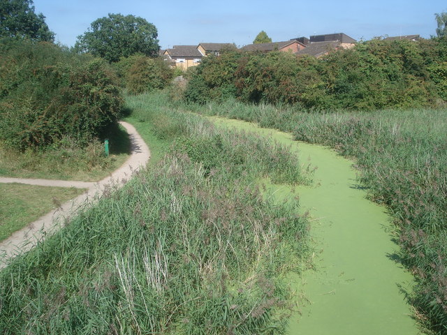
View north-east from Ombersley Road near Chawson. In summer and due to lack of boat traffic, the canal is in many places covered with duckweed.
Lock 2 on the canal in February 2007. This section is restored but there are stop planks just this side of the top lock gates. The rectangular overflow weir is nice but there's better to come.


