Gwbert Walks

 This small cliff top village is located on the beautiful Ceredigion coast near St Dogmaels.
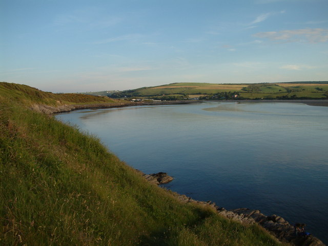
This walk from the village takes you along the Ceredigion Coast Path with some fine sea views. You can start the walk from the car park and viewpoint just to the south of the village. The route then follows the coast road north towards the cliff hotel and the impressive rocks at Craig y Gwbert. Along the way there are some splendid views over the Teifi estuary and lots of wildife to see. Keep your eyes peeled for Bottlenose dolphins and porpoises which can often be seen swimming in the bay, as can grey seals from the neighbouring Cardigan Island colony. There's a whole range of sea birds too with gannet, razorbill, guillemot, Manx shearwater, black-headed gull and fulmar to see.
Please scroll down for the full list of walks near and around Gwbert. The detailed maps below also show a range of footpaths, bridleways and cycle paths in the area.
Gwbert Ordnance Survey Map  - view and print off detailed OS map
Gwbert Open Street Map  - view and print off detailed map
Gwbert OS Map  - Mobile GPS OS Map with Location tracking
Gwbert Open Street Map  - Mobile GPS Map with Location tracking
Walks near Gwbert
- St Dogmaels - This Welsh village sits in a lovely location on the River Teifi estuary near Cardigan.
- Cardigan - The town of Cardigan is located in a lovely spot on the Teifi Estuary
- Pembrokeshire Coast Path - Brace yourself for some spectacular coastal scenery on this magnificent 186 mile trail that passes through the Pembrokeshire Coast National Park
- Penrhyn Castle - Explore 60 acres of woodland and parkland surrounding this large 19th-century neo-Norman castle near Bangor, Gwynedd.
- Ceredigion Coast Path - This walk follows the beautiful coastline of Ceredigion from Cardigan to Borth.The walk is waymarked with a coast and sea logo.
- Aberporth - This walk follows a section of the Ceredigion Coast Path from the village of Aberporth to Tresaith and Traeth Penbryn
- Pentre Ifan - Visit the largest and most well preserved neolithic dolmen in Wales on this fascinating walk in Pembrokeshire
- Llangrannog - This circular walk explores the area surrounding the village of Llangrannog on the Ceredigion coast
- Aberporth to Mwnt Coastal Path - Follow the Ceredigion Coast Path from Aberporth to Mwnt on this splendid coastal walk.
- Cilgerran - This historic Welsh village is located in North Pembrokeshire, close to Cardigan and the Teifi Estuary on the coast.
- Aberporth to Llangrannog Coastal Path - This walk takes you along a section of the Ceredigion Coast Path from Aberporth to Llangrannog.
- Newcastle Emlyn - This lovely Welsh town is located in the heart of the Teifi Valley near Carmarthen.
- Cenarth Falls - Visit these beautiful falls and enjoy a woodland stroll along the Afon Teifi on this walk in Carmarthenshire
- Llangrannog to Cwmtydu - This walk follows a section of the Ceredigion Coast Path from Llangrannog to the beautiful beach at Cwmtydu.
- Tresaith to Penbryn Walk - This walk from the village of takes you to neighbouring Penbryn along the Ceredigion Coast Path.
Pubs/Cafes
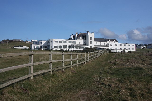
The Cliff Hotel is in a splendid cliff top location. It has some of the most breathtaking views in Wales, overlooking Cardigan Bay, the rugged coastline, the Teifi Estuary and the broad sweep of Poppit Sands. You can find them at postcode SA43 1PP.


