Harbottle Crags and Woods Walk

 This circular walk from the Northumberland village of Harbottle climbs to Cold Law, Dove Crag and Harbottle Crags.
It's an interesting and peaceful area with some splendid geology and wonderful views to the Cheviot Hills enjoy.
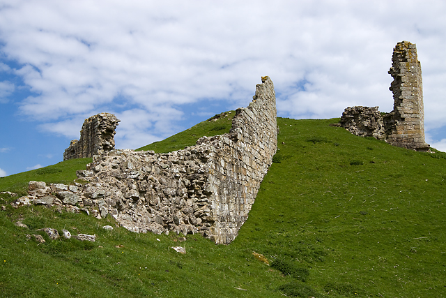
The walk starts from the historic Harbottle Castle ruins and follows country lanes south east to Rockey's Hall. Here you follow footpaths south into Harbottle Woods, passing Gallow Edge and Sealburn Quarry before coming to Cold Law and Harbottle Crag. The hill rises to a heigh of 361 metres commanding fine views over the Northumberland National Park.
The route then loops round to visit the scenic area of Dove Crag where you will find photogenic rock formations and pretty heather. From here you continue north through the woods to return to the country lane leading back to the village.
To continue your walking in the area follow footpaths west to visit the Drake Stone and Harbottle Lake. Here you will find a huge sandstone boulder which has been compared to the Bowder Stone in the Borrowdale area of the Lake District National Park. The stone is one of the area highlights and a popular place for photographers to capture an atmospheric shot of the local landscape.
Postcode
NE65 7DG - Please note: Postcode may be approximate for some rural locationsHarbottle Ordnance Survey Map  - view and print off detailed OS map
Harbottle Open Street Map  - view and print off detailed map
Harbottle OS Map  - Mobile GPS OS Map with Location tracking
Harbottle Open Street Map  - Mobile GPS Map with Location tracking
Walks near Harbottle
- Alwinton - This Northumberland based village has some lovely heather moorland, riverside trails, interesting geology, hill climbs and a historic old castle to explore
- Kidland Forest - Explore Kidland Forest and Upper Coquetdale on this circular cycle ride in the Northumberland National Park
- Harwood Forest - Enjoy a largely traffic free cycle ride through Harwood Forest and the Simonside Hills in the Northumberland National Park
- Simonside Hills - The Simonside Hills are a fabulous place for walkers with miles of footpaths taking you through woodland and moorland to wonderful viewpoints
- Fontburn Reservoir - This circular walk takes you around the lovely Fontburn Reservoir in Northumberland
- Usway Burn - River Coquet - Upper Coquetdale Walk - Enjoy some lovely waterside walking along the Usway Burn and the River Coquet on this route in the Upper Coquetdale area of the Northumberland National Park
- Elsdon - This attractive village in the Northumberland National Park is a lovely place for a stroll
- Otterburn - This circular walk follows the Otterburn Village Trail around this Northumberland village
- Otterburn Ranges - This walk explores the Otterburn Ranges, an expansive Ministry of Defence owned area of the Northumberland National Park.
Pubs/Cafes
The Star Inn dates back over 200 years and began life as a coaching inn. The inn is steeped in history and would have once been used by drovers crossing the Anglo-Scottish border just a few miles away in The Cheviot Hills. It was built using sandstone from the ruins of nearby Harbottle Castle. They have a good menu and some outdoor seating for warmer days.
There is also a well stocked village shop and newsagents at the side of the pub, which is also a small Information Point for the Northumberland National Park. The pub provides rooms if you wish to stay in the area. You can find them at postcode NE65 7DG for your sat navs.
Dog Walking
The woodland and the hill climbs are great for fit dogs. The Star Inn mentioned above is also dog friendly.
Further Information and Other Local Ideas
The circular Alwinton Walk starts from the neighbouring village to the north west. It visits various local highlights including the River Alwin, River Coquet, Harbottle Castle, West Wood and the Drake Stone.
To the north east there's the circular Shepherds Cairn Walk which visits a memorial to two shepherds who lost their lives in the exceptionally cold winter of 1962. The walk starts from Alnham where there's a noteworthy Grade I listed 12th century church.


